
| home:u.s. highpoints:wheeler peak (NM) | site map | navigation help |
|
Wheeler Peak (NM) |
Elevation: 13,161 ft
Date: November 25th, 2005
Group Size: 2
Miles Covered: 14
Difficulty: A long hike with some semi-steep sections near the top
Scenery: Amazing snow-covered mountains
This was the first step on a highpointing trip I took over Thanksgiving vacation. Sarah was the only person crazy enough to come along. I think Mike was excited about the hikes, but couldn't bring himself to sit in a car for some 15 hours just to reach the first trailhead. We left Wednesday in early afternoon with intention of getting to Flagstaff, AZ, some 450 miles away. However, we didn't make it that far, and instead found a motel in Kingman, which is about 2 hours west. Next day we drove through Flagstaff and I got to see Humphreys Peak once again. We then passed through Albuquerque, and reached Taos, NM around 4pm.
Thanksgiving evening in Taos, NM
Taos is a pretty cool town. Unfortunately, almost nothing was open on the Thanksgiving day. The evening was saved once we found the Alley Cantina . This watering hole is located in the oldest building in Taos, and serves great (and cheap!) food. Our Thanksgiving dinner consisted of beer and quesadillas, just what the pilgrims ate...
Right before heading out on the trip, I stumbled across The Outdoors Club. It is a huge listserv for people interested in the outdoors. I was quickly glancing through the calendar, when I noticed that some guy Patrick from L.A. was leading a Thanksgiving trip to Wheeler Peak as well. My quick invite for a beer turned into a challenge to a drinkathon. On they way out, those guys must have realized they will never win and conveniently didn't show up in Taos until near midnight. Quitters!
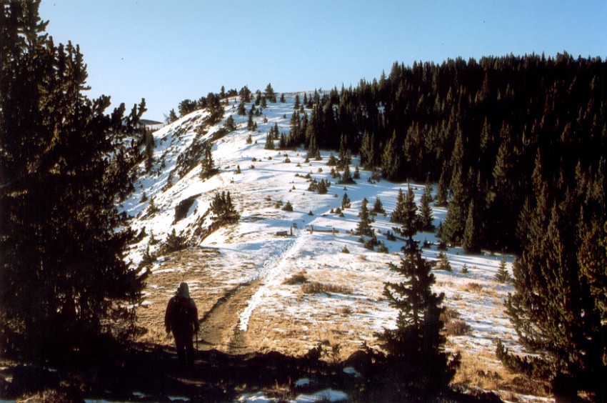
Approaching the treeline on the Bull-Of-The-Woods trail
We left the motel around 5am, and reached the Bull-Of-The-Woods trailhead shortly after 6. This and the Williams Lake are two most commonly used trails on the mountain. The Williams Lake trail is much steeper, but somewhat shorter. Seeing a lot of snow on surrounding mountain tops, we decided for the flatter Bull-Of-The-Woods trail. The total mileage on this trip was around 14 miles.
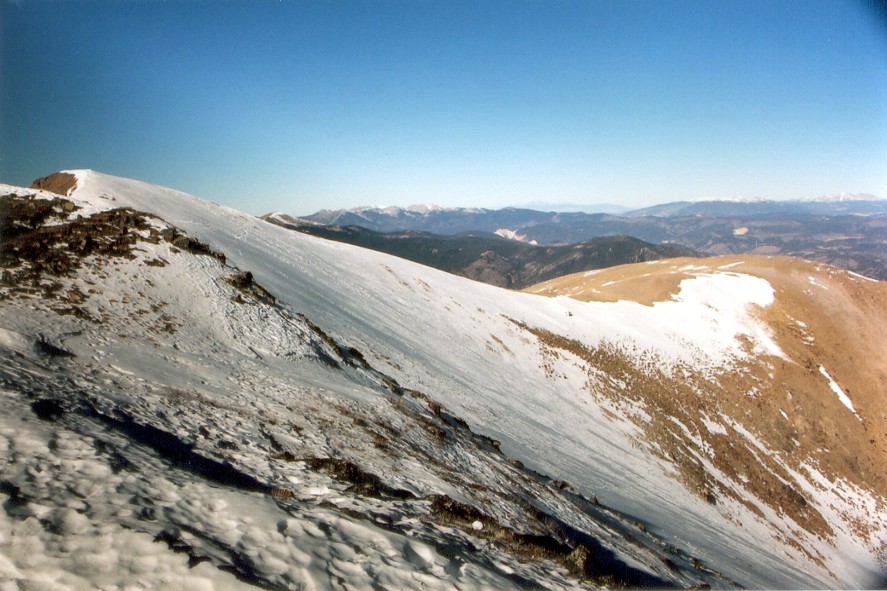
There was definitely more snow on the ground than I had expected. The lower mountains looked clear of snow, but this was simply an effect of the trees blocking the view of the ground. The first part of the trail is somewhat steep, as it climbs towards the Bull-Of-The-Woods mountain. We encountered several pretty treachorous icy sections on the way. The trail levels off once it reaches the treeline. The views from the open section were simply incredible, with the view dominated by a long ridge full of snow-covered peaks. We were relieved to later find out that neither of the peaks was the highpoint, since the approach to those mountains looked a bit tricky. Wheeler Peak is not visible from this point, since it is blocked by lower mountains on the trail.
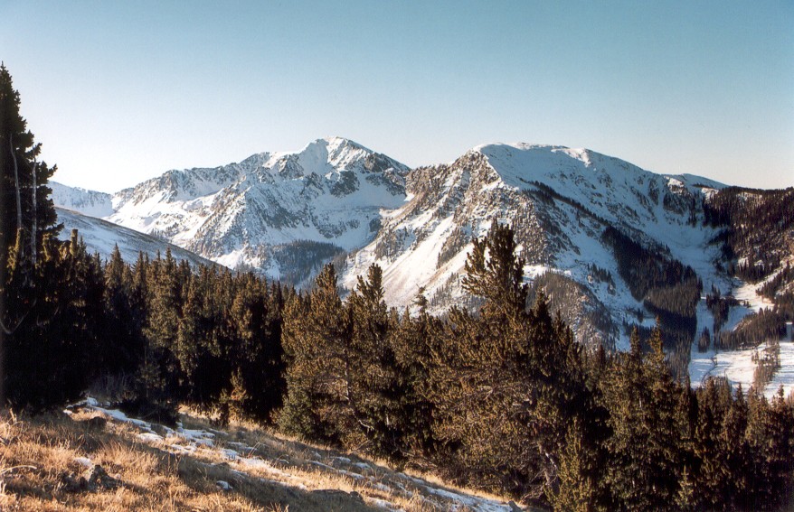
Mountain range near Wheeler Peak. The range containing the HP is to the left, but is not visible in this picture.
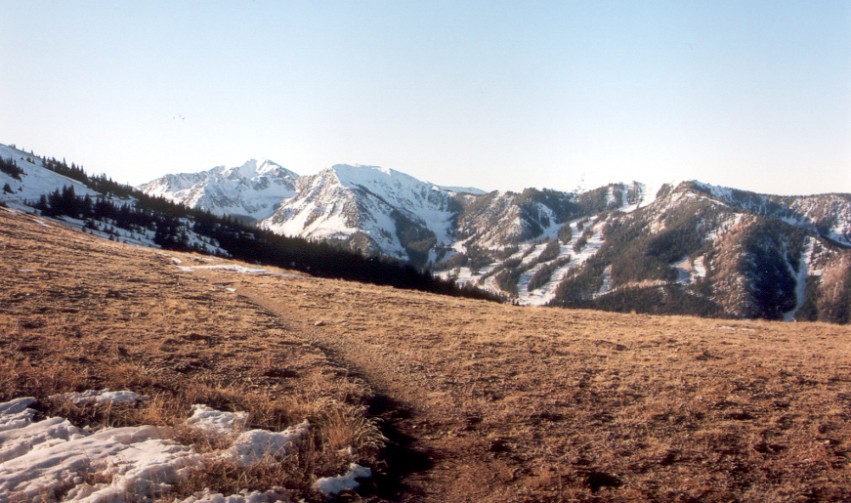
Majority of the remaining trail was covered in snow, which was several feet deep in some spots. The snow was well frozen, and snowshoes were not needed. Beyond the treeline, the trail continued up, and down, the Frazer Mountain to a large bowl. Although at first the bowl didn't look too big, it took us a considerable time to cross to the ridge on the opposite side. We next reached a fairly hairy section, as we had to cross a ridge with a significant drop-off. I cramponed up at this point, since a slip here would have resulted in a very long and painful fall all the way down to the Horseshoe Lake.
The trail crosses the bowl on the left before climbing the ridge. The summit is the black peak near the flare.

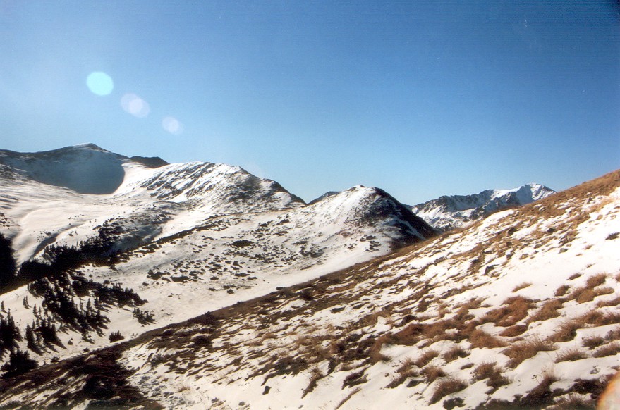
Summit ridge. Wheeler peak is the dimple near the middle.
Crossing this dropoff was the trickiest part of the climb. The faint trail visible in the picture crossed some 50 feet below the ridgeline.
The final part of the trail was pretty straightforward. The trail first reaches Mount Walter. From there, it is another 20 minutes to reach Wheeler Peak. We reached the top around lunch time. The weather on top was spectacular. Although it was really windy down by the bowl, the summit was surprisingly calm. The temperature was around 20F, and stayed below freezing all day.
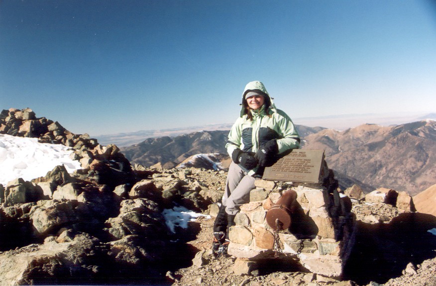
On top of my 22nd highpoint

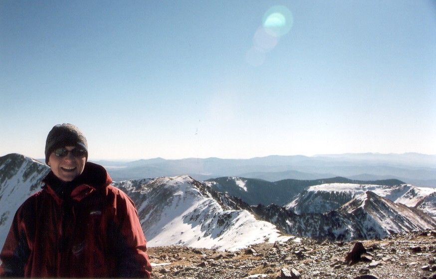
Here I am cramponing back to Mount Walters
It took us about three hours after summiting to reach Mount Frazer. Here we ran into Patrick's group. His group consisted of 3 guys and a girl. One of the guys, Kevin, is leading a trip to Denali in the summer. It was starting to get dark, and they decided to camp in the bowl. Patrick later told me in an email that only him and Kevin reached the top the following day. Supposedly, the weather turned over night, and the wind was too powerful for the others to summit. I guess we got lucky.
We didn't get back to the car until about 5pm. The hike took us 11 hours, which I blame on me getting really tired on the way down. The altitude really affected me on this hike, more than it had on any other mountain I have done in the past. Maybe it was because of a nasty cold I have been fighting for some time. We decided to postpone the drive to Oklahoma until next morning and instead we spent another night in Taos. And once again, we paid a visit to the Cantina...