| home:Mt. Kilimanjaro | site map | navigation help |
|
Mt. Kilimanjaro |
Elevation: 19,341 ft
Date: August 30th-September 4th, 2005
Group Size: 6
Miles Covered: About 40
Difficulty: Really depends on your body's response to the altitude
Scenery:You pretty much get everything here: jungle, alpine zone and a glacier desert
I summitted Kilimanjaro, Africa's highest mountain, on September 3rd, 2005.
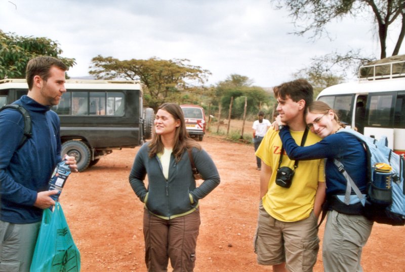
This trip was supposed to happen in 2004, but due to a lack of both time and (especially) money, it got pushed back a year. This time, I was joined by Sarah and friends from work: Dan Brown and David Kirtley. Dave's girlfriend Ellie Nick also came along.
Sarah and I left from L.A. on August 25th, 2005. We got to New York in the morning. Our flight for Africa didn't leave until that evening, so we spent the day strolling around New York's Central Park. Dan Brown flew from Michigan and met us back in the airport an hour or so before departure. Our next layover was in London, where we were joined by Dave and Ellie. The plane arrived in Nairobi the evening of 27th. The NYC to NBO flight cost us 1300 dollars, which really wasn't that bad, considering the distance. The climb cost about 800 dollars (of which about half went for the climbing permit), and a four-day safari was additional 400 dollars. The whole trip cost less than what some U.S. based companies charge just for the climb...
Most people in Nairobi had an excellent command of English, and thus finding our way was very easy. However, we got our first share of excitement shortly after landing, since Dave and Ellie's luggage didn't show up. Their flight to London was delayed, and they barely made the connection. Their luggage wasn't as lucky. The luggage was put on the next flight, which got to town at 7:30 the next morning. Our bus (the Davanu Shuttle) for Moshi didn't leave till about 8:30, so things worked out fine.
The group (Dan, Sarah, Dave and Ellie) at a bus stop right before the border crossing
Traveling on the Davanu shuttle was awesome. The bus was nice, and we got to see a lot of the countryside. I was expecting the bus to be filled with Kili/Safari tourists, but there were quite a lot of locals on the bus. The border crossing was also pretty interesting, with people trying to sell us all sorts of trinkets. Crossing the border consisted of everybody getting off the bus, and walking to a passport control bulding. From there, we walked over to the Tanzanian side, and repeated the whole process. The bus made it across, and we all piled back on. However, nobody verified that we actually went through the passport control. As far as I could tell, we could have simply walked across the border, and thus saved 100 bucks on visas. Oh well.
We kept our eyes open for Kilimanjaro, but since it was overcast, so we couldn't see too far into the distance. Mount Meru came into sight near Arusha. However, we still couldn't see the big momma, until we noticed something in the sky that looked like vertical clouds. Then we realized that those "clouds" were actually the glaciers on the top. It think everybody's first thought was "Damn, that's freaking high!"
We climbed the mountain with ZARA, which not only has a good reputation but also owns a hotel in Moshi, the "base-town" for Kilimanjaro. Their Springlands Hotel is located on the outskirts of the town, down a dirt road away from the center. The hotel has no signs on the outside, but we didn't need to look for it, since the bus dropped us off inside the hotel. Passing through the tall gates was like entering an oasis after a long wander through a desert. The white buldings were placed next to a central garden with an amazing landscaping and a pool. Although being here cut us off from the "real" Africa, I think that everyone was happy towards the end of the trip to have this refuge from merchants trying to sell things to mzungus (white people).
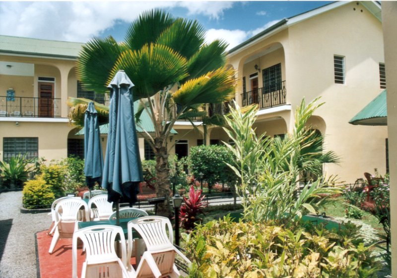
The Springlands Hotel
I spent the next day at the pool, drinking local beers Kilimanjaro, Safari and Tusker. The others went to town for a bit. At 4:30 we met our guides, Masoud and Adam. Besides them, 12 porters would be joining us, along with the cook. That was 2 porters a person, since an Irish guy named Frank decided to join our group. He had been in Africa for about a month on a nine month journey around the world.
We woke up the morning of August 30th to a light drizzle. The rain kept picking up, and by the time we turned off towards the Umbwe village, it was pouring pretty hard. A mud road lead from the village to the Umbwe gate, and before we knew it, the bus got stuck in the mud. We were actually pretty close to the gate when this happened, but there was no way for the bus to turn back, so we had to push it all the way to the gate. It was exciting, but at times the 20 of us had a hard time getting the bus to keep moving.
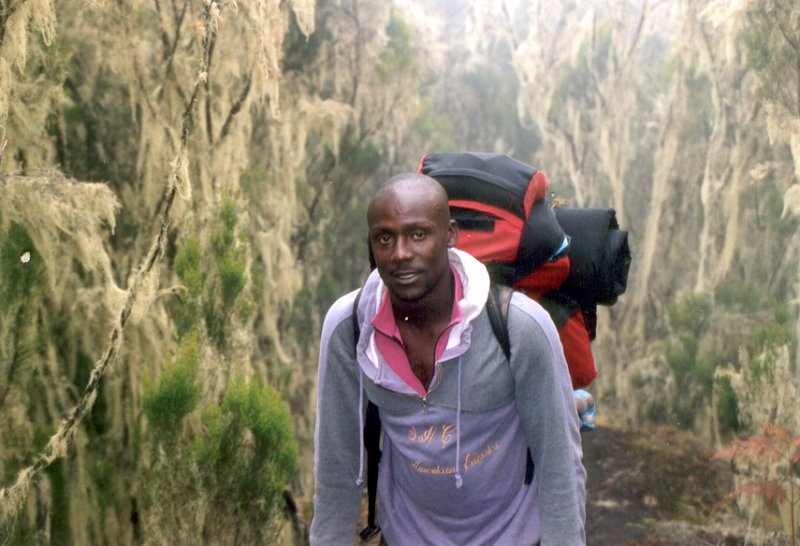
Adam, our assistant guide
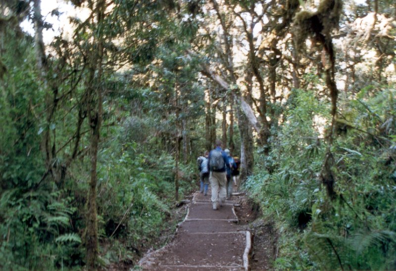
We went up the Umbwe route, which has a reputation of being really steep and difficult. Honestly, it wasn't that bad. The first day was pretty miserable, but that was mostly due to the persistent rain. We moved through a pretty dense forest and on few occasions, we had to pull ourselves up on roots and branches. The mud made the footing a bit unstable. It took about 5 hours to get to the first camp. The porters set up the tents, and we crawled in to hide from the rain and to dry off a bit. That proved pretty futile since everything we had on was soaked. My boots were holding up until about 30 minutes before the camp, at which point the Gore-Tex just gave up. Such seemed to be the case with everybody else's gear, as well. We changed to the dry clothes that were in our packs, and ate dinner that the cook brought to our tents. The food on the mountain was amazing, by the way. The first night we were served a beef stew. Future dinners included breaded chicken breast, fish, and even watermelons. We were also offered popcorn with tea before dinner on the following nights. This seems to be a tradition on the mountain, since we saw groups going with different climbing companies being served the same as well.
Frank on the Umbwe route
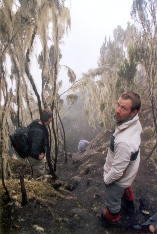
I went out for a bit that night and saw that the clouds have lifted. I could see the stars through the trees. That was my first time seeing the southern sky. It was really amazing. I recognized some of the circumpolar constelations, but now due to the close proximity to the equator, they were circling around the horizon. Next morning we woke up to a dense fog, but luckily it wasn't raining. I put on the wet, frozen clothes, and started moving to warm up after snacking on a really quick breakfast. Next we came upon probably the most technically challenging part of the whole climb: a 50-meter rock wall. Although this wall was really just a scramble, it looked pretty imposing from the bottom. The wet rock and muddy boots also made things whole lot more challenging. However, all of us made it up without a problem. Even more impressive is the fact that the porters made it up there as well. I bet the porters shiver when they hear they are going up the Umbwe route!
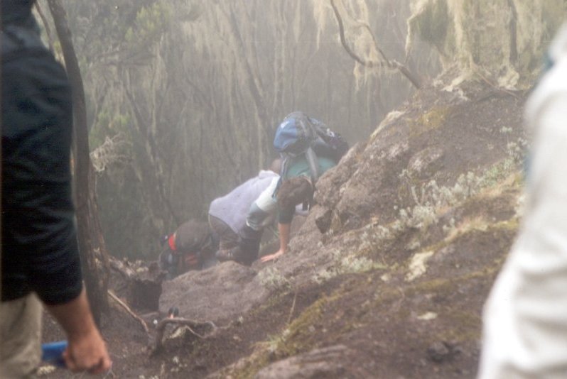
Climbing the 50-meter rock wall on the Umbwe route
From there, the trail continued up a ridge, where the fauna started changing rapidly. The rain forest of the lower elevations was slowly giving way to evergreens. As we kept climbing higher, we started seeing the famous groundsel trees. Although they look very tropical, these trees must be very sturdy since they grow in pretty harsh conditions: at elevations above the normal treeline.
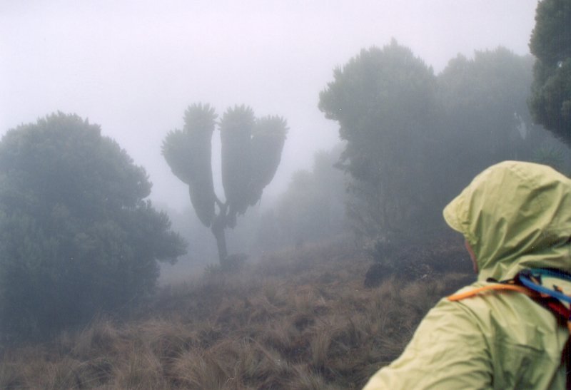
Groundsel trees on the ridge line. Soon after we reached the top of the clouds and got our first glimpse of the mountain.
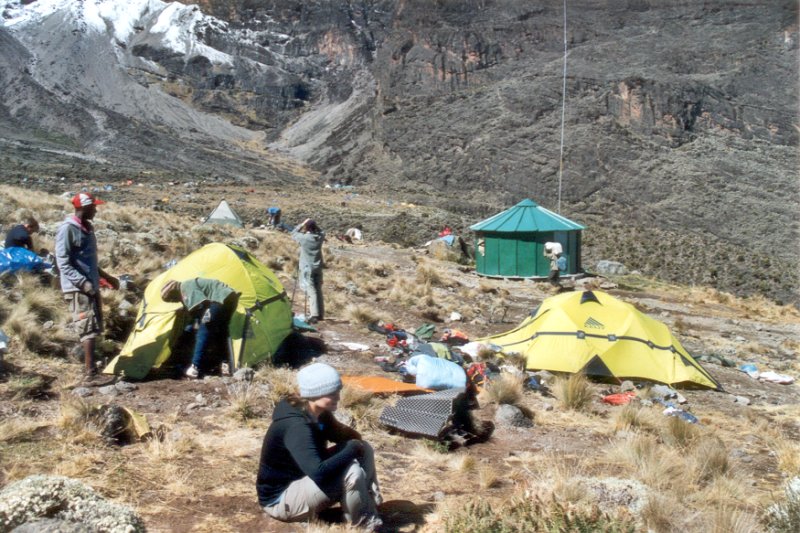
Barranco camp, our first encounter with other climbing groups
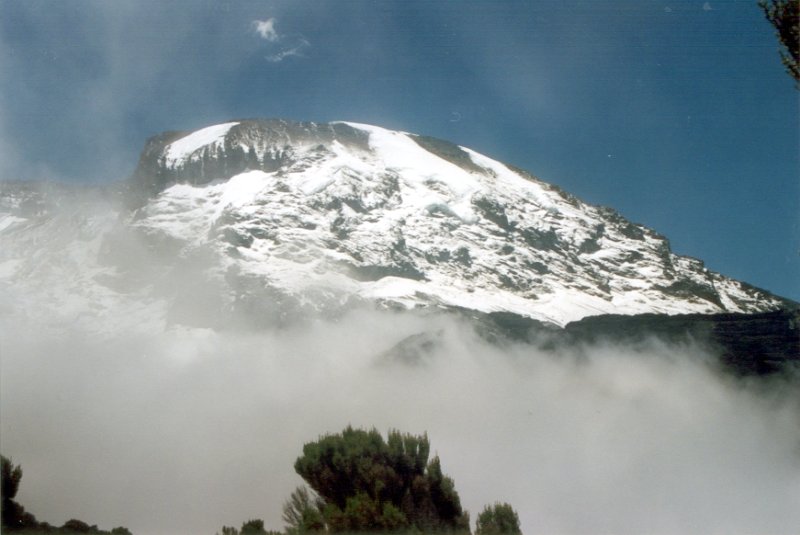
Soon we reached the top of the cloud layer, and got our first glimpse of the mountain. It was definitely an amazing sight. We got the Barranco camp (el. 12,800 ft) shortly after lunch, and the scenery was spectacular. The sun was shining, the mountain was right in front of us, and the valleys were covered by a dense layer of clouds. And it was also full of people... Barranco camp sits at the junction of the Umbwe route and the Southern Circuit route, which is used by people who have taken the Machame route through the rainforest. We didn't encounter any other groups on the Umbwe route, which made us appreciate the Umbwe route even more. Anyway, we dried our clothes in the sun, and after dinner Sarah, Dave and I took a little hike to a ridge by the Barranco Valley.

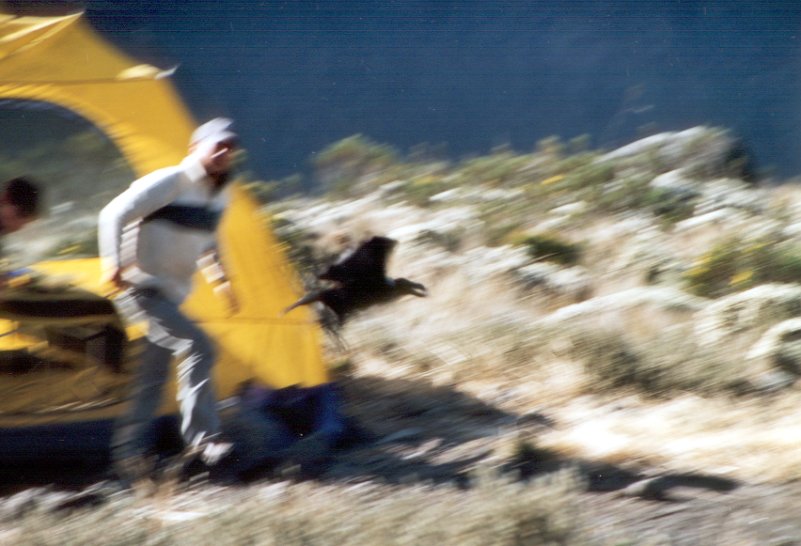
The group eating dinner before Frank realized that a crow stole his chocolate bar
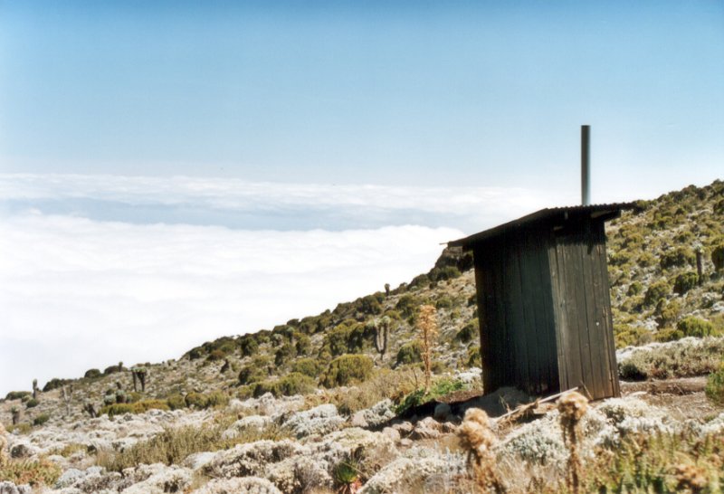
Latrine at Barranco. Latrines here were really just holes in the ground, having no "seat."
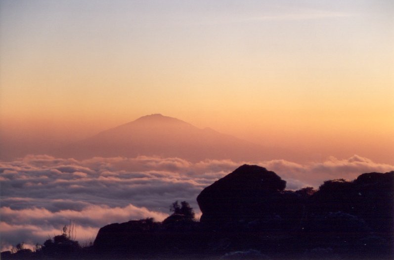
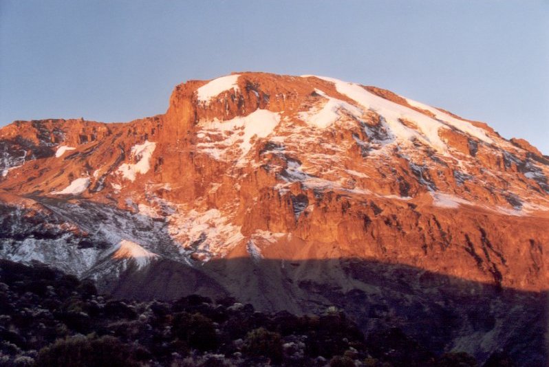
Mount Meru from a ridge by Barranco Valley. We also got to see an amazing view of Kibo (Kili's highest mountain) from up here.
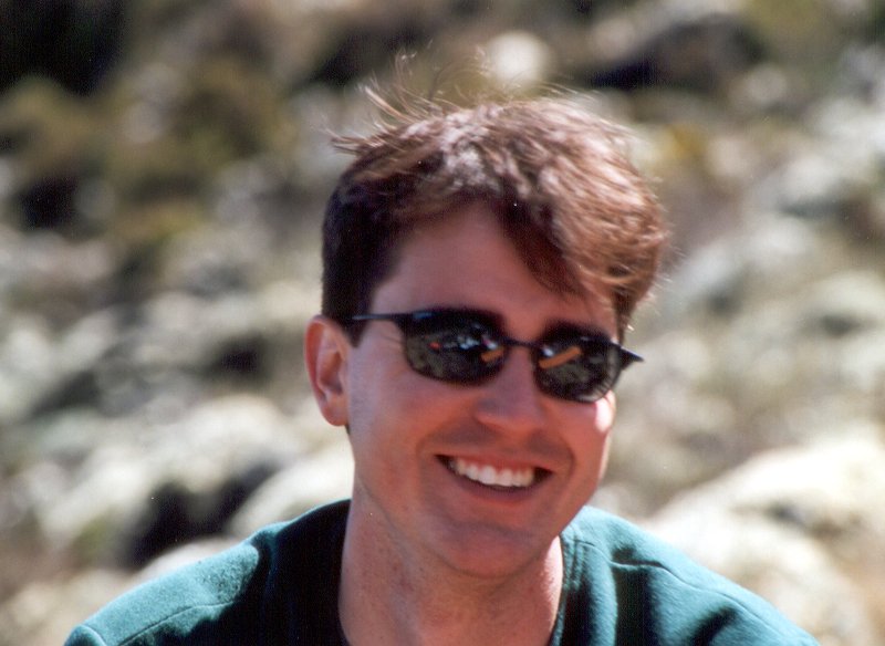
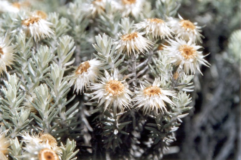
Dave Kirtley looking pretty, but not as pretty as these white flowers
Originally, we planned on taking the Western Breach route to the top. However, back in Springlands we heard stories about people getting killed there just few days ago by a rockfall. Western Breach is supposedly a great route, if it can be combined with sleeping in the crater rim. However, since this requires the porters to summit, this option is also pretty expensive. The standard way of doing Western Breach involves scrambling up the rock wall in the middle of the night on the final summit push. Climbing the loose rock with only a limited visibility didn't sound too appealing to our group, and thus we settled for the Southern Circuit option. Next day we crossed over the Great Barranco Wall. This is a high wall clearly visible from the camp. Even though the wall looks steep, there is a nice trail across it. This day we also got to experience something that people who took the other routes were probably used to by now: a traffic jam. The wall topped off at around 16,500 feet, however from this elevation we dropped down to the Karanga valley, where we spent the next night. The elevation at the camp was 13,800 feet. The next day we headed up to the Barafu camp, our last camp before the summit climb. The landscape at this point is usually referred to as a "moonscape". Now, I have never been to the Moon, but I can definitely imagine it looking quite like this part of the mountain. The amount of vegetation was minimal, with only some lichens and mosses clinging to life. Surprisingly, the Barafu camp had a significant population of little rodents and crows.


Climbing the Barranco wall on foot, and, in the case of my backpack, on a porter's head
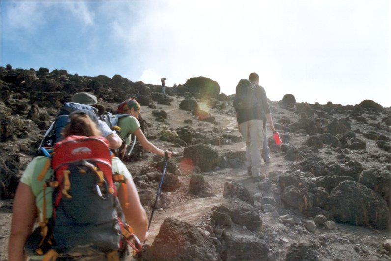
Heading towards Barafu, surrounded by the high-altitude "moonscape"
The Barafu camp, elevation 15,100 feet, is positioned on a pretty narrow ridge. Perhaps 10 feet behind our tent was some 1000 foot drop off into the Karanga valley. Basically, this was not a place to stumble out of your tent in the middle of the night looking for bathroom. Up here, some of the guys went up the trail to get a feel for what to expect on our summit push. Sarah and I decided to take a nap instead. Next to our tent was a group of guys with skis. I am not sure what they were up to, but they couldn't get more than about a minute of skiing up on the mountain. Seems a bit silly for the distance they had to carry the skis. Well, I guess that's what porters are for...
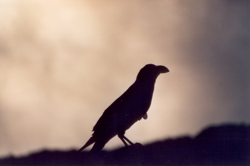
One of the many Barafu crows


Karanga Valley from the Barafu camp
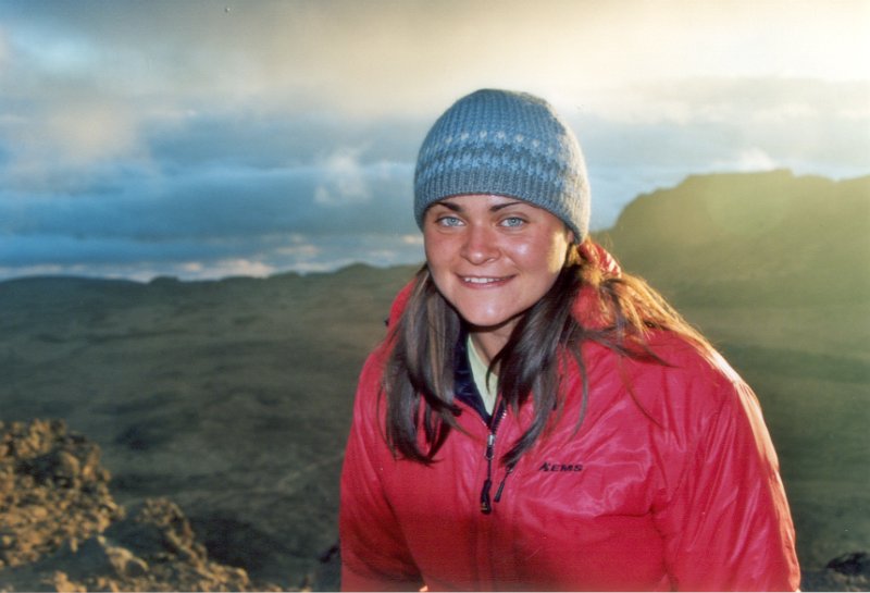
Sarah, looking forward to the climb to the summit

The toilets at Barafu had no doors. Maybe that was so that you can enjoy views like this.
And we finally got to the actual climb! We woke up at 11:30pm, and had a quick breakfast. We then started heading up the mountain in a total darkness. Amazingly, the guides were not using any flashlights. Either they were really used to the darkness, or they had the route memorized. We started by moving up a little rock field, and soon we got on a something that could be described as a solid scree. I guess all the trips to Boundary Peak paid off, since the scree didn't seem all that bad. Anyway, we were moving fairly slow. Ellie and Frank were struggling a bit, but Sarah was doing great, at least until we got to about 18,000 feet. Then something hit her and she started to have a really hard time keeping up. I guess her body ran out of energy and even though she was snacking on some gorp, it just wasn't enough.
We were running a bit behind, and hence by sunrise we only reached the crater rim. Yet we got to see an amazing view, with the sun rising over Mawenzi, Kilimanjaro's second highest peak. We rested for about 10 minutes in the pretty warm (25F) air at Stella Point, and then kept on moving towards Uhuru Peak, the actual highpoint. Sarah was in a pretty bad shape by now, so Adam decided to carry her daypack. We slowly covered the remaining half-mile (or so) and got to the top at around 7:30am.
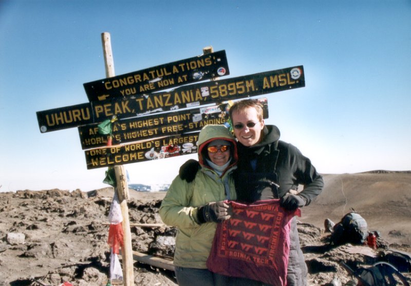

On top of Africa's highpoint
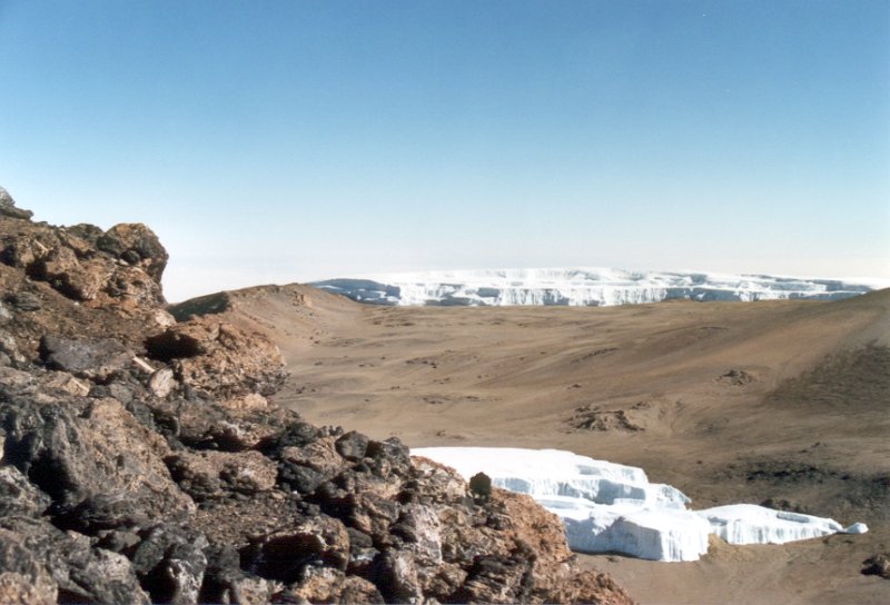
The ash pit. The Western Breach route crosses around the glacier field before reaching the top.
Dan, Dave, Frank and Ellie went down with Masoud, while Sarah and I stayed with Adam. It took us a while to make it back to the Barafu camp, even though the descent route involves quite a bit of glissading. Sarah developed a mild AMS, and wasn't showing much of improvement even as we were descending. She had to sit down fairly frequently to catch her breath, and was feeling dizzy. I think part of the problem was a lack of food, since her condition improved drastically after grabbing lunch back in the camp. After lunch, we rested for about an hour, and then descended down towards the Mweka trail.
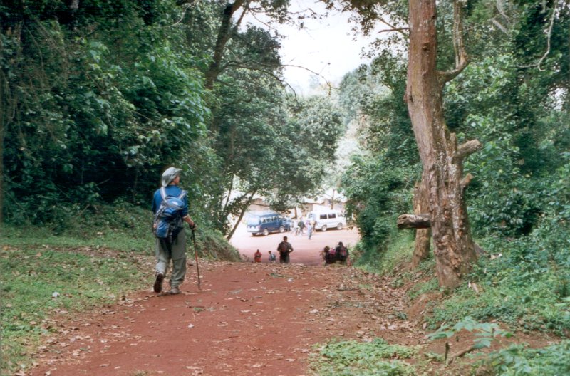
Descending down the Mweka trail towards the first parking lot
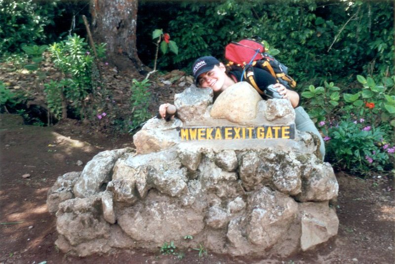
The Mweka trail is the standard descent route for all, but the Marangu routes. Altough it is a well maintained trail, it is fairly steep. It was definitely doing a number on my toes. I would rather climb the mountain again than having to descent down this darn trail. The other guys didn't really seem to mind it so much, so maybe my boots were just not meant for descending. Anyway, it really sucked. The first day we made it down about half-way, to the Mweka campsite. We got there at around 4pm, about 16 hours after waking up for the summit push. We had some sort of a simple dinner (I think the cook ran out of ingredients by now) and passed out. Next morning was more of the same downhill insanity. I was really glad too see buses in a clearing in front of us!
Sarah really happy to be off the mountain
Time for a shave and a shower after six days on the mountain
In conclusion, climbing Kili was amazing. We went with ZARA and I would definitely recommend them to anyone looking for a climbing guide. My only negative comment about them was the lack of variety as far as food is concerned. This wasn't so much a problem on the mountain, since the dinners were really good (and varied). However, back at the hotel, and especially on the Safari, we were fed daily pretty much the same eggs, crepes and sausages for breakfast, followed by a boxed lunch consisting of a boiled egg and a grilled chicken. The climb went well, and all of us made it to the top. I didn't take any Diamox, and I was doing fine besides feeling a bit nauseous near the top. There is really something to be said about the whole acclimatization thing...