| home:travel:road trip | site map | navigation help |
| Road Trip (WV, KY, IN, IL, MO, KS, CO, UT, WY, SD, IA, OH) |
Date: 15 days, August 8 to 22, 2002
I always wanted to see the west coast. I kept thinking of backpacking the Grand Tetons, but I figured it would take too much planning, and that it would be pretty expensive. Then, while working for P&W, I went backpacking with Reuben. He mentioned that one summer he just got in his car and drove by himself to Utah where he backpacked through the Bryce Canyon. So I though, "why the hell not?". I decided to end my internship early and I bought a map of the Grand Teton N.P. Then, after coming back from Niagara Falls, I got in my car, and drove...
Backpacking was awesome, but the trip itself was even better. I had a rough idea of the route I wanted to take, but I went with the flow. I decided to spend the nights in state parks. For one, it would save me money (camping costs about 10 bucks, while hotels are about 50), and second, it's hard to get the feel for different landscapes from the inside of a hotel room.
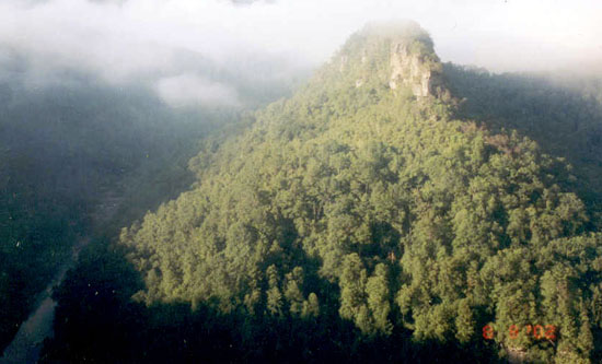
I spent the first night in the Breaks Interstate Park, on the border of VA and KY. I found out that the Towers formation shown here is the largest canyon on the east coast.

In Kentucky I took a little detour through Red River Gorge, which led me through the Nada Tunel. This tunnel is carved into the mountain and is barely wide enough to allow one car through at a time.
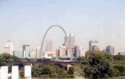
My trip next led me through Indiana and Illinois to Missouri. This is St. Louis.

I drove through Missouri to Kansas. Here I am enjoying a cup of tea in the Wilson Lake State Park. It turns out that the nearby town of Wilson dubbed itself the "Czech Capital of Kansas".

People think that there is not much to see in Kansas. I loved Kansas. After Wyoming, it was the most beautiful state I drove through. I visited the Cathedral of Plains, which is the largest building of the Great Plains. Then I went to the Castle Rock, shown above. Many roads in Kansas were unpaved. I got lost looking for this place and wound up doing some major off-roading through somebody's farm.
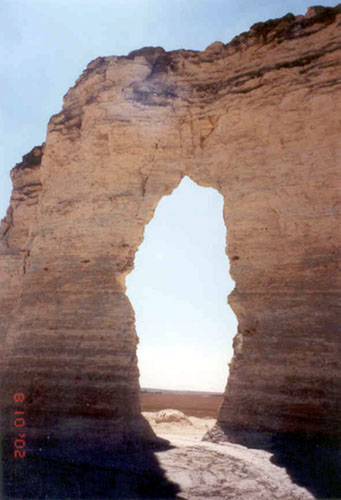
From Castle Rock I went to the El Cuartelejo Pueblo Ruins, only known remains of pueblo Indians in Kansas. From there I drove to the Monument rocks, shown here.
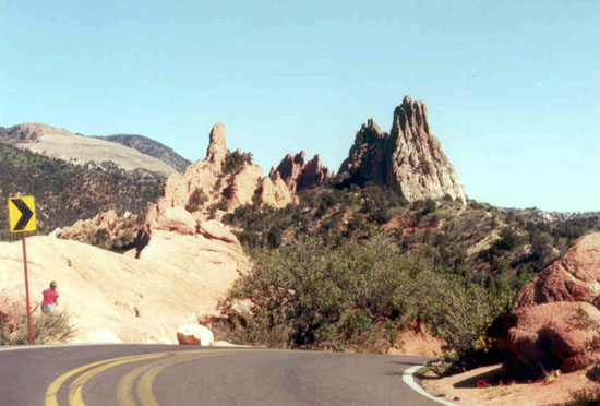
I made it to Colorado fairly late and didn't have time to cross the Rockies. I originally planned on spending the night in a park on the west side of the mountains. Instead, I drove down to Colorado Springs. I spent the night in HoJo. It was pretty costly, but I got to see Pike's peak and the Garden of Gods, shown here.
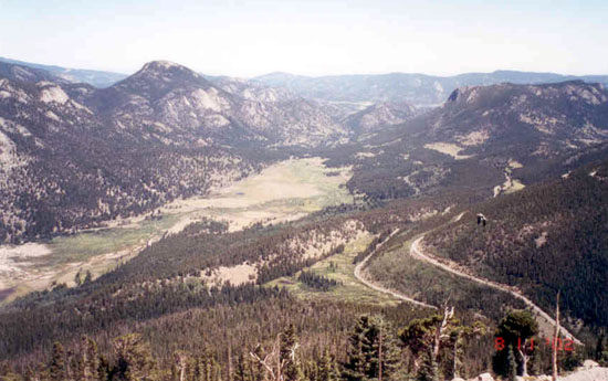
Next, I drove through the Rocky Mountains National Park. The Rockies are very, well, rocky, which makes them look very different from the Appalachian mountains.
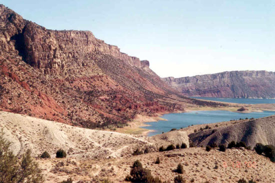
Next I drove through the west part of CO to Utah. The speed limit in Colorado is 75 mph, but its not like there were many cops around to enforce it. I came really close to breaking 100. I had the camera pointing at my speedometer, but couldn't get it past 98. This is a picture of the Flaming Gorge, a really beautiful region on the border of Utah and Wyoming.
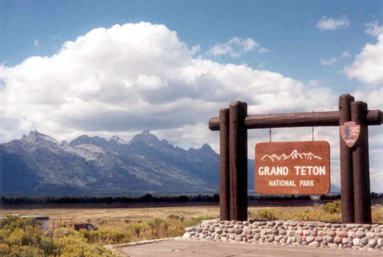
And I made it! Time to put on the hiking boots and hit the backcountry.
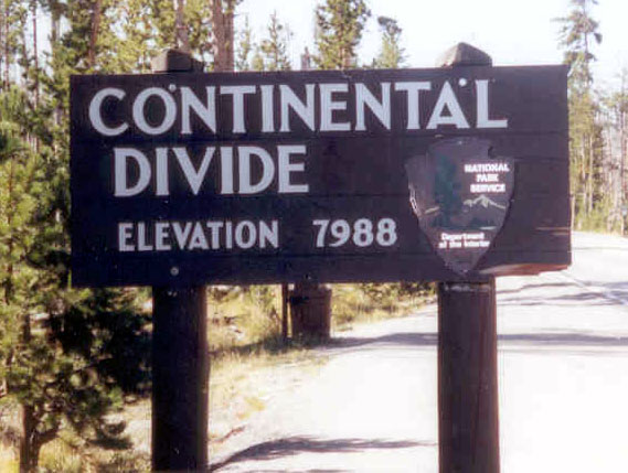
After resting up from backpacking, I went to Yellowstone. Yellowstone has got to be the most diverse piece of land on Earth. There is so much to see here. I had time to only visit the three major attractions: the geyser basin, hot springs and the grand canyon, and I still spent almost 8 hours in the park. It would take about a week to see all the viewpoints. The continental divide also runs through the park.

This is the Blue Star Spring.
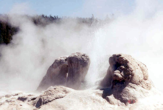
A lot of people were waiting for the Old Faithful to erupt. I didn't have the time for that. I walked around the basin, this is the Grotto geyser.

But I got lucky. On my way back, I saw the Grand erupt. The Grand is the tallest predictable geyser in the park.
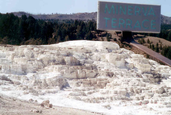
From the basin I went to the Hot Springs. This is the Minerva Terrace.
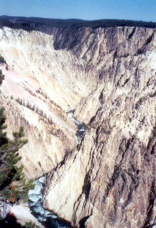
I stopped by the petrified tree and went to the Grand Canyon of Yellowstone. This was an indescribable sight. Seeing the springs and geysers was nice, but seeing this 1200 foot deep canyon was amazing.
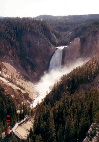
The canyon is also home to the Lower Falls, which at 308 feet are taller than the 167 foot Niagara Falls.
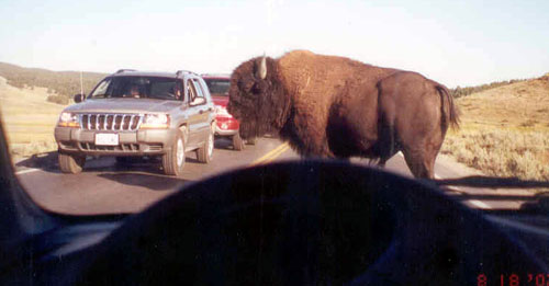
I started heading out of the park. I kept getting pretty close to the exit and was pretty disappointed since I didn't see any buffalo. Then, maybe 5 miles from the exit, I came to a huge herd crossing the road. This bull decided to cross right in front of my car, where he stood for good 5 minutes.
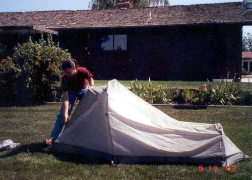
Next I crossed the Big Horn Mountains and stopped in Sheridan. Here I visited my friend Lea, who was nice enough not only to let me camp in her backyard, but she also set up my tent. Then the next day we went to a cowboy museum full of saddles and other cowboy thingees.

From Sheridan, I headed to the Devil's Tower in eastern Wyoming.
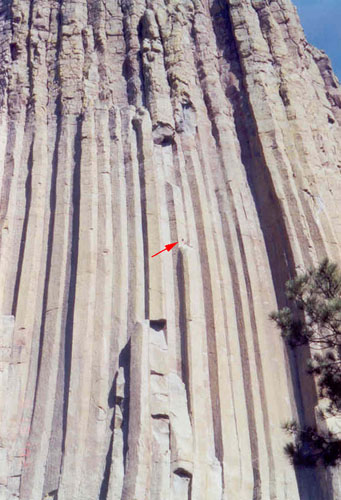
It is a popular place for rock climbers. The red arrow in this zoom-in points at a group of climbers.
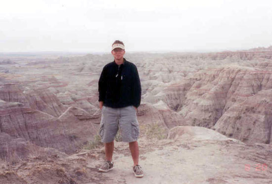
And I made it to South Dakota. I wanted to stop by Mt. Rushmore, but a forest fire erupted close by. The most direct road leading to the statues was closed and I would have to take a long detour. So I just went onto my next destination, the Badlands. All that haze in the sky is the smoke blowing from Mt. Rushmore.

Next I made it to Glenwood, Iowa, where I visited my friend from Florida Tech, Shaela.
I made it back through Illinois, Indiana, Ohio and West Virginia. This was one hell of a trip.