| home:u.s. highpoints:boundary peak (NV) | site map | navigation help |
|
Boundary Peak (NV) |
Elevation: 13,140 ft
Date: Overnight with summit on October 15th,2005
Group Size: 5
Miles Covered: About 10
Difficulty: Moderate, if the weather cooperates and you stay on the trail. Otherwise, a pure
hell on earth.
Scenery: Spectacular views of the Sierras, and of thunder clouds
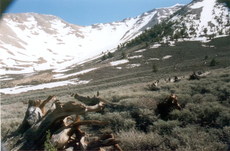
Finally! I took me four tries to make it up this darn mountain. I don't remember all the details, but briefly, here is the story of me and the mountain. The first attempt was in late May. We made a mistake by listening to the warning not to drive to the trailhead in a passanger car, and instead parked by the pond. This increased our approach by some two miles. This was pretty early in the season, and there was quite a bit of snow on the mountain. We made our own trail by following a snow-free patch on the eastern side of the first ridge. The rock was loose, so it took us some time to get up to the ridge, from where we got to see a spectacular view of the snow-covered Sierras. However, there was no sign of the trail (we were too far north), and the snow to our left was few feet deep. On top of all this, I had to return to Lancaster that evening to prepare for my thesis defense, which was just few days later.
There was a significant amount of snow on the mountain during my first attempt
No big deal, at least so I thought. We came back in late June for a second attempt. This time, I was joined by a large group of friends from work, including Dan, Dave and Ellie, for whom this was a practice for Kilimanjaro. This time, we settled for the regular route, which picks up by the saddle. We got up about half way to the first ridge, when the beautiful morning blue skies turned into dark thunder clouds. Rain was clearly visible in the surrounding valleys. We debated giving up, since some of us didn't have decent gear. No later than we decided to turn back, the hell broke loose. Hail few milimeters in diameter started falling all around us. The winds also picked up, and soon lightning started to hit the mountain. The valley below the mountain looked like New England in a middle of a blizzard.
Ok, third time is the charm. Well, not on this mountain! Or at least not for me. This attempt happened in August. Dan was walking much faster than the rest of the group, and hence he split from us. I, instead of following him, made a mistake of trying the mountain from the western side. Oooh, not a good idea! We started climbing up some 50 degree slope, where we needed both legs and hands to pull up. Unfortunately, the big boulders we tried using for holds were completely unstable. I decided to turn back after a boulder the size of half my body started sliding next to me. I descended, to find out that Sarah turned back too, after sliding down some 100 feet. I spent the rest of the day with her on the surrounding mountain, where we saw a pack of wild horses. Later that evening we ran into Dan, who made it to the top. Well, at least somebody made it... Garrett also reached the ridge, but was too exhausted to continue.
I figured I'll give the mountain one more chance the weekend of October 15th, 2005. This would be the last attempt of '05, since I wouldn't be able to return until late November, by when the trail would most likely be impassable due to snow. It looked like this may be yet another chapter in the book of the Curse of Boundary Peak, since the weather forecast looked lovely: 40F, snow showers, and steady winds at 40mph, with gusts at 100mph. Oh boy! But anyway, we took off on another 5 hour car odyssey.
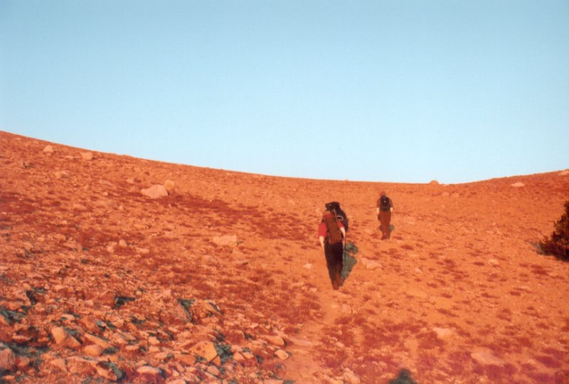
This time, to assure our success, we woke up at 3:45am, and hit the trail before 5am. This was the first time Jared has been on a night hike, and he was definitely enjoying it. The stars were out, and there were just few tiny specks of clouds in the sky. The weather was very nice too. It was a bit chilly, but nothing compared to the apocalyptic forecast. We reached the base of the mountain (the naked scree slope) just as the sun was rising.
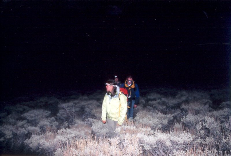
Approaching the mountain in the dark
We reached the base just as the sun was coming up. We got to see this spectacular sunrise.
Here we are heading towards the Trail Canyon saddle in the glow of the morning sun
We took the normal Trail Canyon route which starts on the northern side of the mountain. The trail was surprisingly solid, at least compared to the instanity we encountered on the previous attempt on the western slope. Of course, the term "solid" has its own meaning on this giant pile of kitty litter. We kept going up, until we reached the ridge. At the end of it, we got the first look at the summit, and the second ridge we had to cross to get there. At this point, Sarah decided to turn back. She was feeling sick, and just didn't have the stamina to keep going. She descended down the east chute.
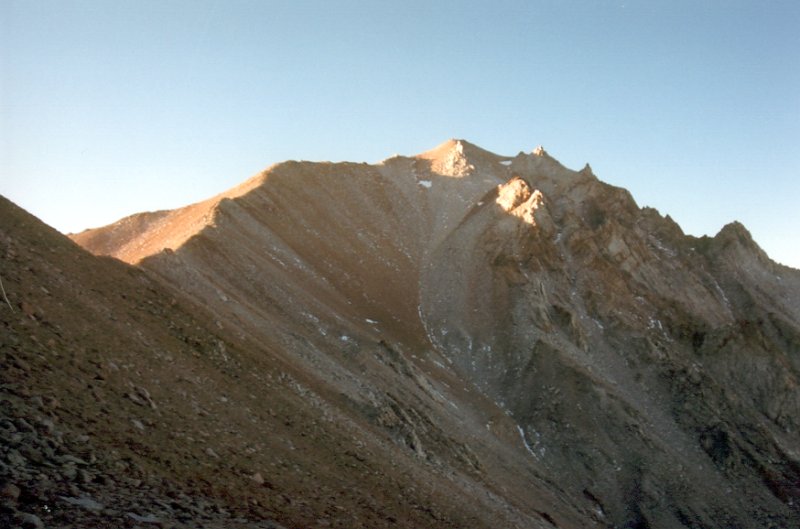
The trail to the top follows the ridge on the left. Summit is the little hill near the center
Looking back towards the first ridge from the second saddle
From here the trail was pretty easy to follow, with numerous cairns marking the way. Reaching the summit requires passing two boulder fields. Although these are not technically challenging, the sharp drop off on the side, combined with very unstable holds, made this passage a bit unnerving. We also encountered a mountain sheep here. The guy was showing off his skills, by hopping from boulder to boulder, and then waiting for the slow us to catch up.
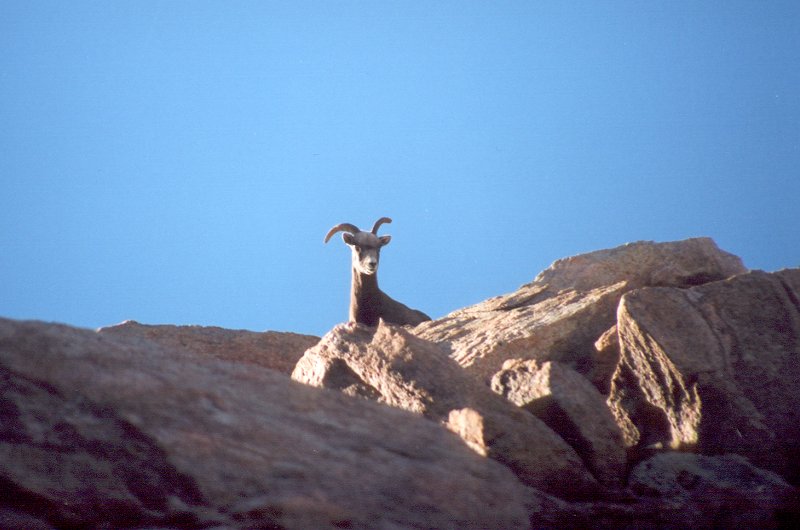
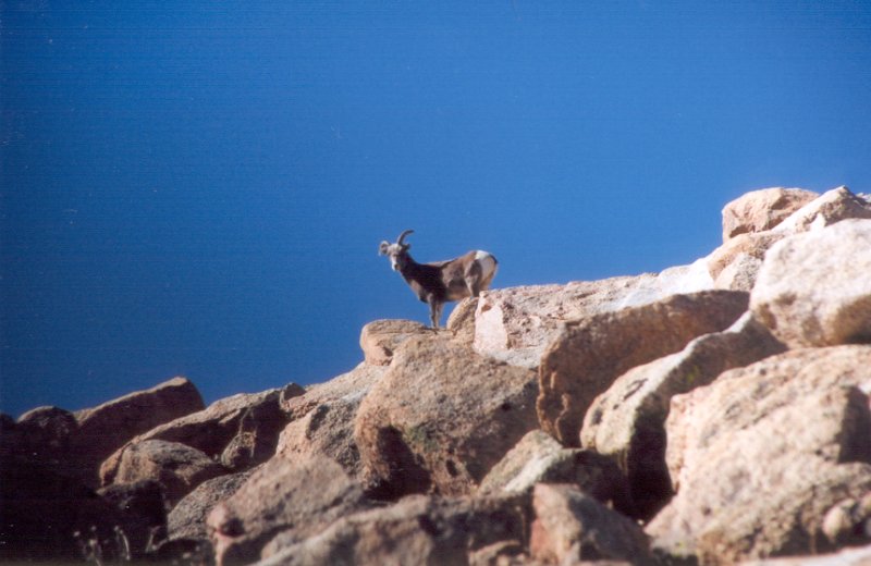
Climbing Boundary Peak seemed to be a joke for this mountain sheep
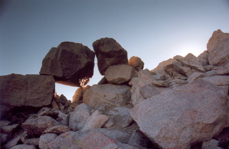
I wonder how long it will take for these rocks to tumble off the mountain, and join all the other rocks in the merry game of scree
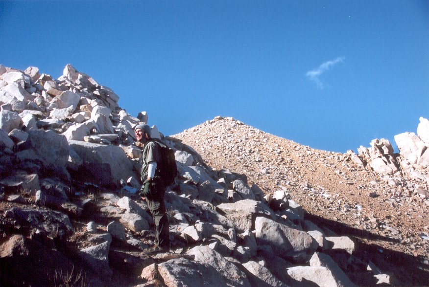
Garrett, with the summit cone in the background
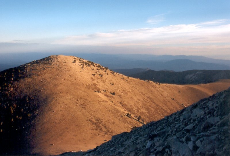
We reached the top at around 10am, about 5 hours after starting the hike. The way up there was great, but greatest feeling was knowing I won't ever have to return to this darn mountain. Montgomery Peak seemed pretty close, and I think that Mike was actually considering climbing it. The rest of us were pretty happy with just staying in Nevada on this hike, and after a lunch we turned back. The weather up there was really nice: blue skies, and just light wind. It seemed that the weather channel was wrong!
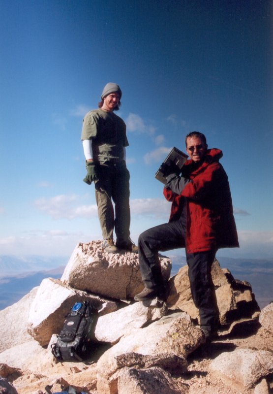
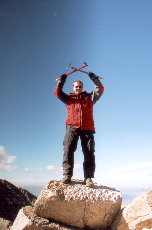
Finally!
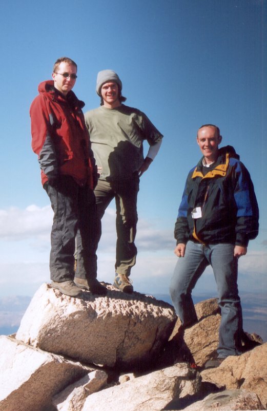
Group shot of the conquering team: myself, Garrett and Jared. Mike took the picture.

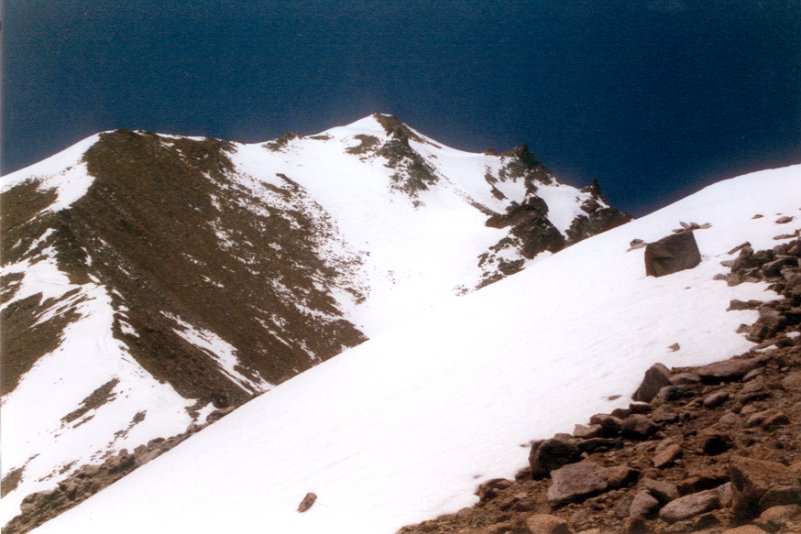
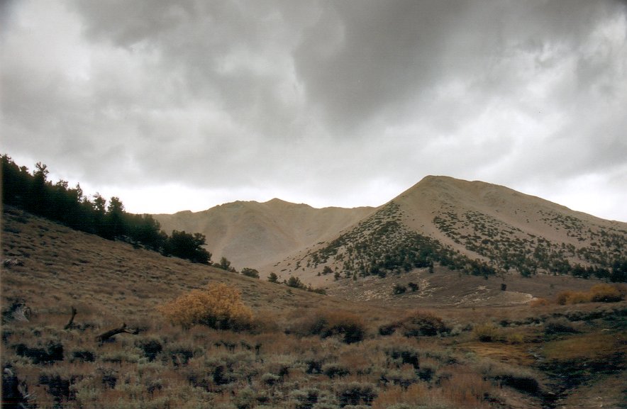
Mount Montgomery. Although it is a bit taller, it happens to be in California.
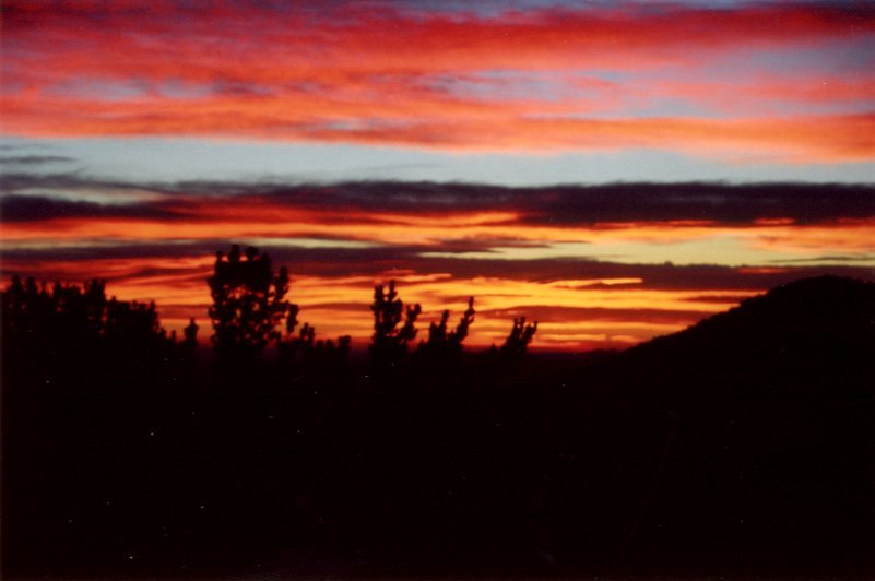
On the way down we started seeing other groups ascending the peak. This was pretty surprising, since we didn't see anybody camping by the trail head. On all previous attempts, the trailhead area was filled with campers. However, this was a bit worrisome, since the weather started deteriorating really rapidly. The blue skies we had on the top were being replaced with nasty looking dark clouds. We met up with Sarah at the bottom of the east chute. We then quickly headed back to the car. It started snowing only few minutes after we got there. Actually, the snow was almost insignificant at the parking lot, but the peak itself was definitely getting hammered. This was a good reminder of the second attempt. If there is one thing I learned during my four tries it is that this mountain has a really predictable weather: nice until about 10, and then hell on earth...
Dark clouds rolled in soon after we got off the mountain. It started snowing shortly afterwards.
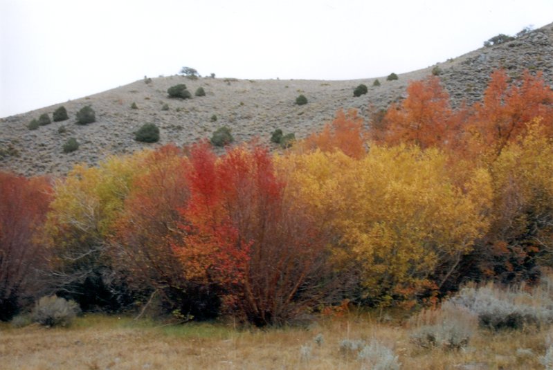
Who said you need to go to the east coast to see fall foliage?