| home:highpoints:mount washington | site map | help |
| Mount Washington (NH) |
Elevation: 6,288 ft
Date: 3 days, July 31 to August 2nd, 2002
Group Size: Solo
Miles Covered: 32
Difficulty: This mountain will kick your ass and come back for more
Scenery: Greatest so far
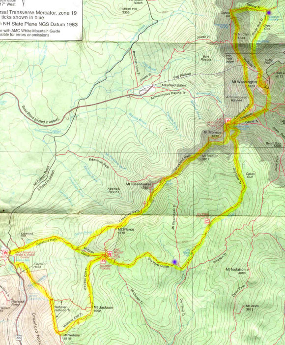
Few weeks after coming back from the Catskills, I drove up to Vermont, where my mom was attending a conference. While there, I went to New Hampshire, to backpack in the Presidential Range (peaks here are named after U.S. presidents). Click here for a map of the trail. Those two blue dots indicate my campsites. I started by Saco Lake off of US-302 and hiked to Mt. Webster and Jackson the first day. Then I camped close to the Dry River Falls. Next day I took the Dry River Path to the Lakes of the Clouds and to Mount Washington. I descended down to the Great Gulf and camped there. Last day I finished by taking the Crawford path (the oldest trail in America) back through Mt. Clay, Monroe and Eisenhower. This hike still holds the crown for the hardest hike I've done - not so much because of the elevation gain but due to the ruggedness of the trail. Most of the hiking here involved either walking in a river bed, in mud or on sharp rocks. But it was definitely worth it - the views here were worth every bit of the struggle.
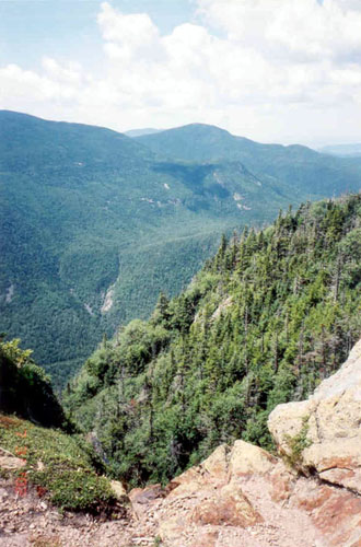
View from Mt. Webster (el. 3910)
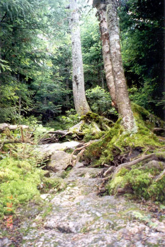
Here is a shot of the dry, non-alpine section of the trail. The trails here were not marked (except river crossings, trails above the tree line and the Crawford Path which is a part of the AT), and were too often overgrown. I often had to backtrack or take out my compass (first time I actually needed it!), but it was actually pretty nice to get away from the gigantic white blazes of the AT. This ruggedness added a nice touch to the feeling of being in a real wilderness, however in several years many of these trails will impassable unless they are maintained.
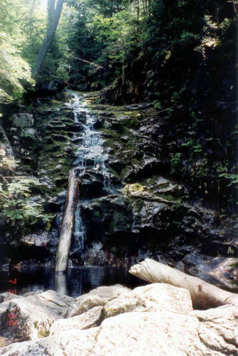
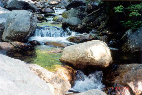
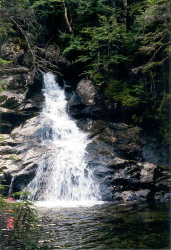
Some of the earlier waterfalls I passed by. The Presidential Range was full of waterfalls of every shape and size.
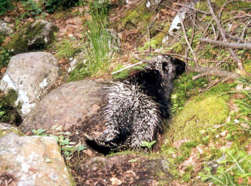
Porcupine! Run! Actually we both kept looking at each other until the porcupine decided to finish crossing the path.
Here is one of the many creeks that lead to the Dry River. Don't let the name fool you. This was the wettest part of the hike. The Dry River Trail was about 2 miles of walking either in ankle deep mud or in water.
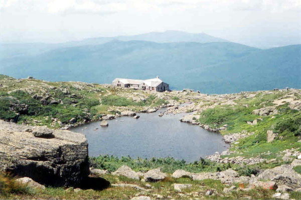
Here is the hut at the Lakes of the Clouds. This hut is about 1.5 miles from the summit of Mt. Washington and is a popular place for day hikers to stop and get a cup of hot chocolate before continuing on. You can also stay here overnight, if you can afford the astronomical hundred bucks a night.

Probably my favorite part of the hike. That sign notifies that the area ahead has THE worst weather in America. In fact, a trail in the Taconic Range was named after two guys who died here in July when they got stuck in a snowstorm. Mt. Washington also holds the record for the fastest wind recorded ANYWHERE on Earth - 231 mph.

Here is the summit (el. 6288). I spent about 5 minutes up here as this was even worse than Mt. Mitchell. The hike up to the summit from the Hut was pretty tough and the first thing I saw once I made it was a parking lot. I took this picture and bailed out.
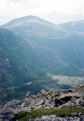
I took my break while descending down to the Great Gulf. This had to be one the most peaceful moments I ever experienced. Total silence, except the humming of bees, with me looking down onto these infinitely long green valleys surround by the panorama of the mountains. I camped in some 2 miles past the Spaulding Lake (in photo).
These are the Wetamoo Cascades, close to my campground
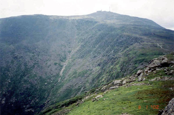
This shot is from the last day, after I made it back up from the gulf. That grayish line running across the center of the photograph is the Great Gulf Trail which I took down the previous day. Going down that trial basically meant slowly sliding over rocks and boulders, hoping my pants will not rip.
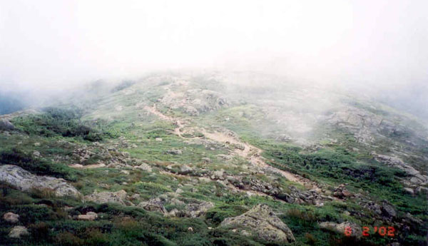
Even though Mt. Washington is known for its bad weather, I got really lucky. It was beautiful every day, with sunny breezy days and blue skies. Only towards the end of my hike it got cloudy. These are clouds rolling over the valley before Mt. Monroe.
Comments or questions? message me