| home:highpoints:mount whitney | site map | help |
| Mount Whitney (CA) |
Elevation: 14,494 ft
Date: 1 day, June 20th, 2004
Group Size: Solo
Miles Covered: 22 miles
Difficulty: Pretty treacherous, especially on the way down
Scenery: Star-filled sky, mountain lakes, snow covered peaks
Whitney was my first "fourteener". Not knowing what to expect, I hiked up Mount Gould with Joe Polidan few weeks before this trip. Gould is 13,005 feet high, so it gave me at least some ideas of how my body would react to the altitude. However, it failed to prepare me for the treachery of doing Mount Whitney in one day!
Hiking Whitney seems to be a very popular activity, which leads to a nice problem: permits. Backpacking permits are snatched early in the year, so by the time I knew I will be spending my summer in Cali (work), I had only one option: a day hike. But don't be mistaken, this is not your typical day-hike. I started hiking at 2am, made it to the top at around 9, and didn't get back to my car until about 5pm.
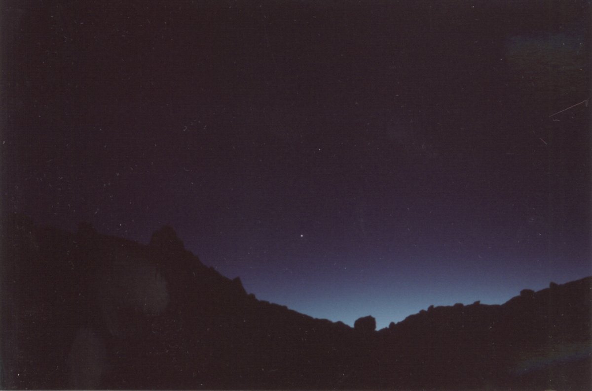
First sun rays peeking over the horizon
Instead of camping by the trail head, I decided to drive in directly from Lancaster. I left town at around 11pm on the night of June 19th. I meant to sleep at the trail head for an hour or two, but since I didn't get there until about 2am, I figured I may as well start walking. The moon was not out (new moon), so I was walking under a beautiful dark sky filled with millions of stars. The Milky Way was nicely visible.
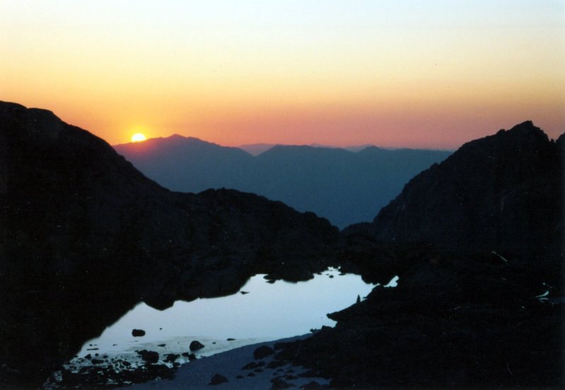
Sun rising over the Trail Camp
I didn't have much problem following the trail. For the first couple miles the trail went through an alpine forest and passed several lakes. Later the trail emerged onto a rocky field, where staying on the path became a bit trickier. The trail was not marked, and my headlight didn't put out enough light to see where the trail picked up past the rocks. However, somehow I always managed to go in the right direction.
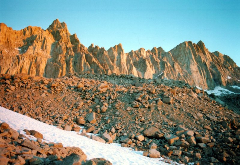
The mountain in the morning glow
People who backpack this mountain usually stay at the Trail Camp right below the 99 switchbacks. I got here just before the sunrise. While going up the switchbacks, I ran into the first person I saw on the trail. This guy was coming DOWN from the mountain! Supposedly he left his car at around 11pm and ran to the summit. Crazy. Going up the switchbacks wasn't really as bad as I thought. There are a lot of them, but they are very short and not very steep. Still, the elevation was getting to me. My heart was beating at about 200 beats per minute. I could hear my pulse in my ears. Doing mundane tasks, such as putting one foot in front of the other, required a constant mental effort.
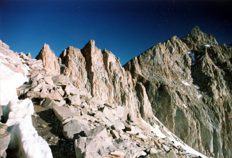
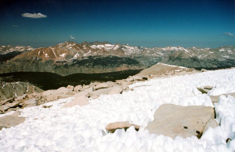
View from the Trail Crest
I took a break on the Ridge Crest (top of the switchbacks). The view from here was really pretty. On one side were the lake-filled valleys of the Sequoia NP and the snow capped mountains surrounding them. On the other side was the Trail Camp being baked by the first rays of a new day. At this point I also got overtaken by two guys who were trying to see how fast they can make it to the top. They were the first people I saw going up.
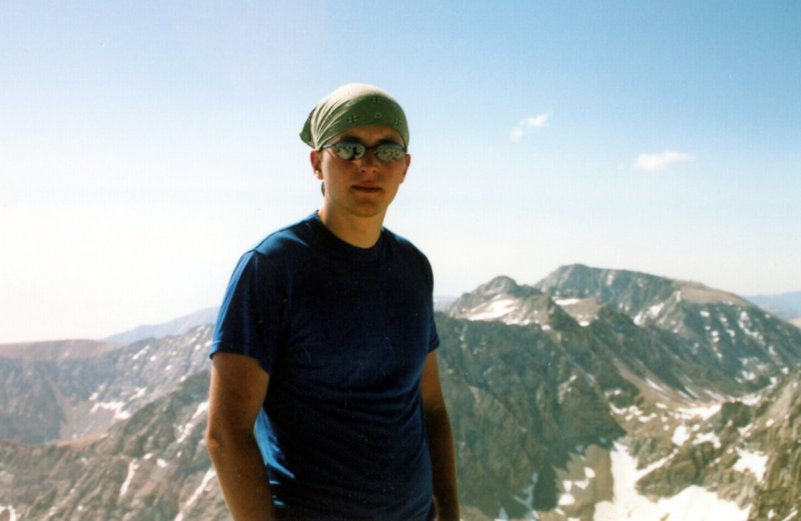
Me on the summit

Summit hut
I reached the summit a little before 9 am. There was another couple up there that came from the direction of the Guitar Lake. Coming down was pretty amusing. While on the way up I had the mountain basically to myself, on the way down I had to let a train after a train of people go by. Everybody looked like a zombie, just slowly trudging uphill. The funny thing about elevation is that you only feel it going up. The moment I started going down, I felt completely fine, even though I was still at 14,000 feet. However, the moment I had to make few steps uphill, the fast heart rate and dizziness came back.
Strange snow patterns near the summit
While going up Whitney was challenging, yet fun, going down pretty much sucks. The trail is 11 miles each way. There is about 8 or 9 miles left from the base of the switchbacks. All downhill! That was bad news for my toes. On top of this, I started getting blisters and the lack of sleep from the night before was starting to get to me. The worst moment came when I saw the parking lot for the first time. It was some 2 or 3 miles away. Seeing the tiny lot in the distance was pretty depressing. Yet, besides cursing this trail, my only option was to keep going. Around 12 a thunderstorm rolled in, and it started raining. This was the first and only time I saw rain during the two months I spent in California. The rain didn't last too long though. I made it back to the car at around 4 or 5pm and immediately went looking for a place to eat. The drive back to Lancaster was pretty rough. I could barely keep my eyes open and I didn't even have a signal on my cell phone to call somebody to help me stay awake.
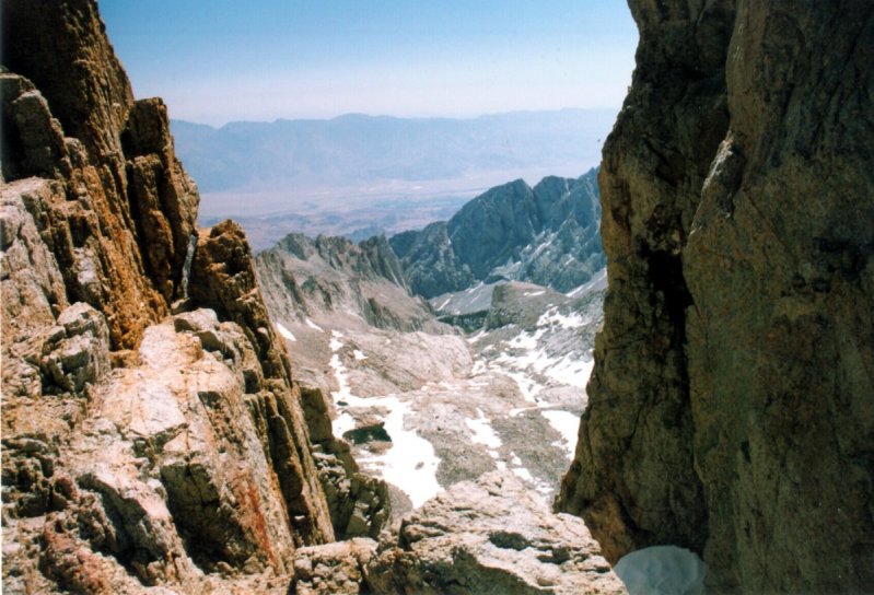
View from the John Muir trail
Going down I realized why some of my friends were reluctant to join me on this hike, having done Whitney before. Going up Whitney in a single day is extremely mentally exhausting. I made a big mistake by not sleeping the night before the hike. I guess I could have left an hour or two later, but then I would have missed the beautiful sunrise over trail camp, and would have to share the trail with herds of other hikers. Yet really the worst thing was the 11 mile trip back down. After achieving the goal, it's pretty hard to convince your body to do all this extra walking, without much break in between.
Comments or questions? message me