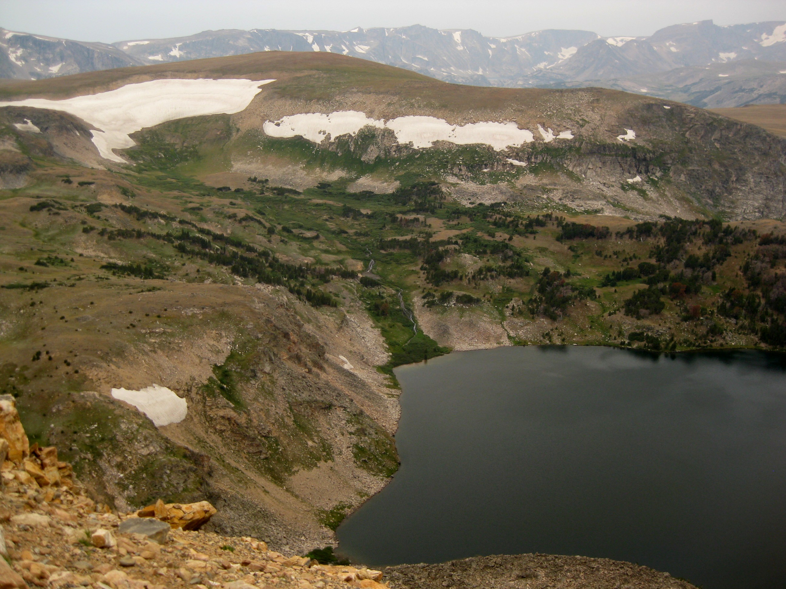
Elevation: 12,807ft Date: August 11-13, 2012 Group Size: 4 Miles Covered: 26 Difficulty: The most mentally challenging highpoint, hands down! Scenery: Absolutely mesmerizing scenery. Even if you don't go for the summit, you should come here for a backpacking trip. This highpoint takes the crown for the most beautiful scenery.
2012 is so far shaping up to be a great year! I finished my Ph.D., completed several projects with my consulting company, will be getting married in about a month, and now, with the climb to the top of Montana, I finished the quest I set off on in 2001 - a quest to climb the highest peak of each US state. Ok, two states still remain, Alaska and Hawaii, but those can wait. Really my main goal all this time had been to knock off the 48 contiguous states. And now it's done!
Granite peak was always that one scary highpoint looming on the horizon. It is the only highpoint that requires a roped class 4 or 5 climb on the standard route. Not being a rock climber and generally having a fear of heights, I found this mountain more challenge than I wanted to swallow. I kept pushing off the attempt year after year, promising myself to take on rock climbing but never finding the time. So when another highpointer Alex emailed me asking if I wanted to join
his group on an attempt of Granite, I first refused. However, after Alex told me that they were taking an alternate back way, up the Southwest Couloir, that required no climbing, I finally relented. The timing was awful, their climb was scheduled for the weekend right before one of my contracts was due, and knowing myself, I knew it will be a miracle to have things done beforehand. But this was also a too-good of an opportunity to pass by.
Cooke City, MT
But I almost didn't even get out of D.C. My Delta flight to Minneapolis left D.C. at 6am. I got only one hour of sleep the night before trying to finish the project so the moment I got on the plane I took a nap. It didn't last long; before the take off I got woken up by the flight attendant telling me I need to place my netbook (the size of a book) under the seat or in the overhead compartment. I told her that I typically fly with Southwest and I've never heard of this policy before. In fact, I even flew with Delta to Atlanta two weeks before and I had my netbook in the seat pocket without anyone saying anything. The lady started barking at me about how she doesn't care what Southwest does and how she follows federal policy. She asked me if we had a problem. I told her that yes, I do have a problem, and that is with her customer service. She then started demanding my boarding pass presumably so she could kick me off the flight! Since it was stashed in the overhead compartment, she calmed down a bit, but not before having the pilot make an announcement. I don't understand the logic of this policy Delta has, but regardless, there were better ways of handling wanting me to place the laptop on the floor than being rude. Incidents like this really make me appreciate Southwest so much more.
I met Alex in Minneapolis and we caught the same flight to Billings. The weather in Billings was quite apocalyptic - blowing wind, orange haze, and smoke-filled air due to a nearby wildfire. We waited for about an hour to get a rental car - most cars were checked out to the fire fighters. Alex' friend Fun was going to meet us in about 2 hours, which gave us just enough time to go to town to look for stove gas canisters and get some food. The first place we tried, Walmart, only had white gas. We then went to Cabela's. At the entrance we were greeted by a gun check-in station where presumably you are supposed to leave your various firearms while you go about shopping. This definitely is not something that we have in the D.C. area! But Cabela's was also out. In fact, the sales clerk told us that he has not had any gas canisters since April, making it sound like there was a major gas canister drought in this city. But he suggested we check The Base Camp, an EMS-like store. Finally, success. I also grabbed a topo map of the Beartooths and a Granite Peak quadrangle, just out of habit. Little did I know how handy the map will become later on. We then headed back to the airport and got there just as Fun arrived.
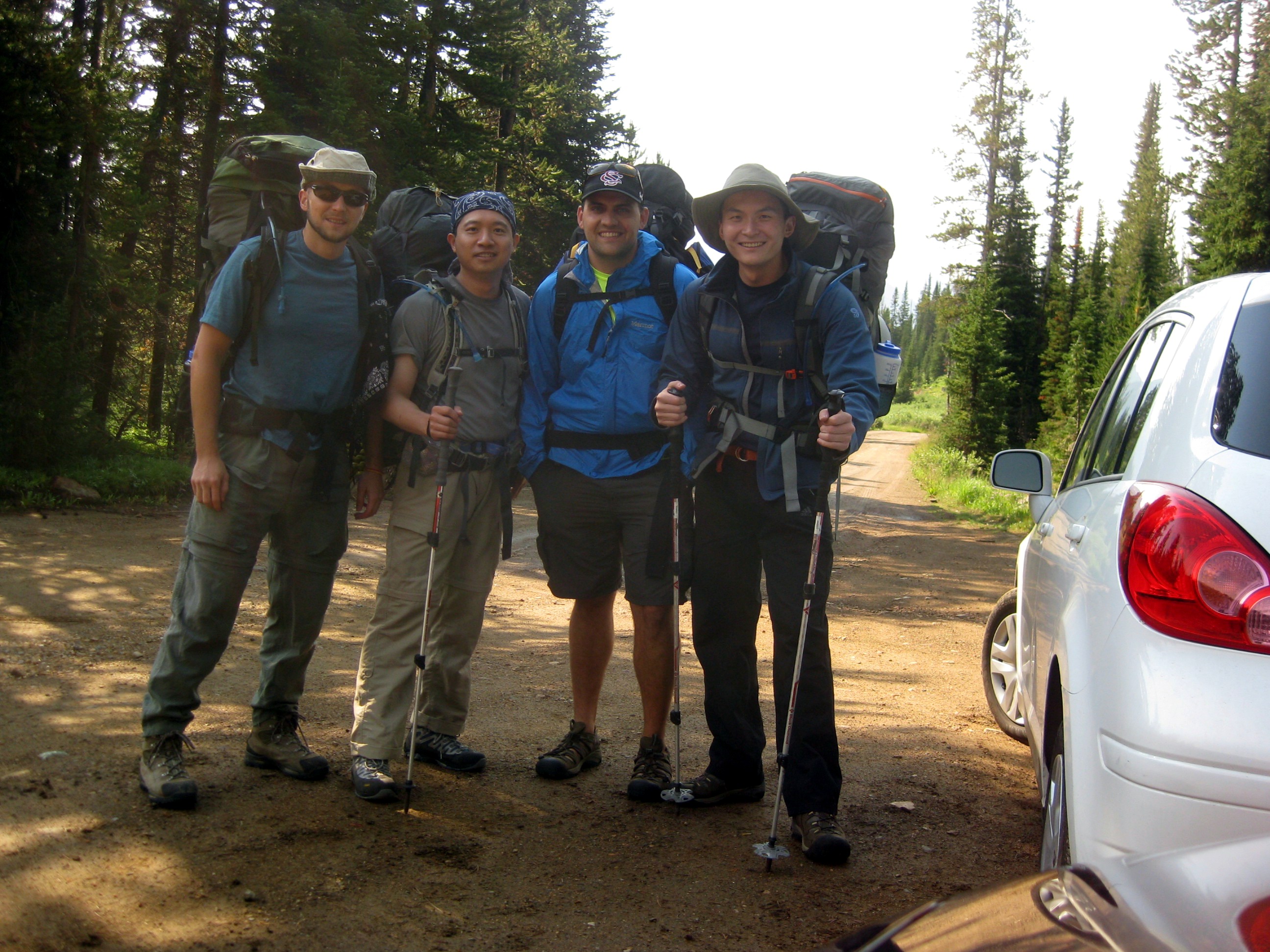
We now had three out of the four climbers. The final guy, Mitchell (with about 44 highpoints under his belt), missed his first flight and got stuck waiting for another one. He wouldn't be arriving until midnight and thus will take a separate rental car. With this, the three of us took off for Cooke City, a two hour curvy journey through an amazing high country that gives you a taste of things to come. We checked into Alpine Motel and went across the street to the Bistro for a bite to eat. Our waitress looked and sounded Slovak, and sure enough, was. Turns out, there is quite a lot of Slovaks working in this area, and this was her fifth summer working in this restaurant (for those who don't know, I am from Slovakia, and also run a Slovak cooking website). After dinner, we headed back to the room, where I continued working on a proposal that had to be submitted before we left for the hike. I stayed up most of the night. We expected Mitchell to come in the next morning around 9, but instead there was a knock at the door before 7. He drove down the night before but didn't want to wake us up so he slept in the car. We had breakfast (biscuits and gravy for me) and then the other guys patiently waited while I finished and submitted the proposal at 10am, right before the intermittent internet went out again.
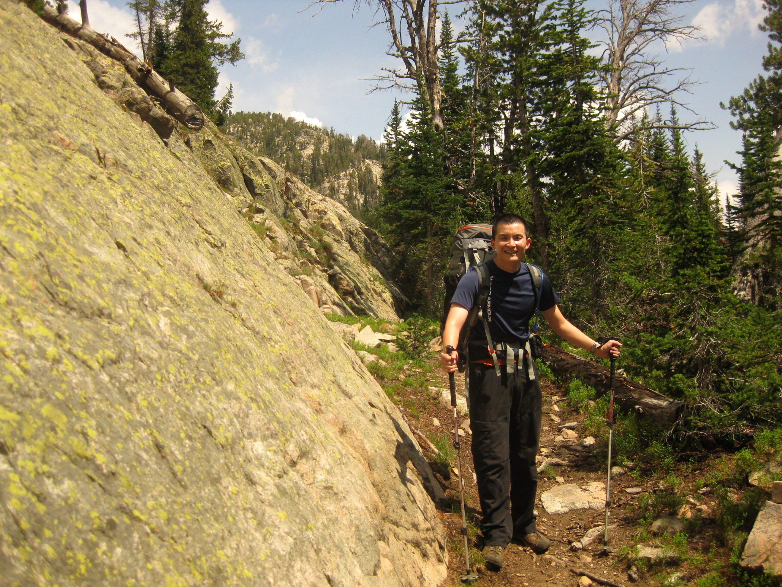
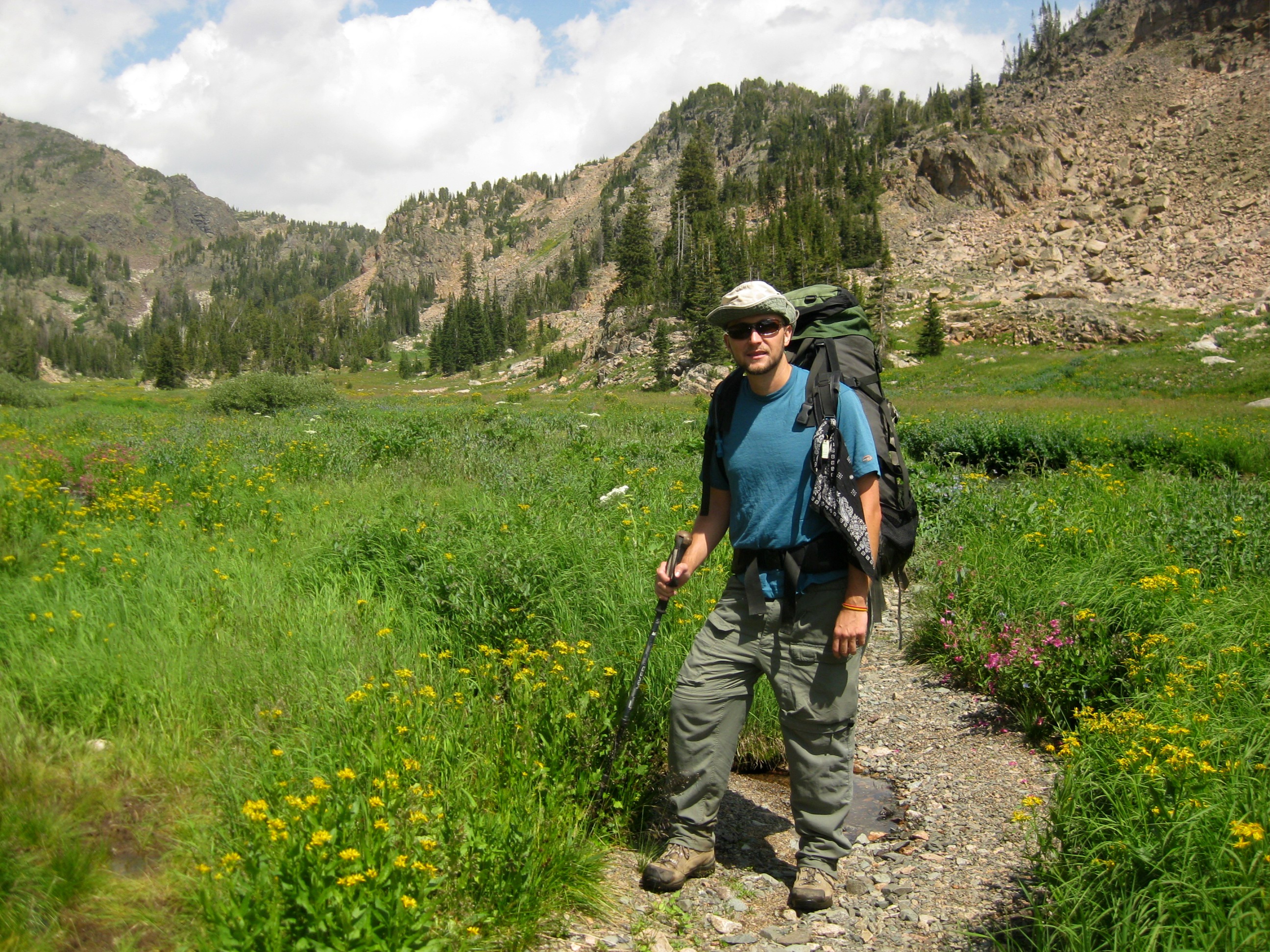
Approach to the base camp
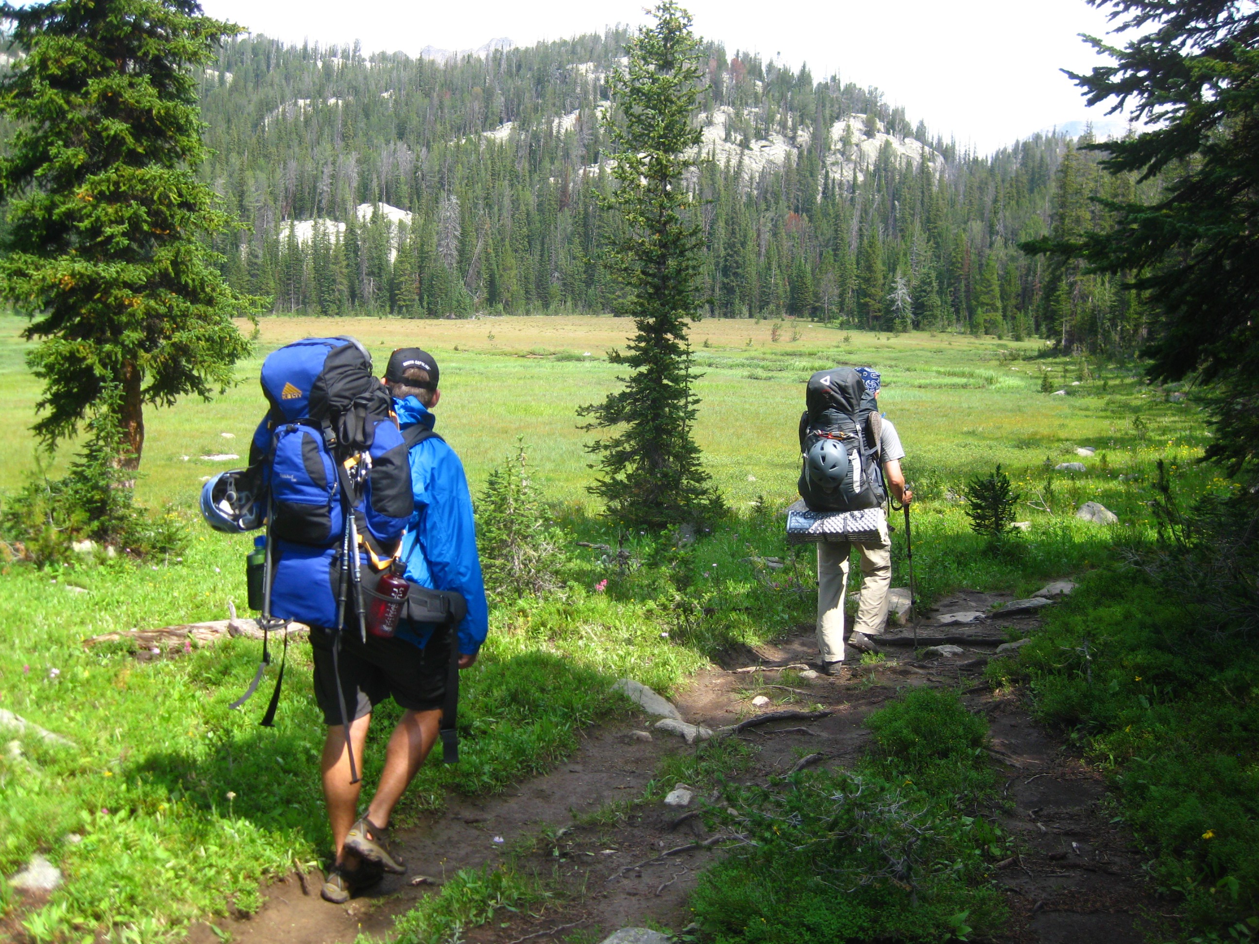
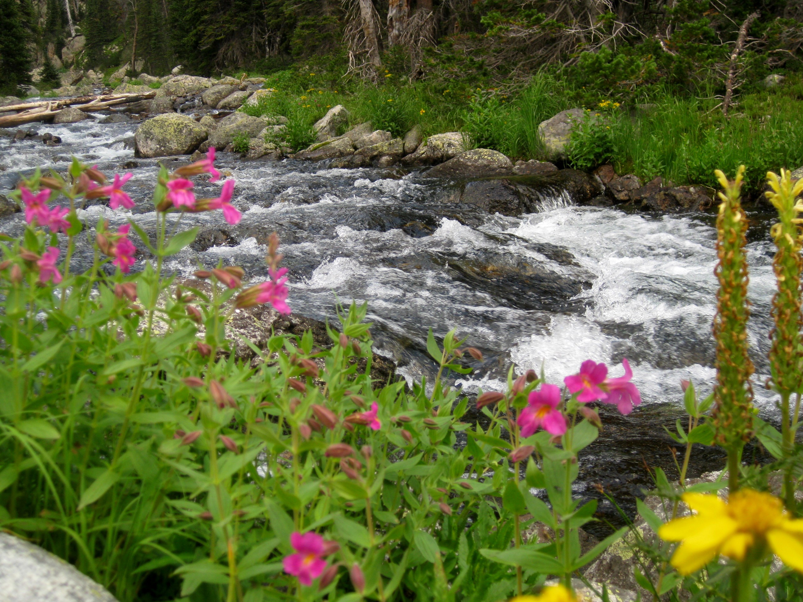
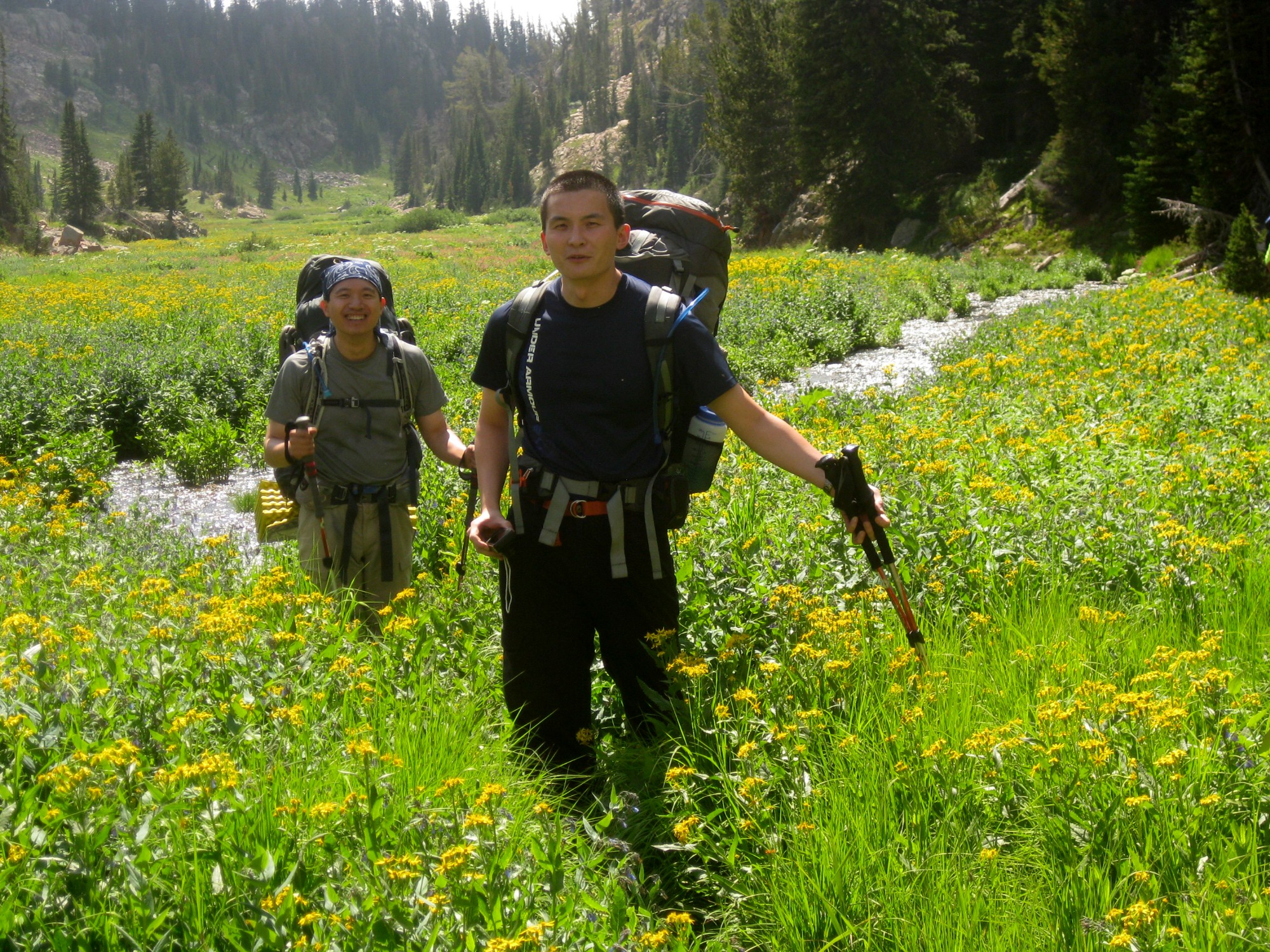
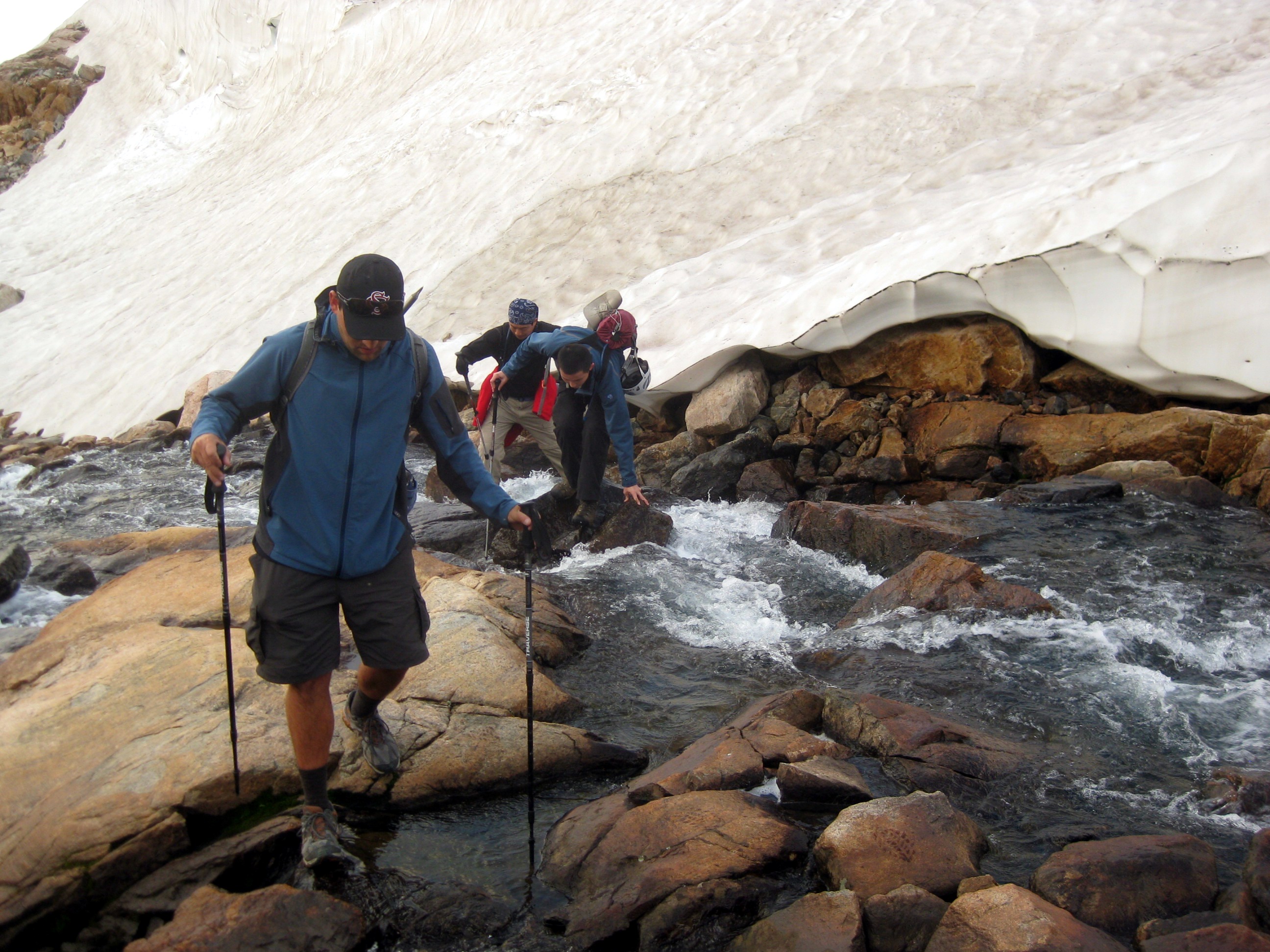
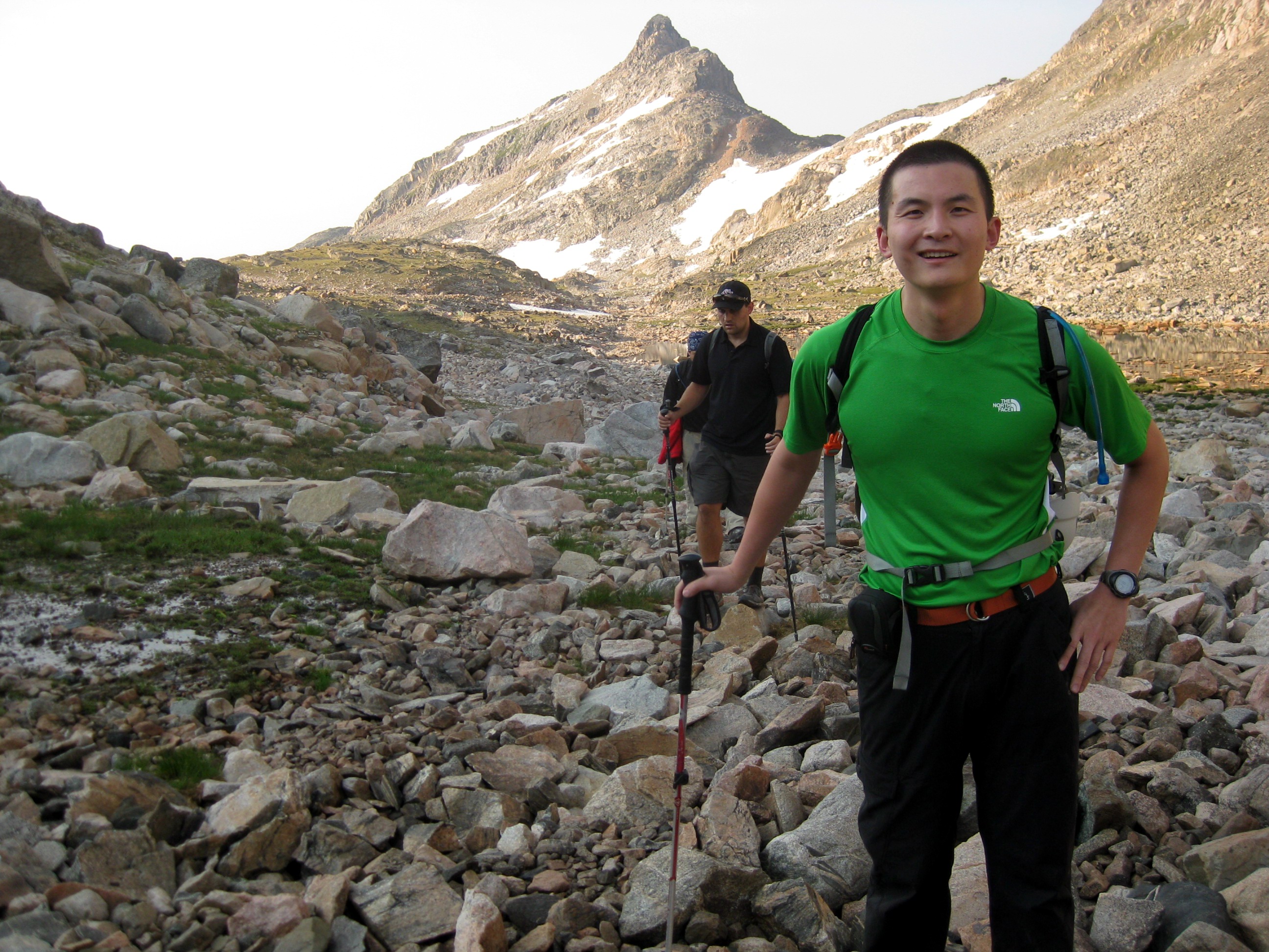
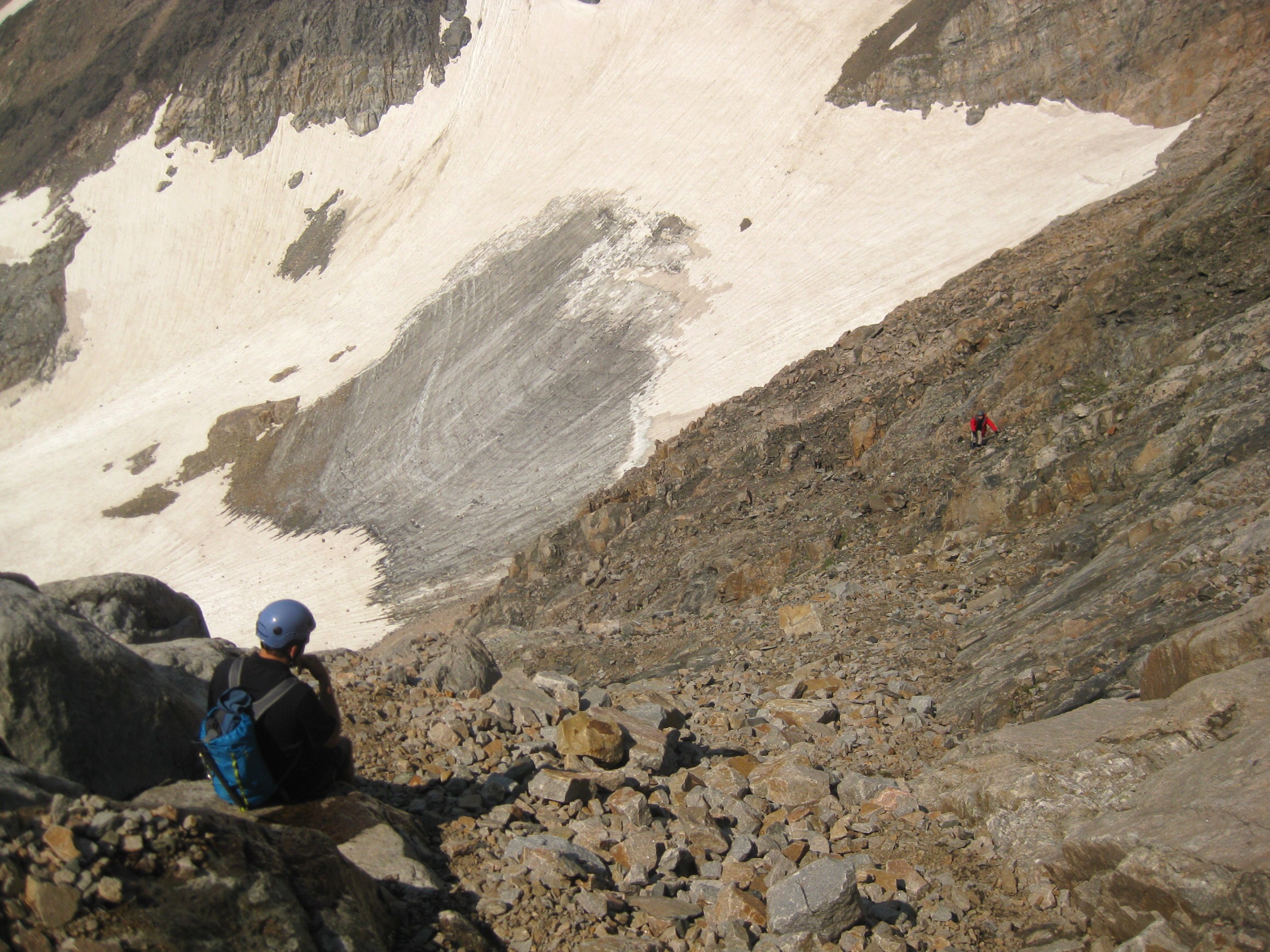
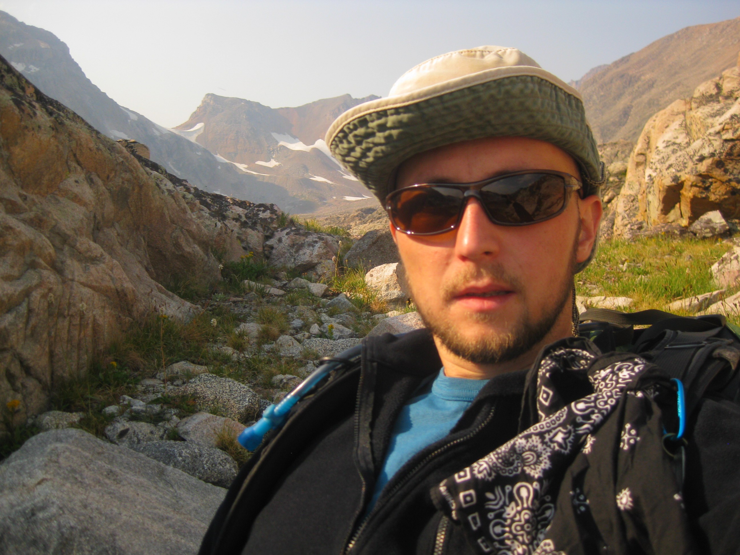
A stunning view along the US 212 snaking through Custer NF on the way to Cooke City. The second picture is us right before we set off on this adventure. From left to right: me, Fun, Mitchell, and Alex.The trailhead for the southwest approach is located just few miles north east of Cooke City. It's off a dirt road heading to Lulu Pass. The trail first passes some abandoned houses. The nice path through woods then continues towards the Lady of the Lake. About a mile after the lake you will come up to a river crossing too deep to make in boots. Right after this crossing, you need to pay attention for a fork. The path continuing straight heads to the Lower Aero Lake.
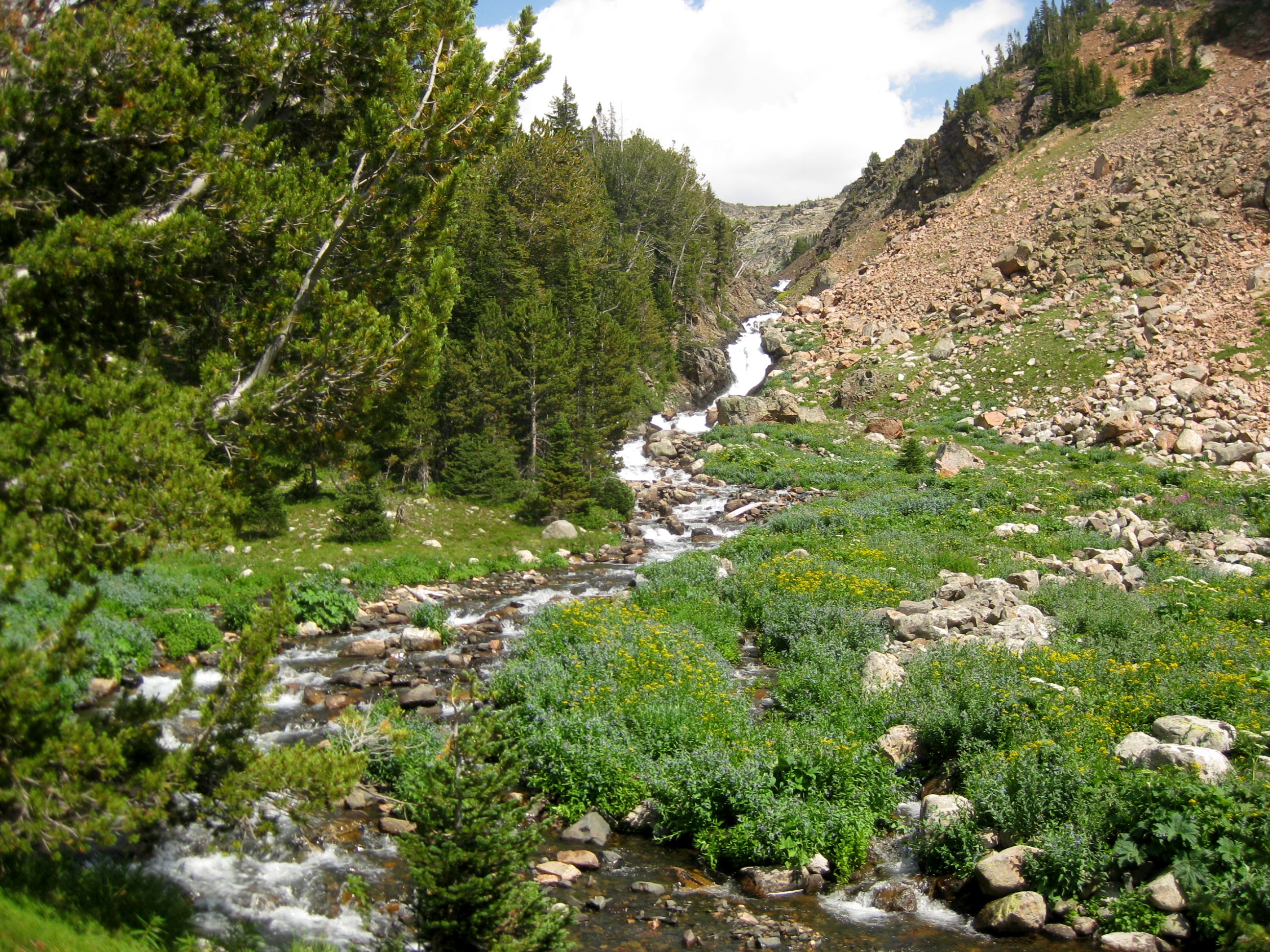
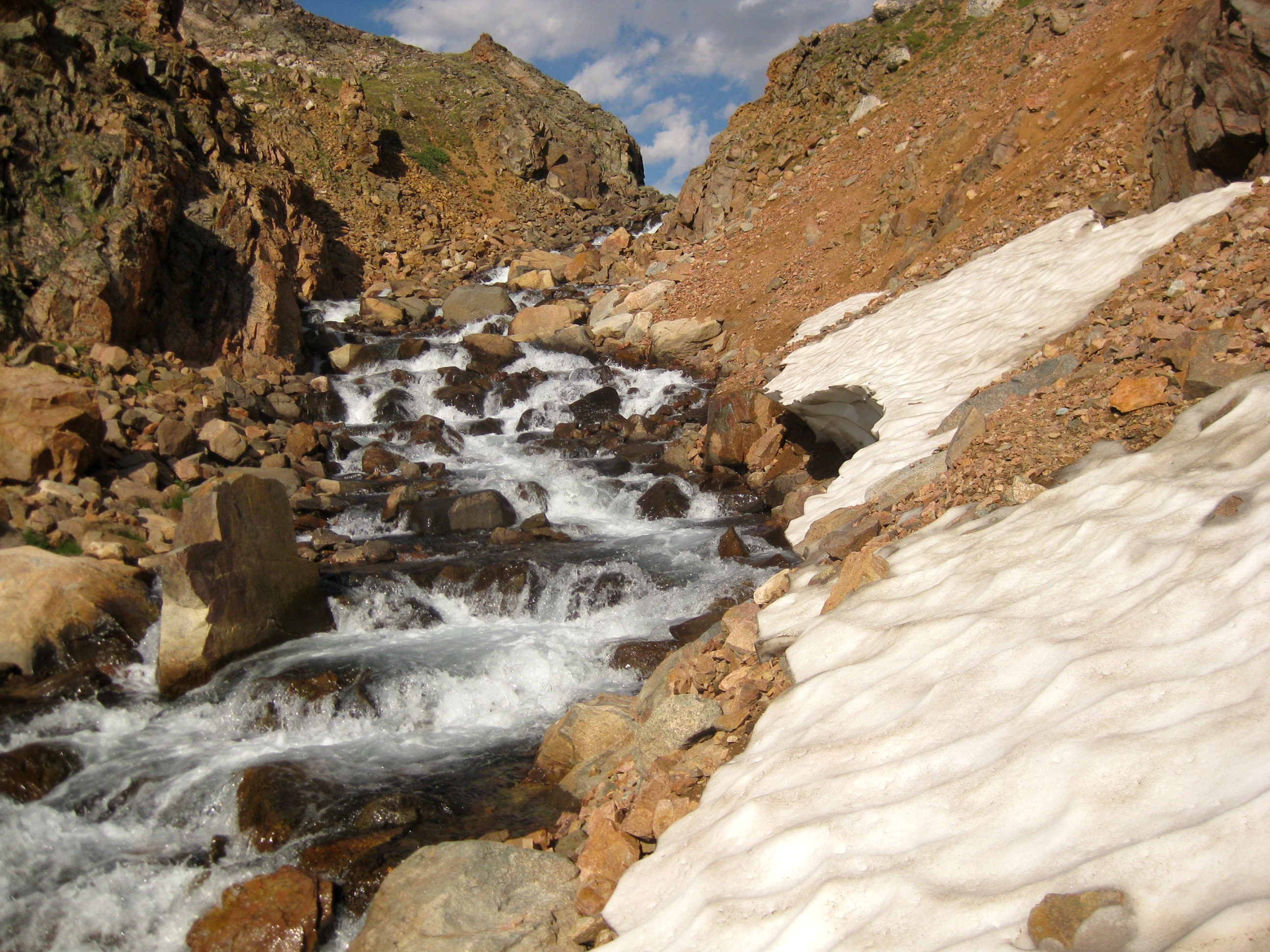
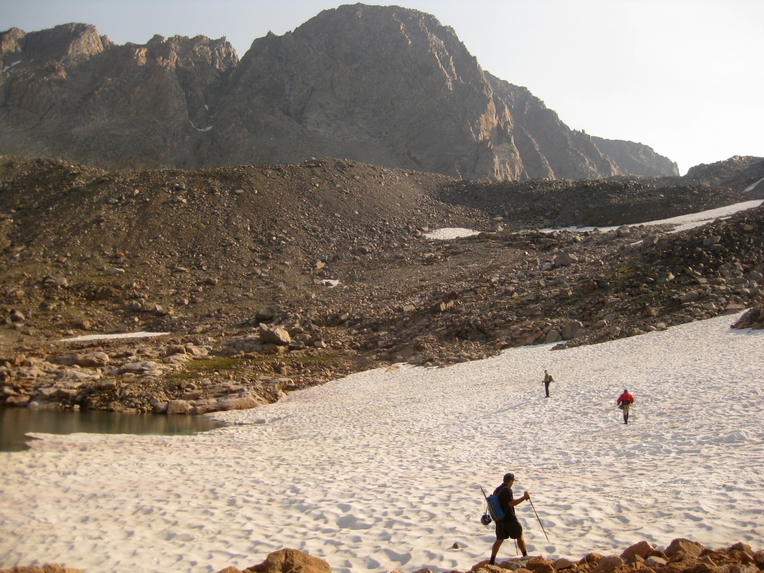
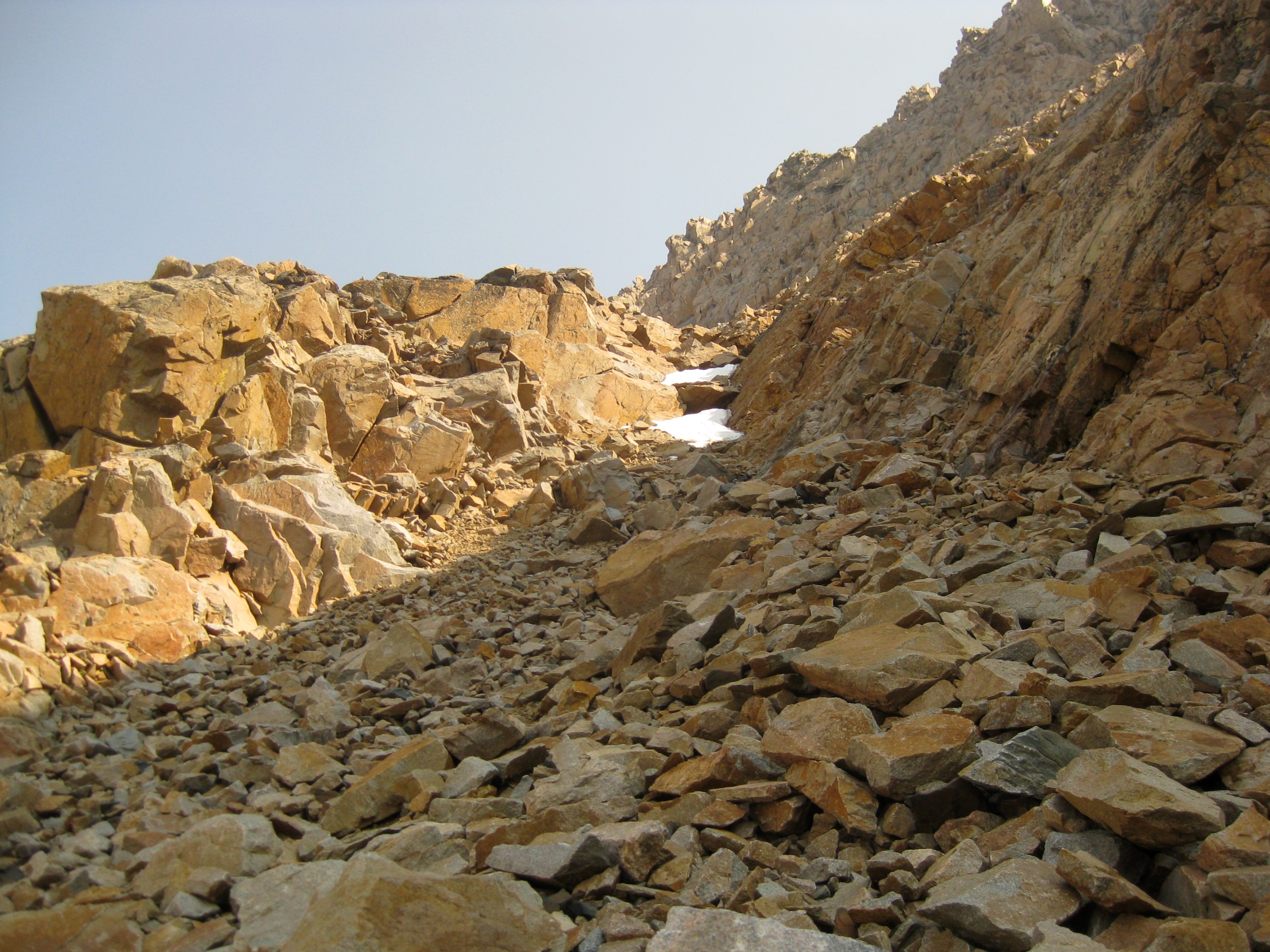
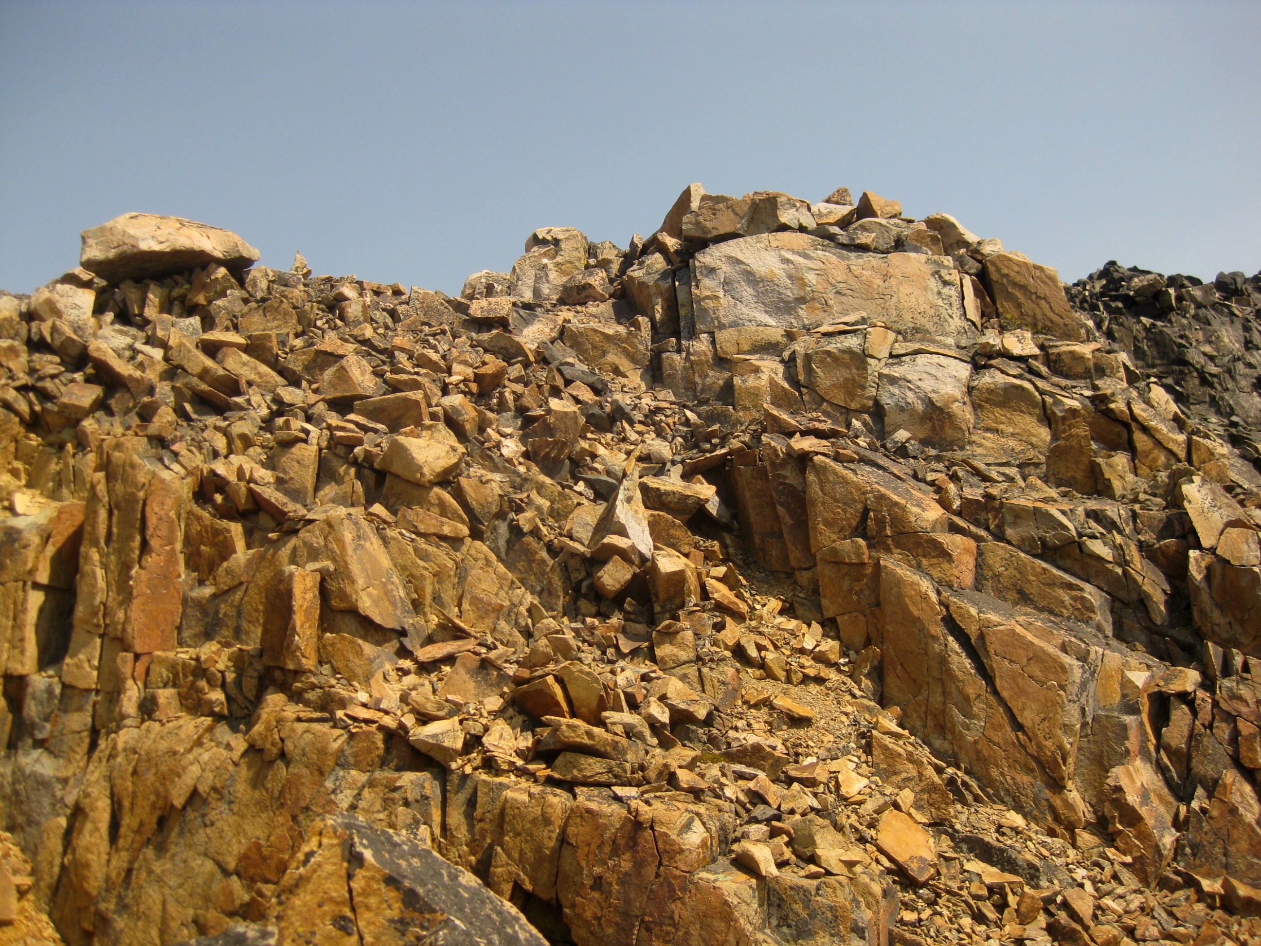
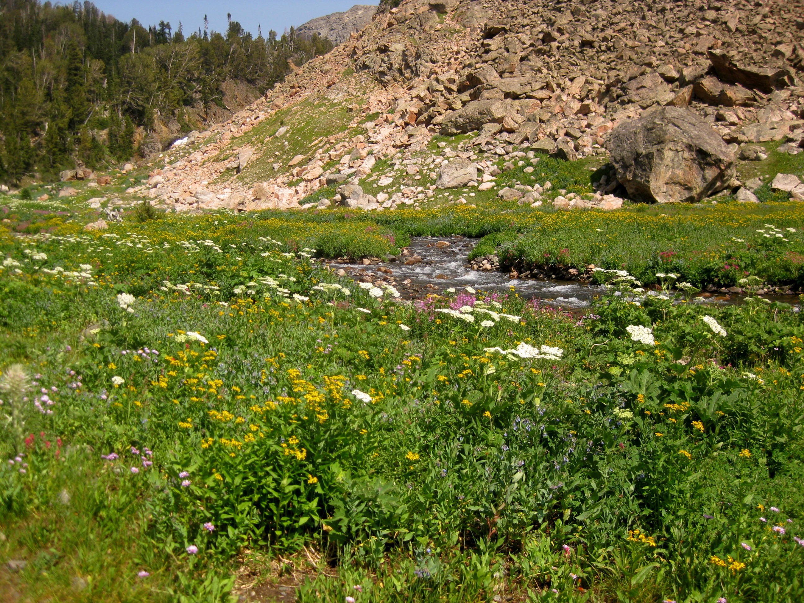
Instead you want to go right. This path first passes through the woods before dropping down to the Sky Top Creek. After another mile or so, the path drops into a wildflower covered alpine meadow. Continue north east up a prominent valley, following at first a small tributary and then the actual Sky Top Creek.The meadow continues until you get to the last hill that brings you to the high country.The scenery rapidly changes as you start gaining Lone Elk Lake.The wildflowers give way to grasses and later to barren talus fields. There is a lot of boulder hopping from now on until the peak so get ready.
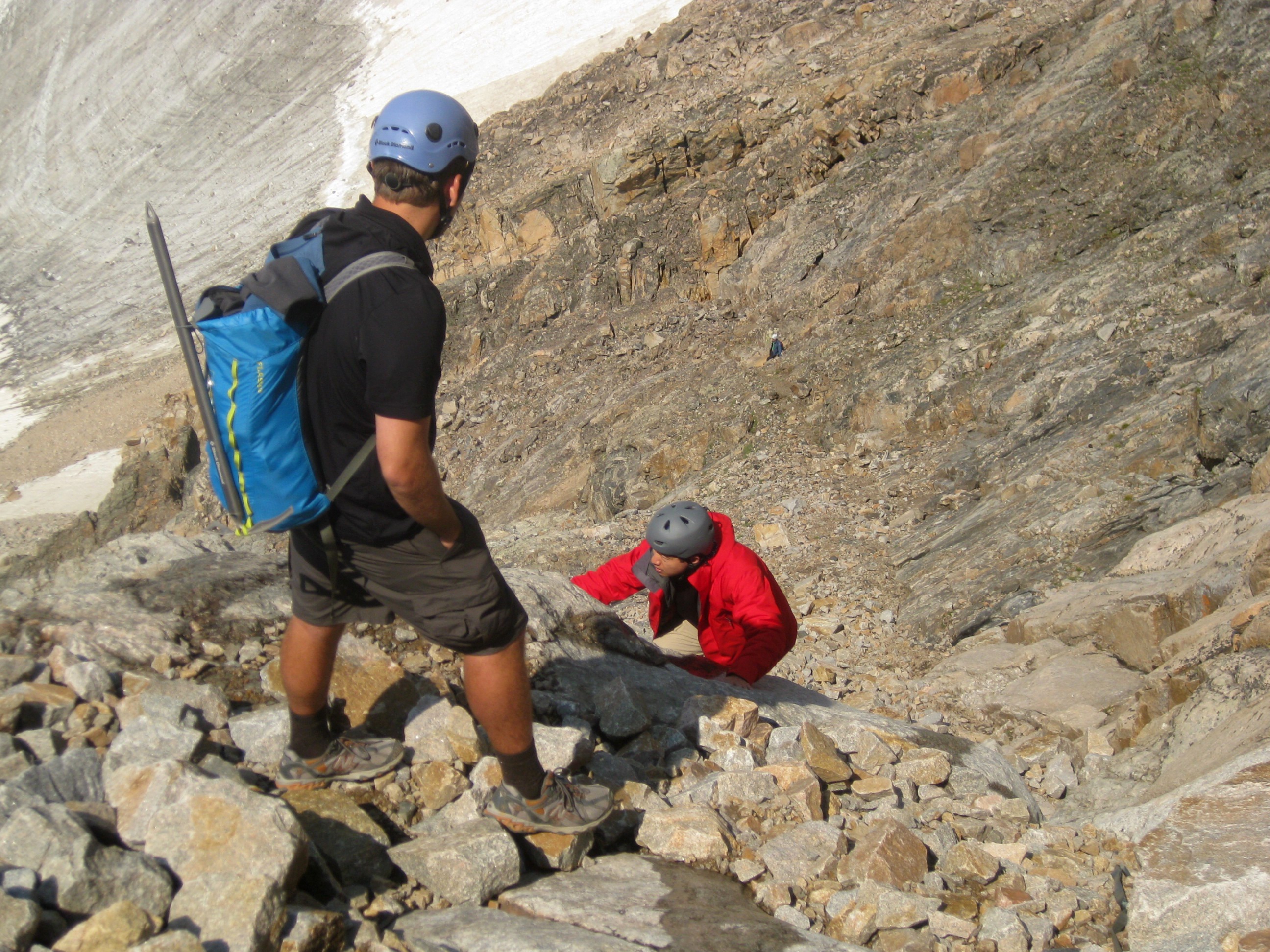
We followed the same route as in this trip report, but did not use Mitchell's GPS. The trail here is marked by cairns and seems to come and go.
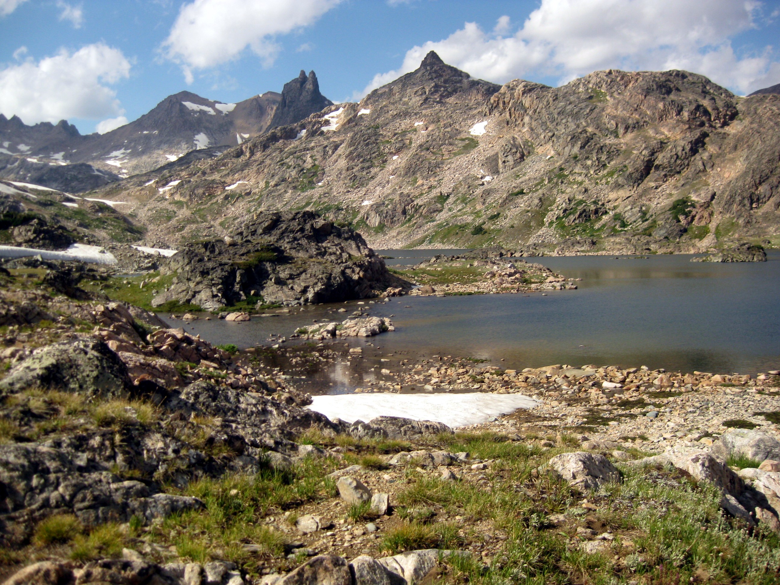
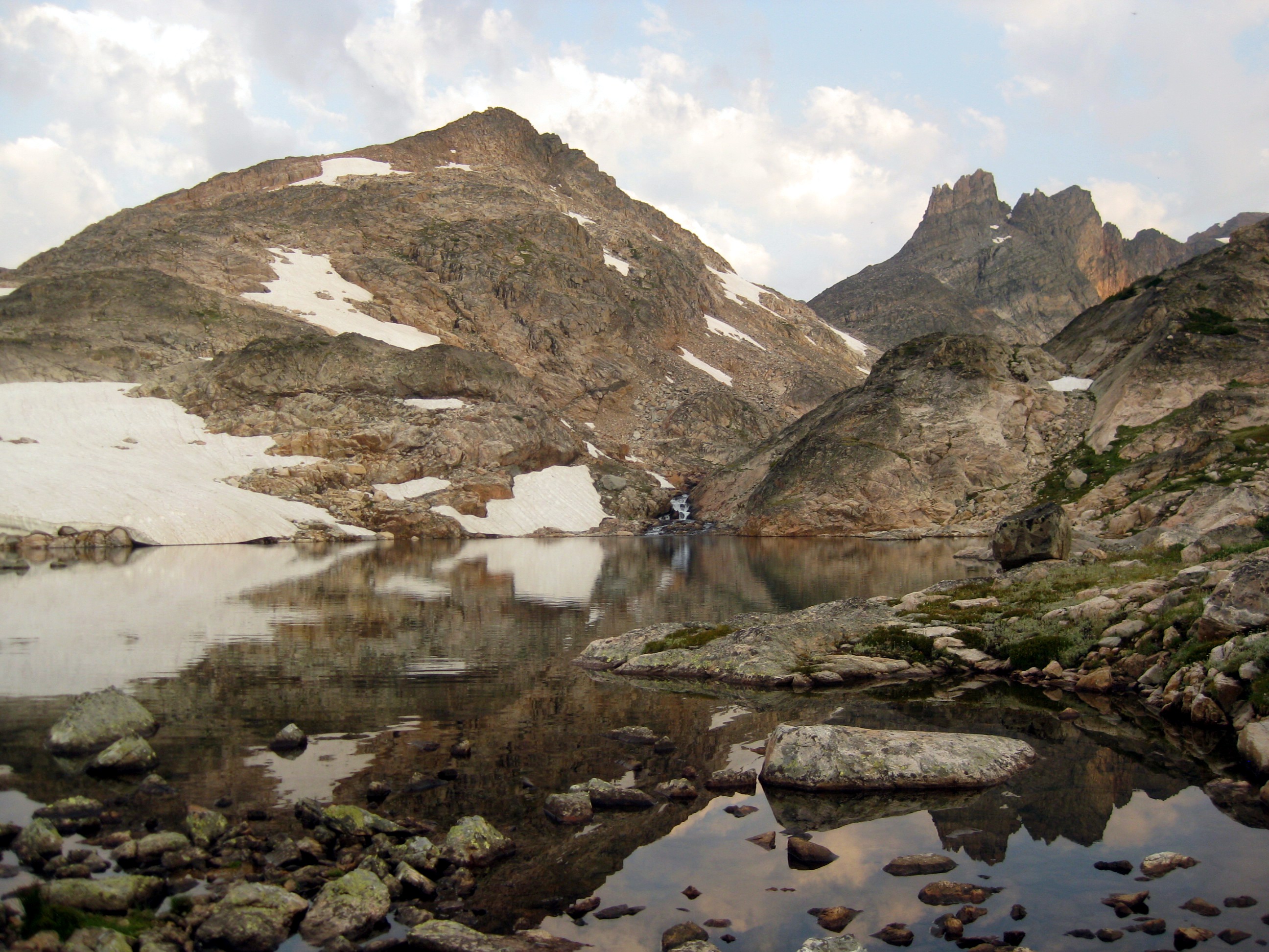
But even without the cairns, it is quite obvious which way to go. The valley and the creek bed you follow is prominent. The only important thing is to end up on the right side of Rough Lake.We had the perfect weather on this trip. Although Granite is infamous for thunderstorms, we had 3 days of partly cloudy skies, temperatures in the upper 70s, and not a single storm.
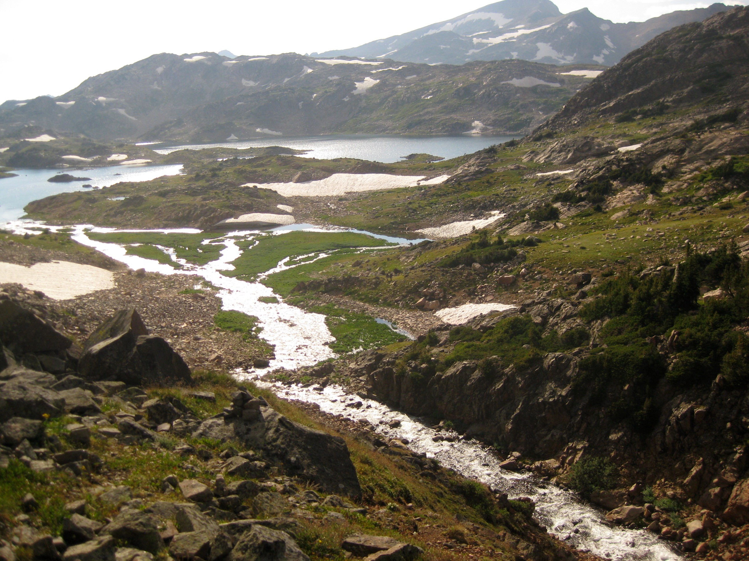
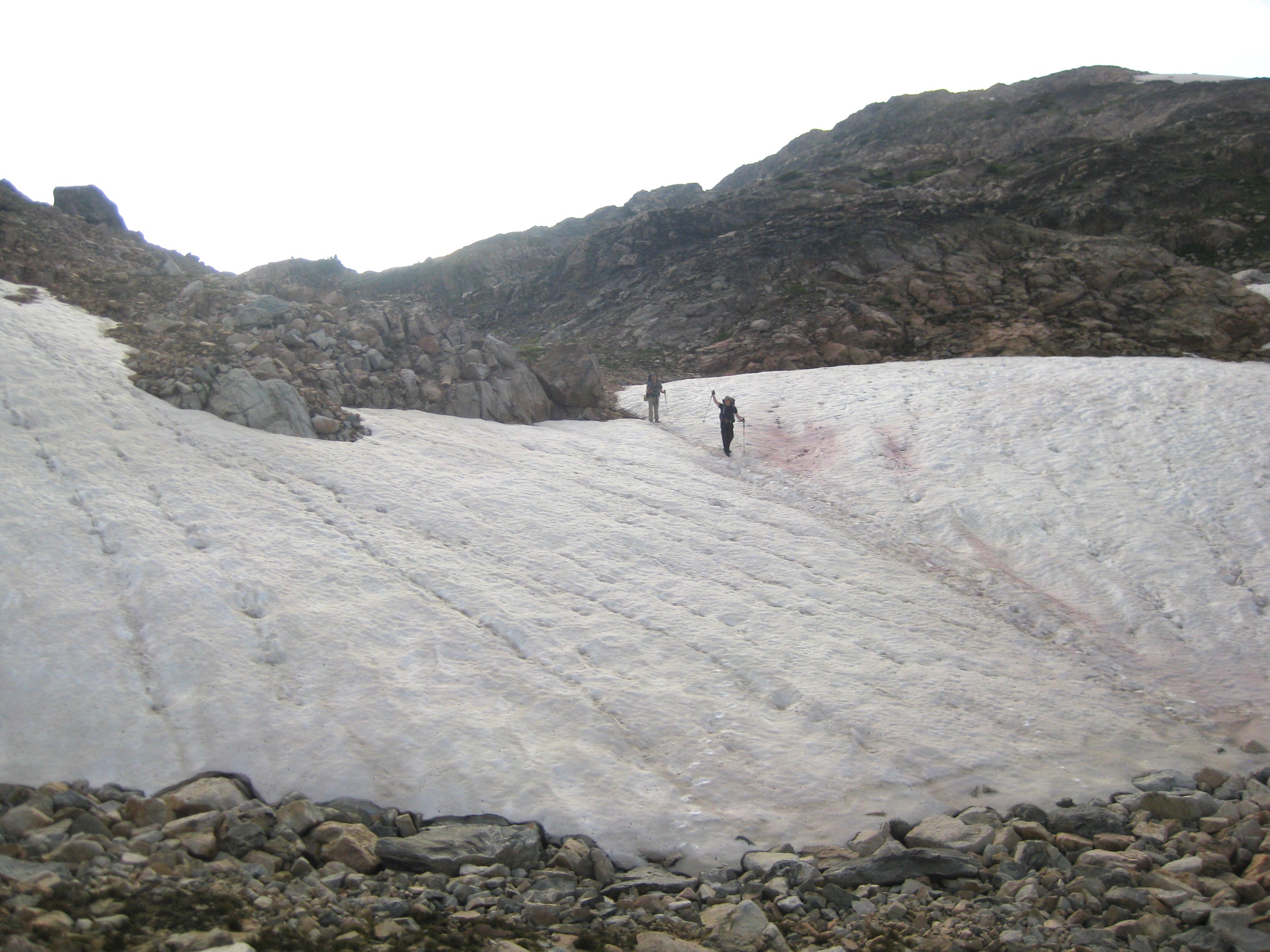
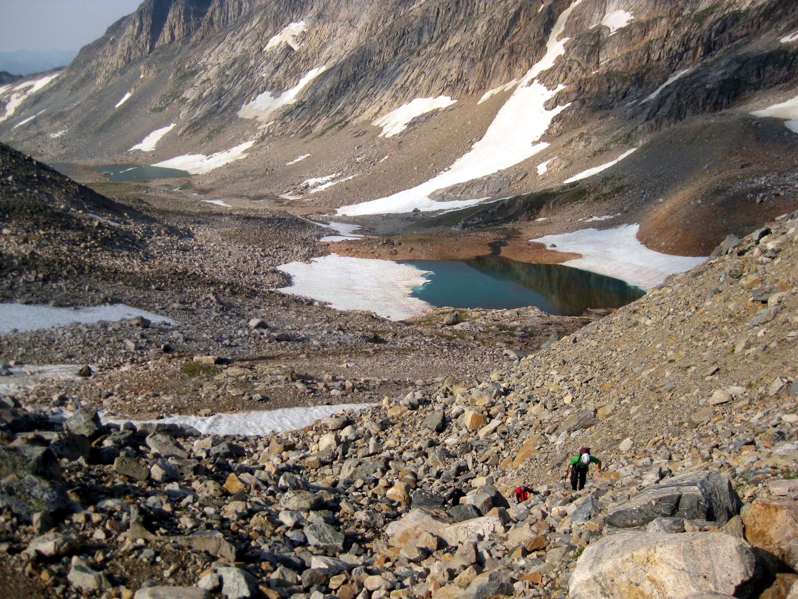
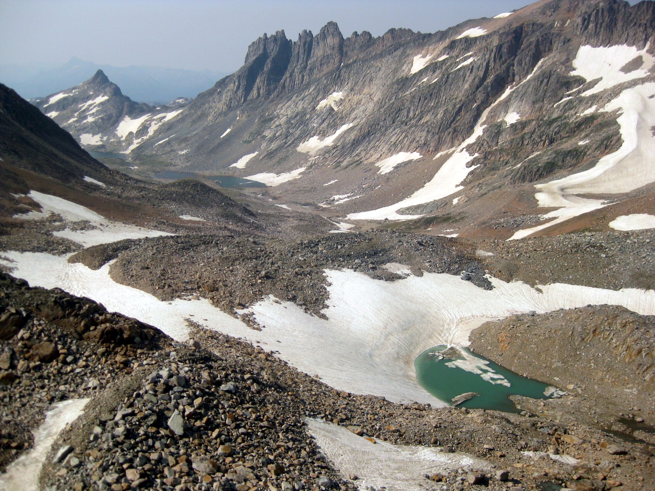
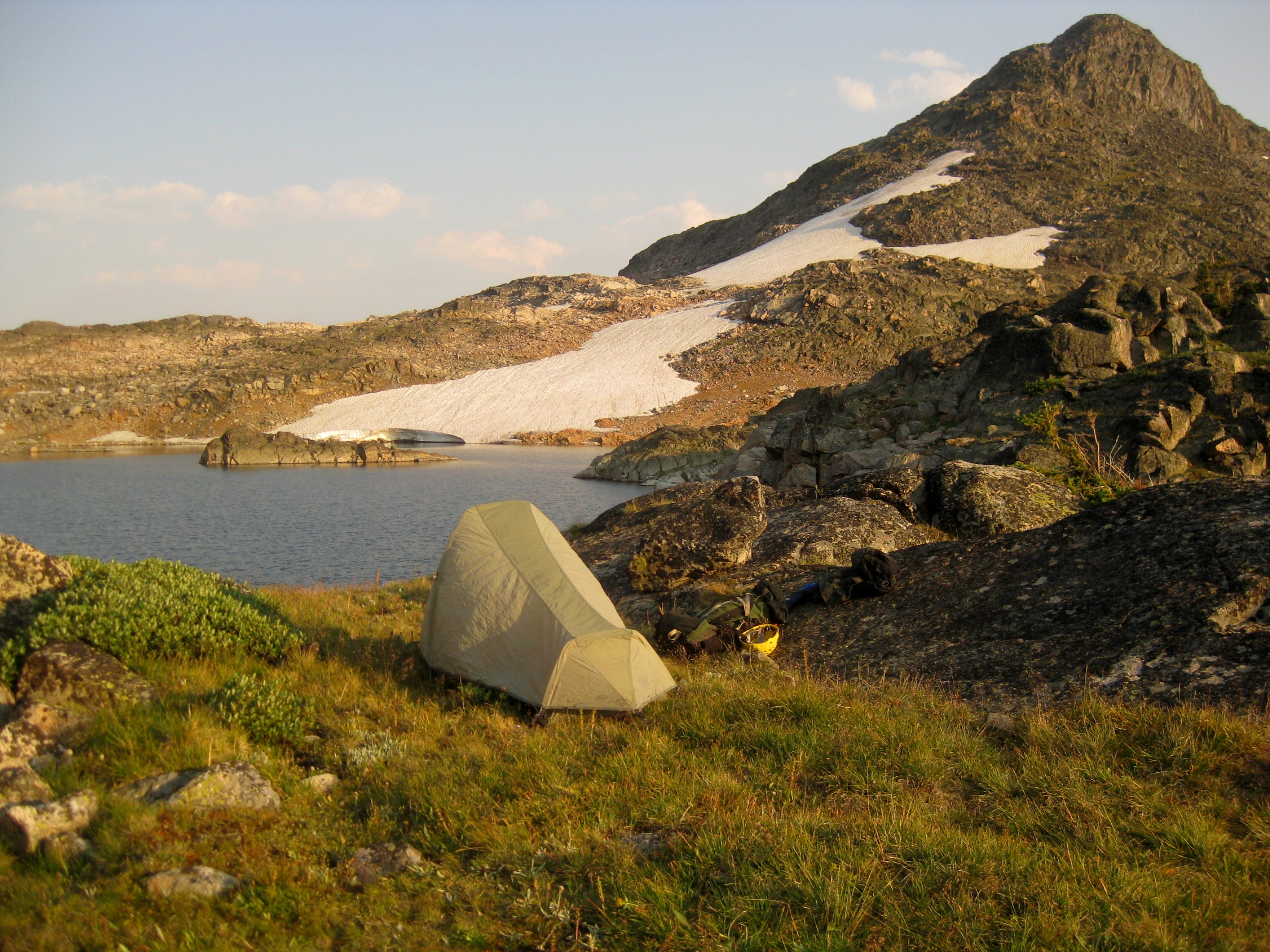
From Rough Lake, there are two ways to continue. I followed a marked path on the right of this waterfall. The other guys crossed the marsh and took a path through the hills (zoom in on the first photo to see them). The scenery becomes even more alpine as you gain the lower Sky Top lake.Will I see the other guys again? Turns out it wasn't too hard to spot them, we met up as they started descending a snow field next to one of the middle lakes. We found a nice grassy field here to camp for the night. It took us from 10am to 6pm to get here. I shared some rice with Mitchell who only brought snacks on the trip and we went to bed around sunset.
On to the summit!
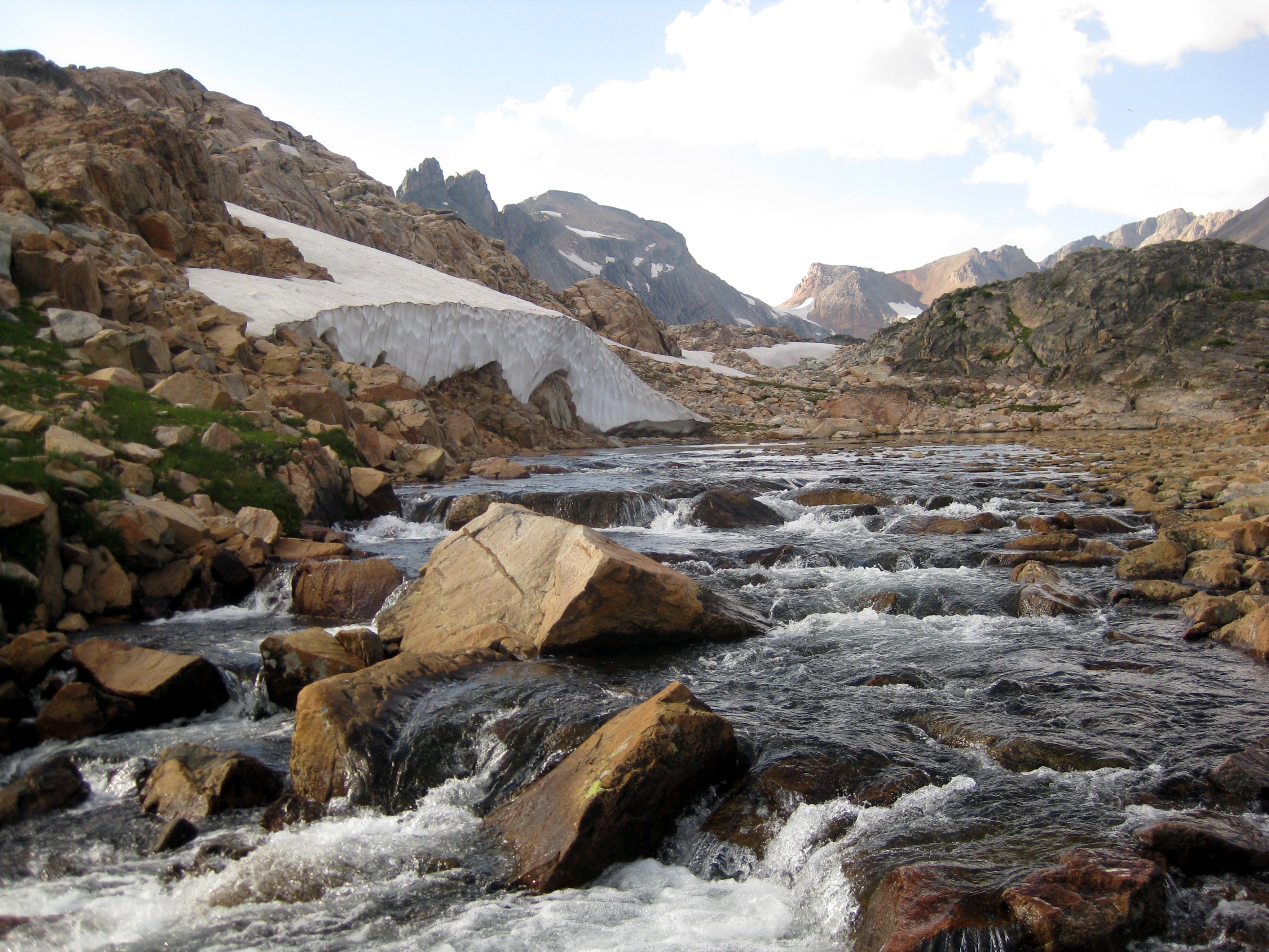
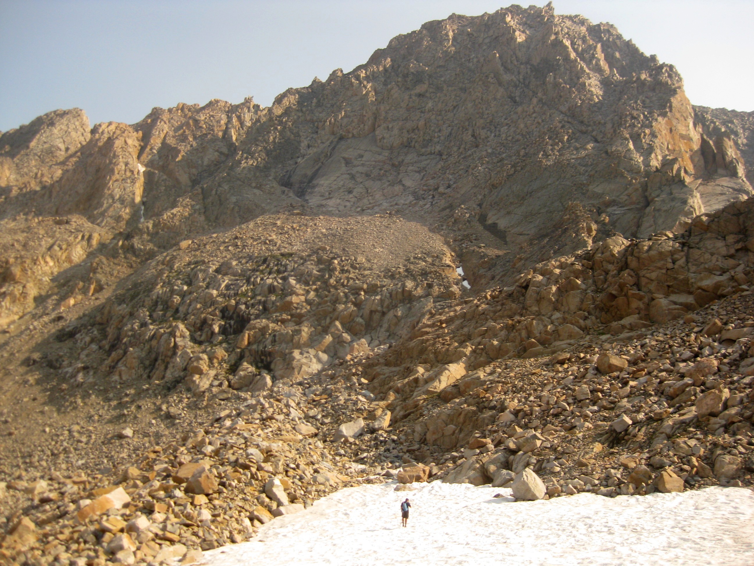
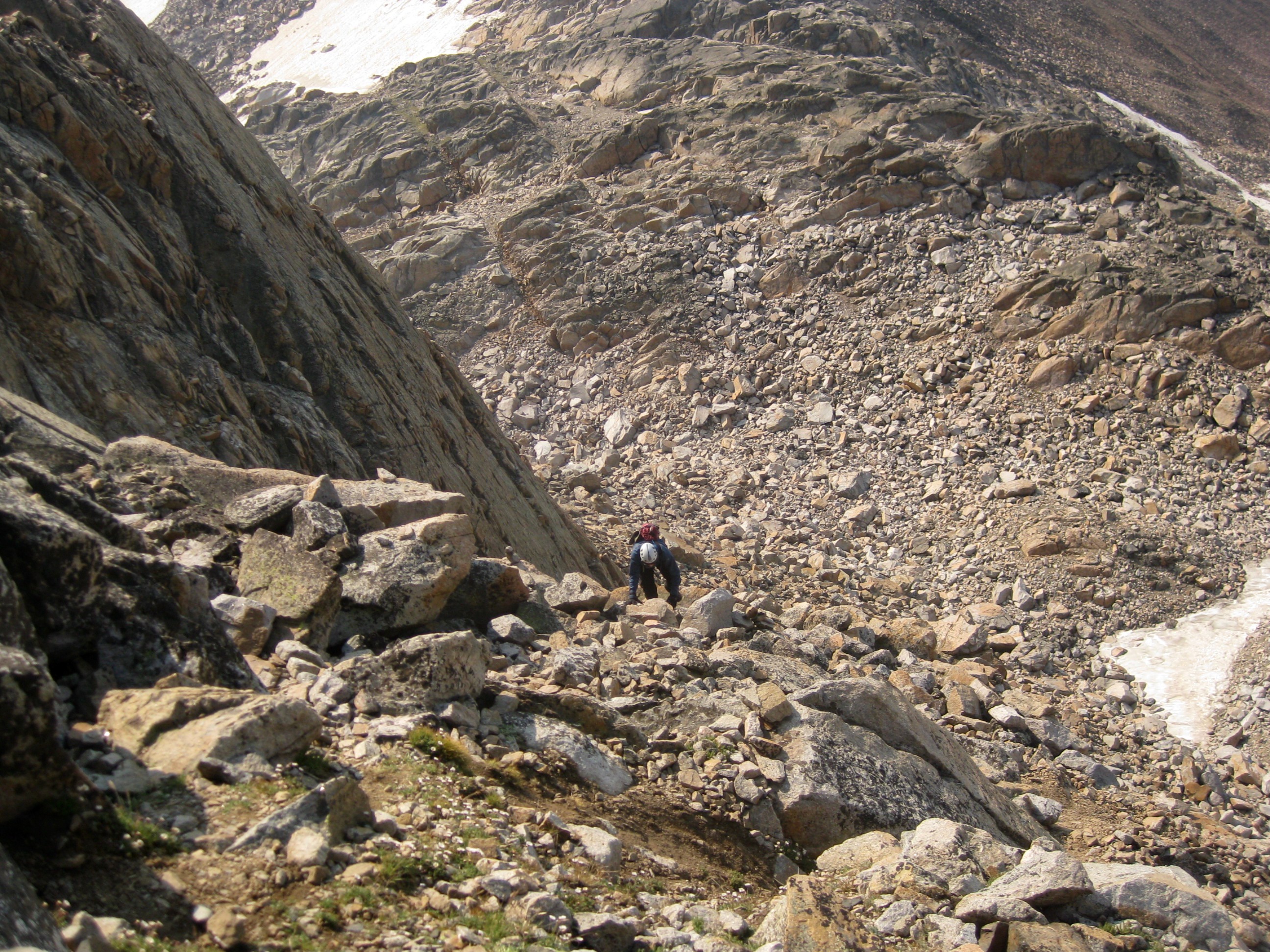
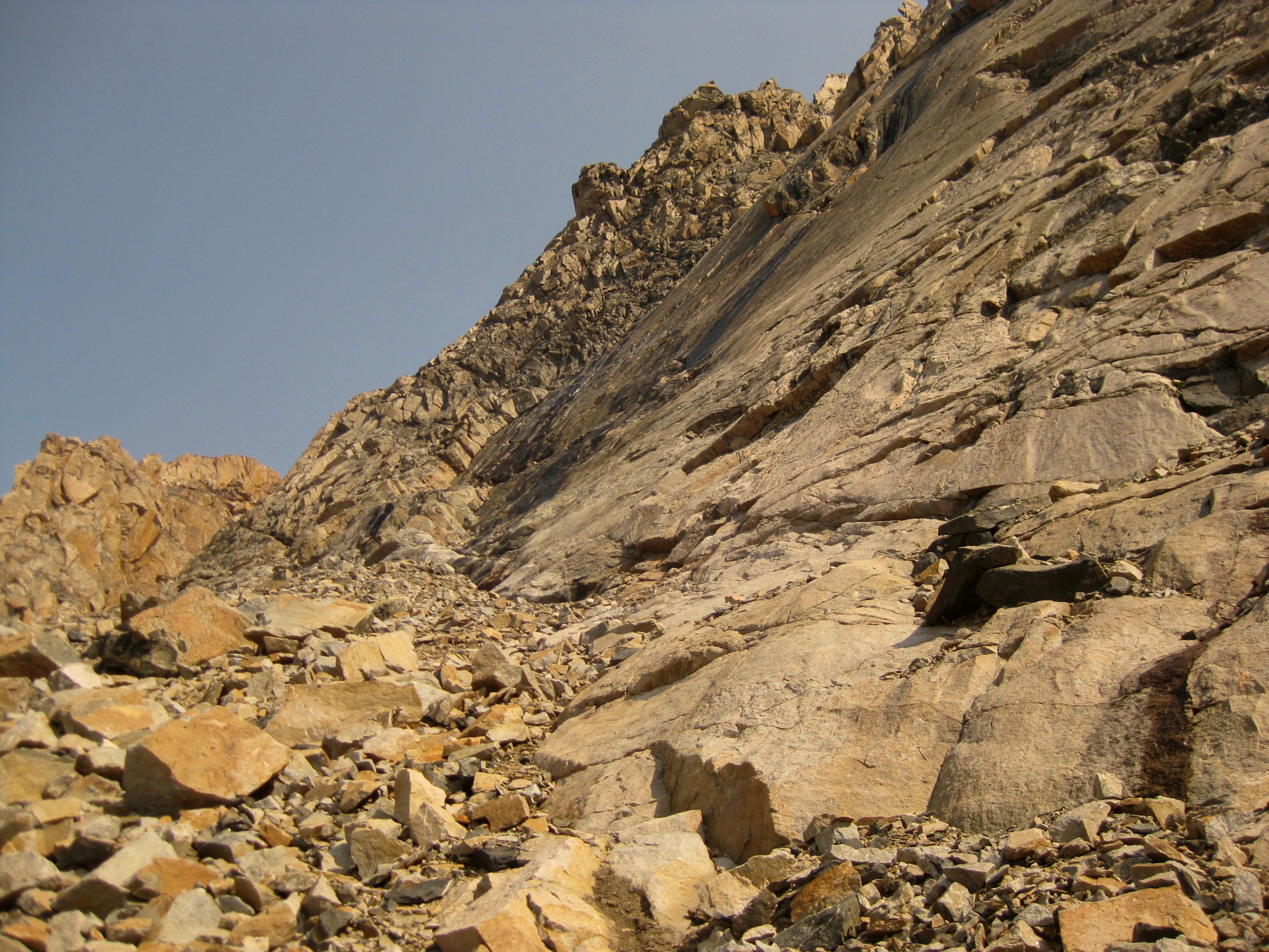
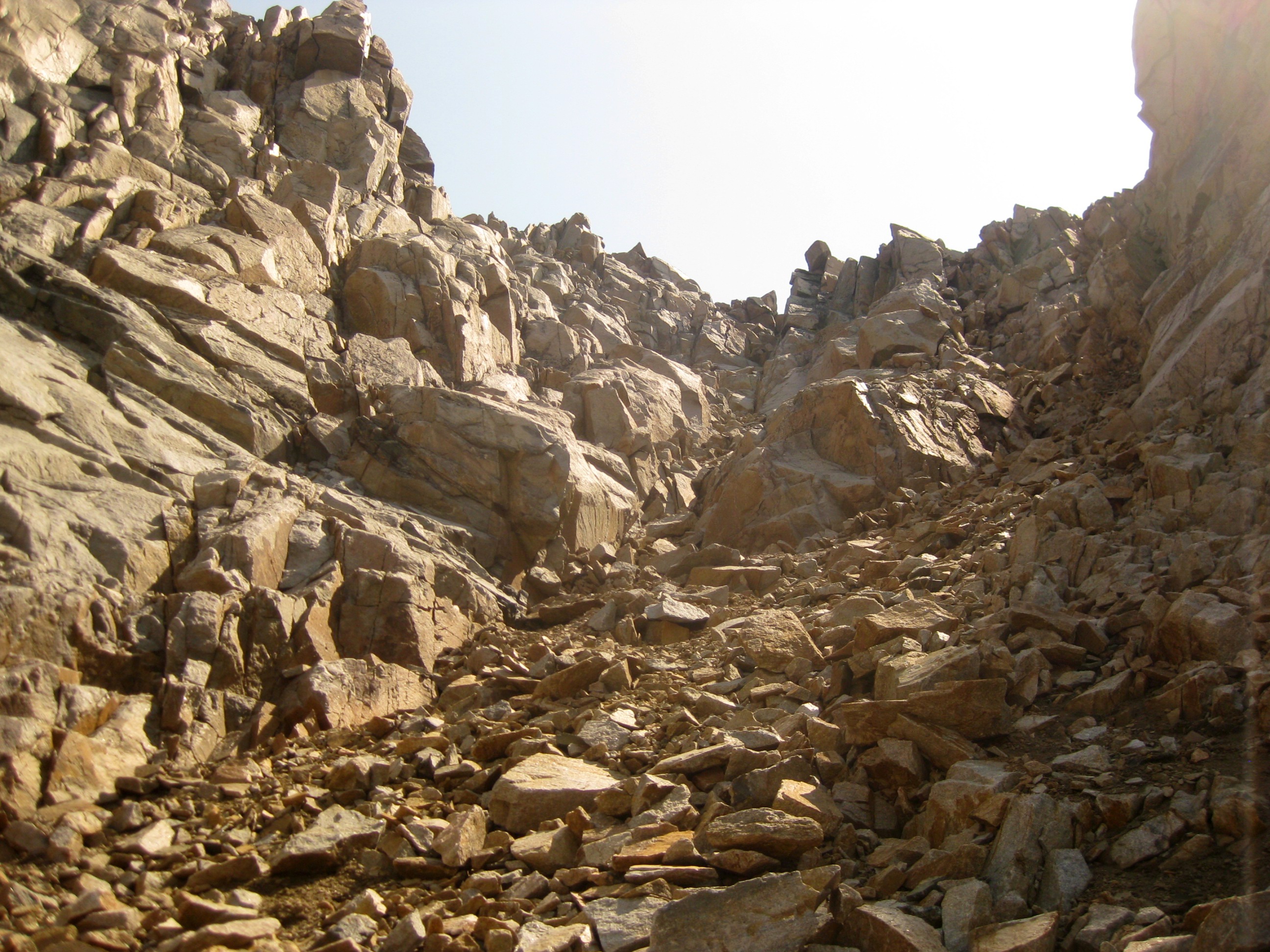
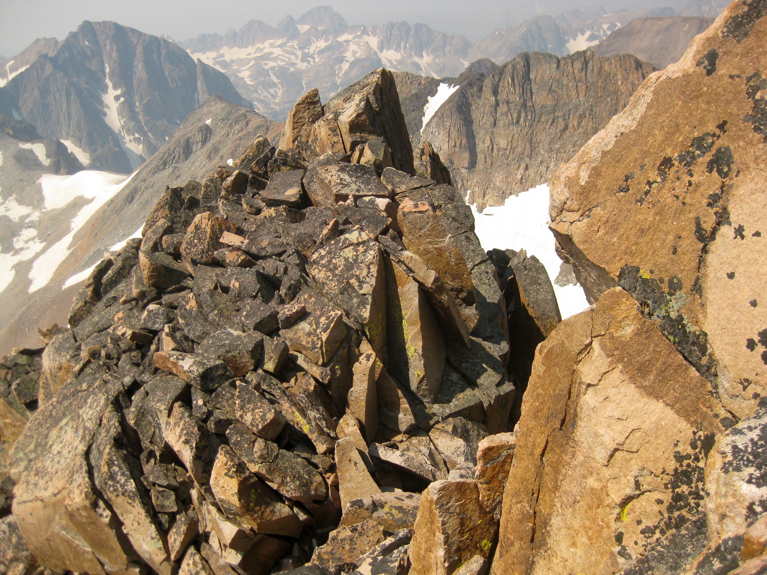
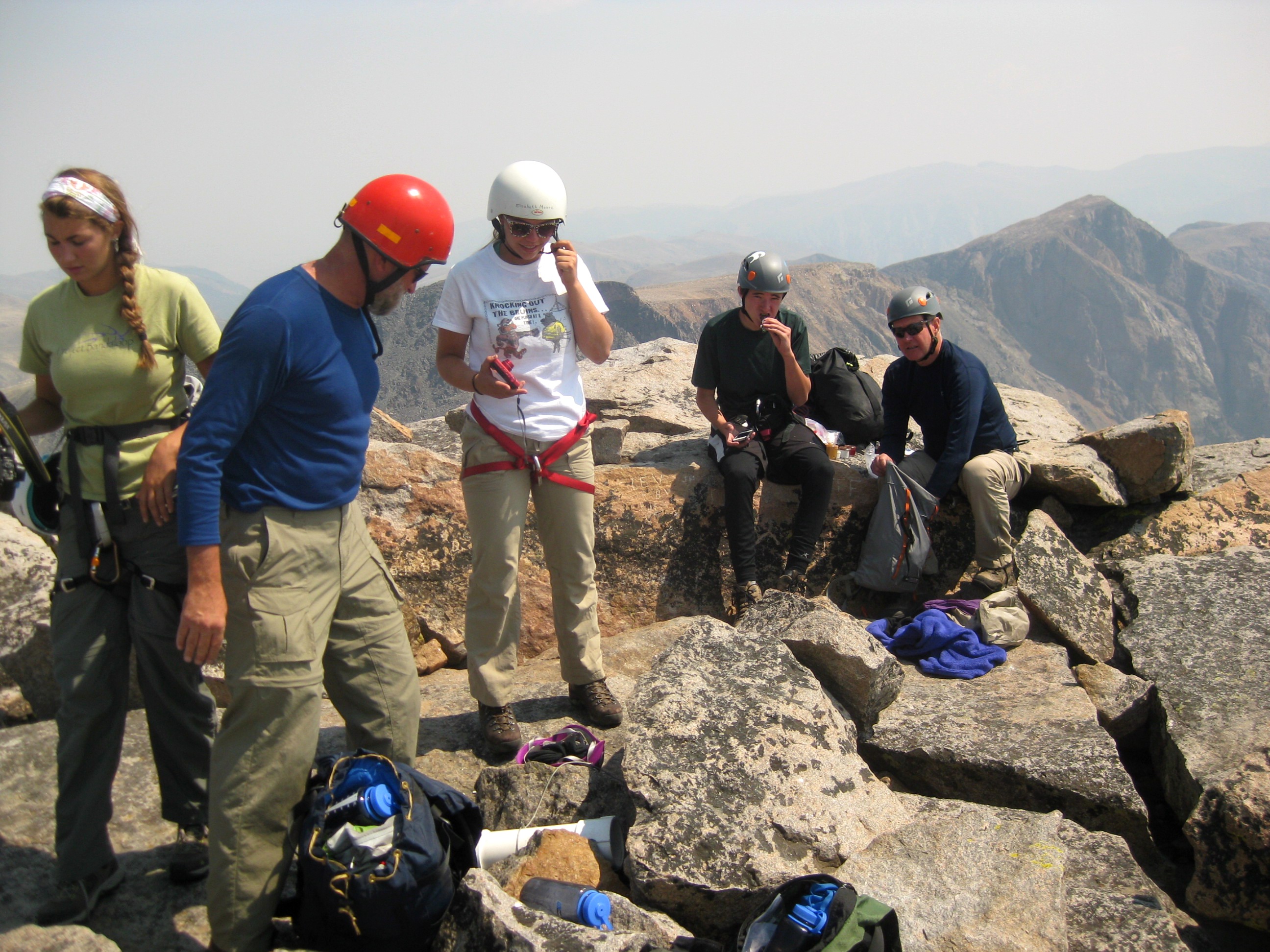
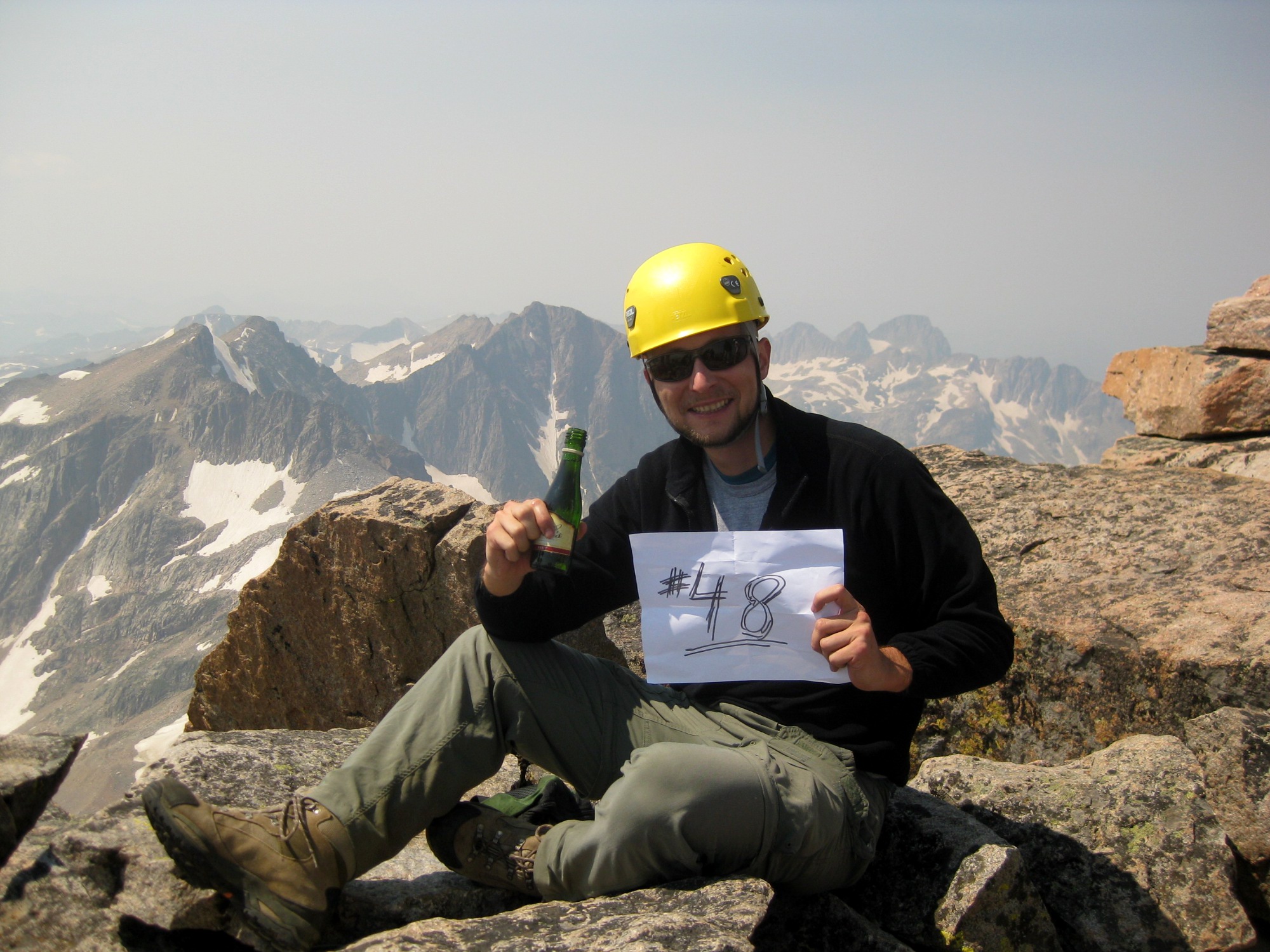
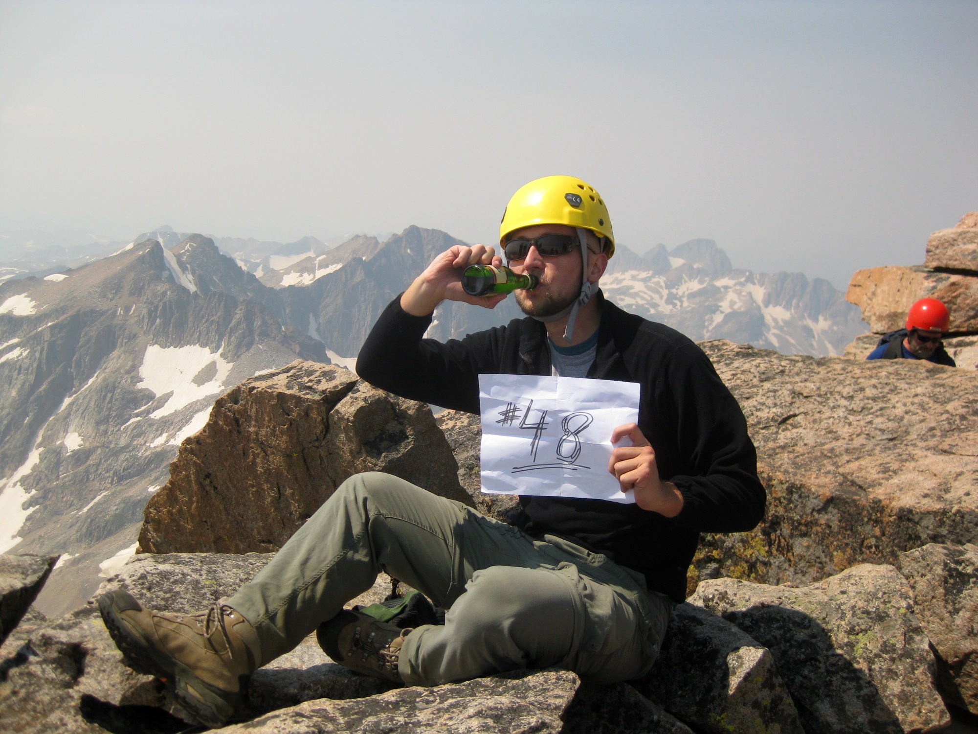
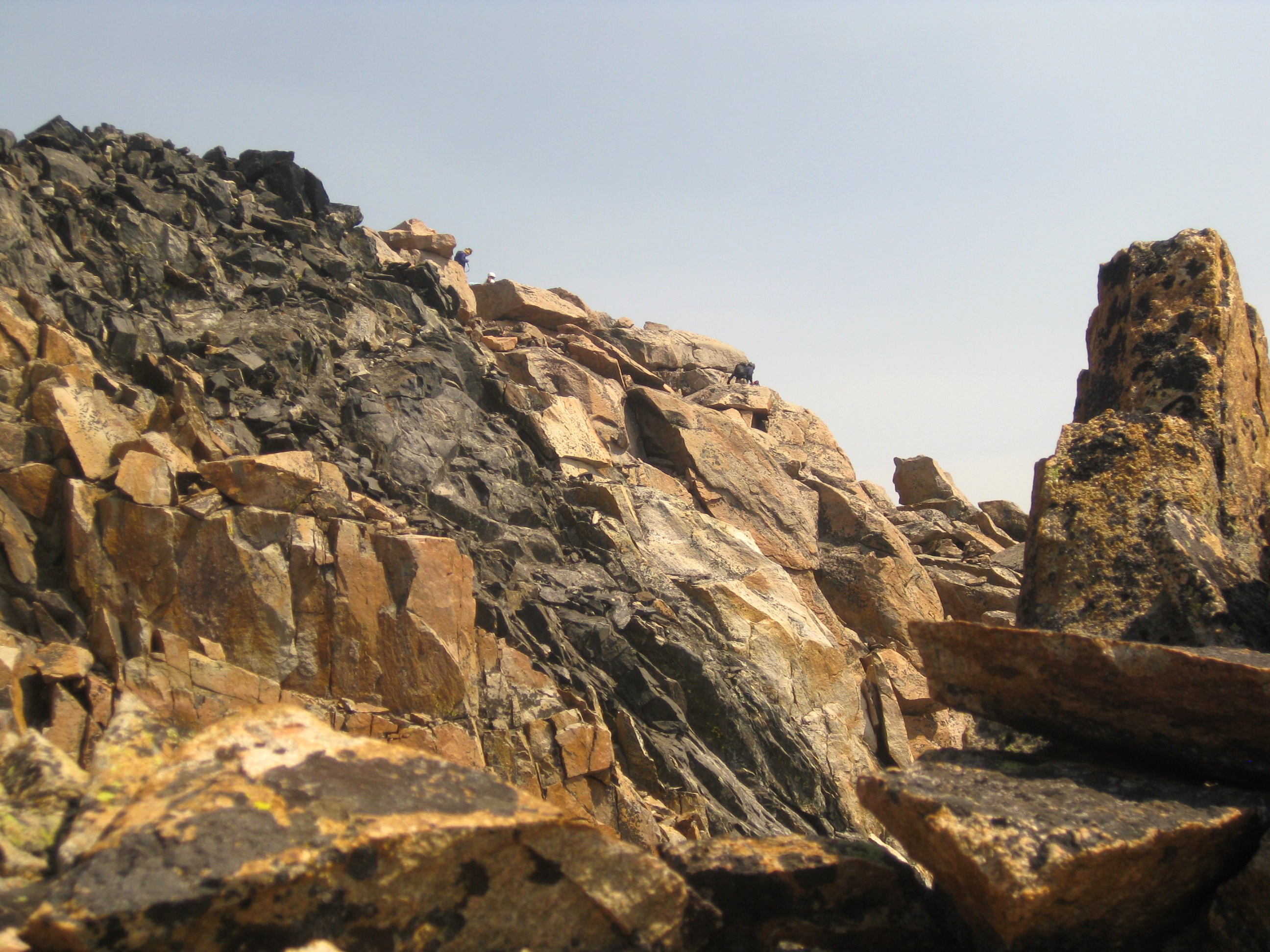
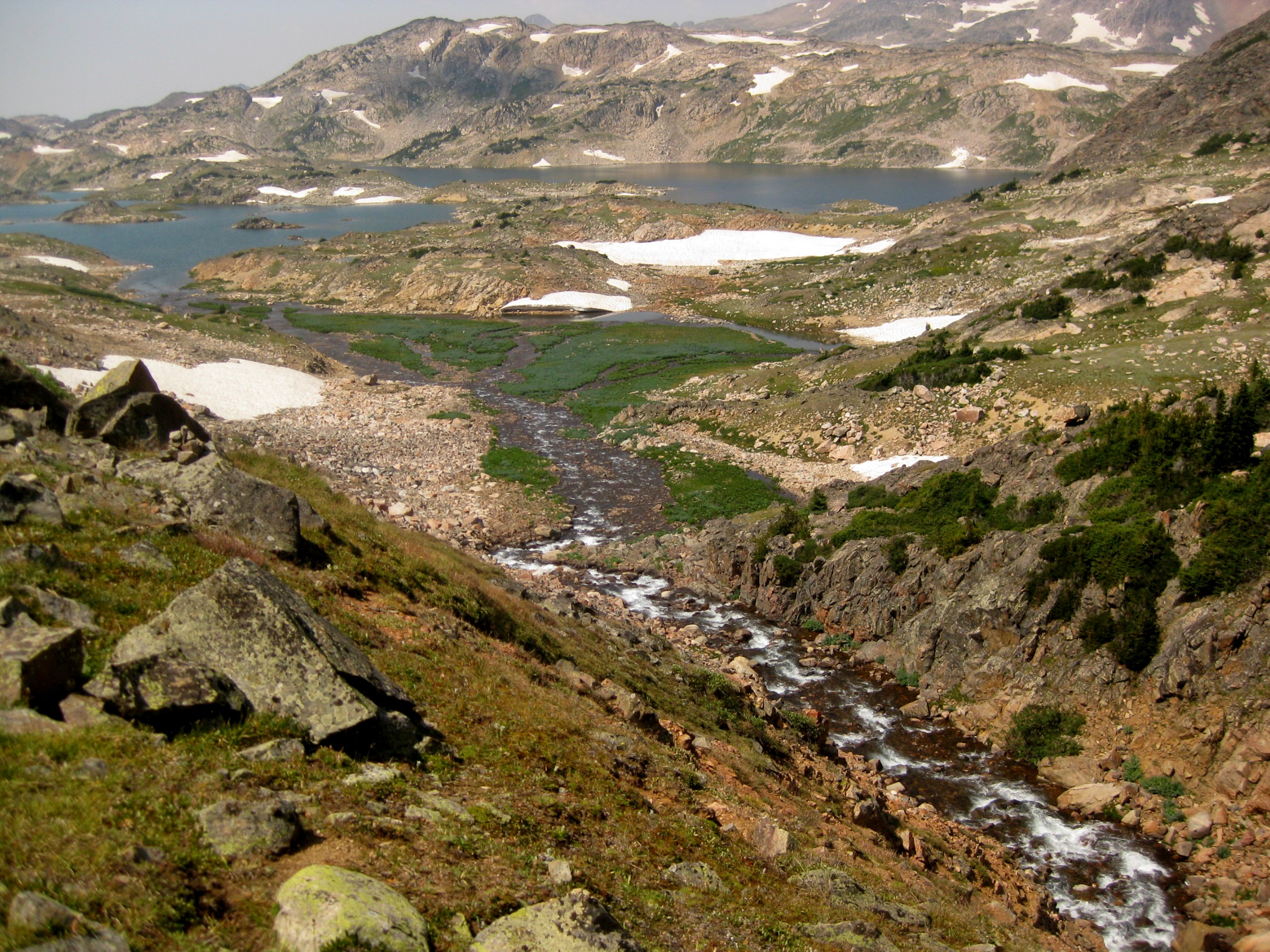
The next morning we set off as the sunrise starting breaking. We first crossed a rapid creek around one of the middle lakes. The Spires, in the second picture, form a prominent waypoint in this high country and aid in navigation.Alex and I then followed the high route, while Mitchell and Fun stayed close to the lakes. Having done both ways, I would recommend the upper route as there is much less rock scrambling here.We joined up before the Sky Top glacier and got our first glimpse of Granite. I left my trusty Gregory Palisade backpack that's been with me throughout all my highpointing adventures by one of the glaciers and continued on just with the lid that transforms into a convenient daypack. This is where we donned our helmets. From here it was more scrambling until we reached the face of the mountain. You want to aim for the gulley with the two prominent snow fields.Here is a photo of the route approaching the snow fields. It was a lot of loose talus and scree here.The route gets steep in few places but it's not too technically difficult. The main hazard is the ever-present rock fall. We heard another party making their summit along a slightly different route and almost every of their moves was marked by a massive thundering rock slide.You next gain this prominent black slab. I turned right at this slab to climb an easy class 3-ish section into a gulley that I thought was the couloir. But, later on, looking at the picture of the route (about half way down), it appears that I went up the "ramp" and not the "couloir". Here is Mitchell cheering Fun on. Alex can be seen in the second photo. He decided to turn back at this point as the exposure and the terrain steepness started increasing. Fun turned back as well after gaining this first class 3 section. Soon after, first Mitchell and then I launched massive boulders down the mountain. Mitchell turned back after we encountered a particularly tricky section with a small creek running down through the slab. It took at least 15 minutes to negotiate it; the trick is to wedge your body against the slippery bedrock. The last I heard from Mitchell was that him and the other guys will wait for me at the bottom of the couloir.So I went up by myself. Having gone this far I had no intentions of having to come back. Plus the weather was perfect. The couloir (or perhaps the "ramp") is full of loose talus, but it's fairly solid at this point. Although the rocks move under your feet, they don't shift more than few inches here and there. At the top of the couloir I headed for the gulley on my right as it looked easier. I gained the ridge below the prominent feature in the second figure. I came up from the right through that gap in the bottom middle. Remember this formation as it is easy to get disoriented on the way down.Next you have about 20 minutes of ridge scrambling to gain first the "brown" sub-summit from where it is an easy hop to the real "black" summit (top right in the first photo). This ridge section was similar to the Chicken Out Ridge on Borah, but less dangerous. Even though the exposure is significant, the ridge is much wider so at all times you stay far enough from the edge. Keep to your left. There was one section where it appeared I had to climb a very exposed class 3 rock where I almost turned back. However, the route navigates around it on the left. I got to the summit as the first of a multi person dads-and-children group gained the top via the standard approach from the Froze to Death Plateau.Best champagne ever! I carried a small bottle to the summit to celebrate. Highpoint #48!
All alone
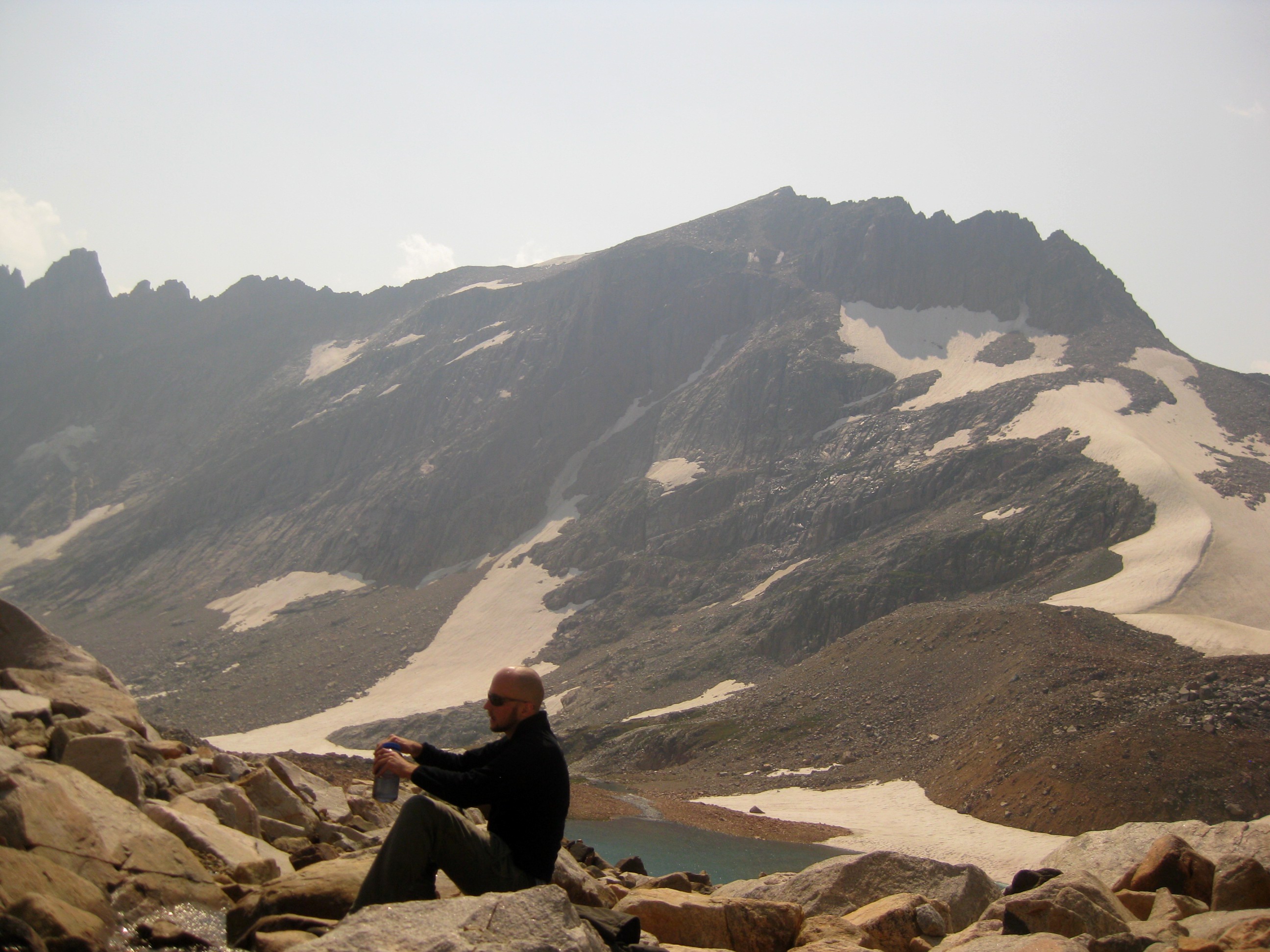
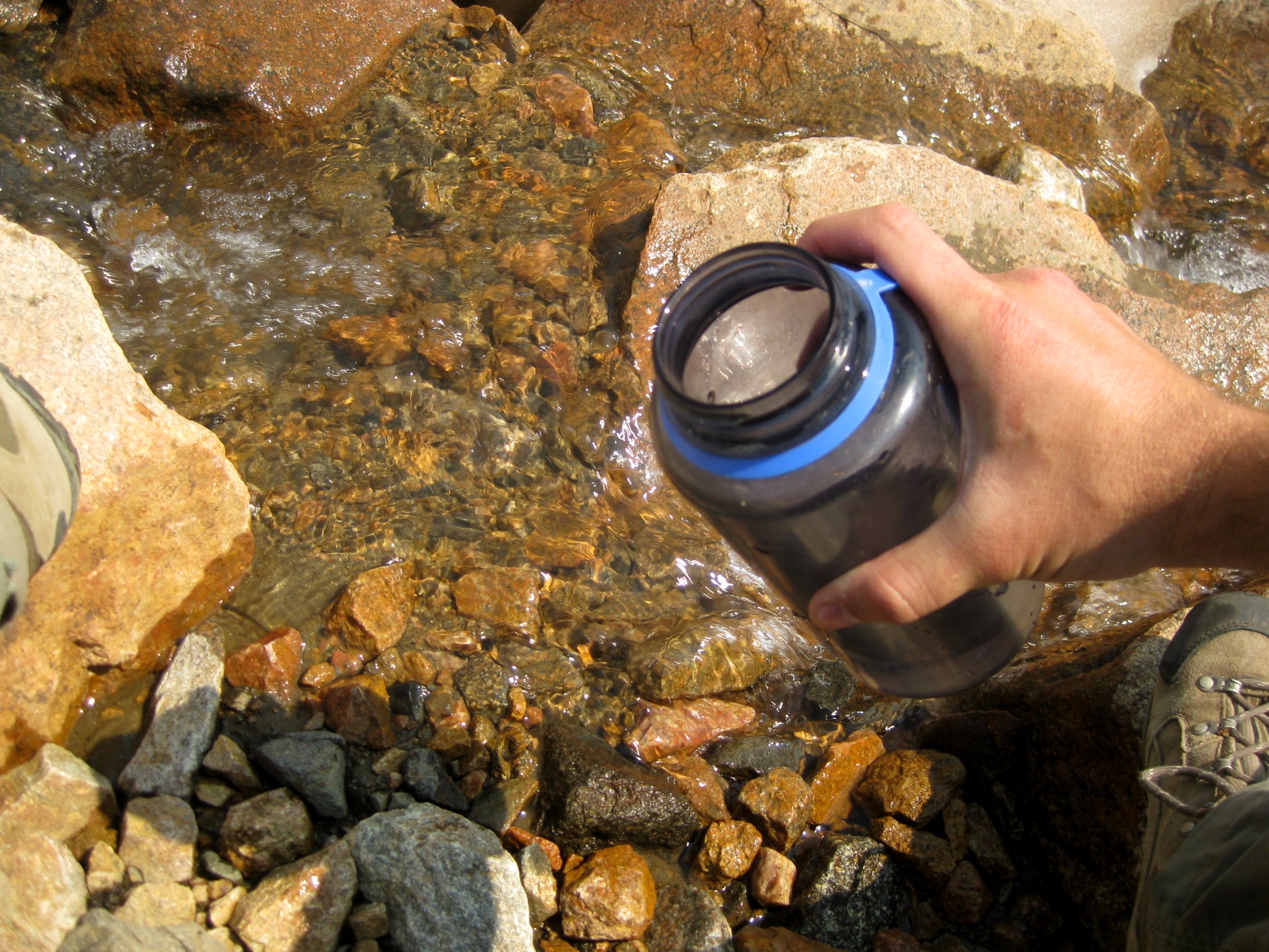
I stayed on the summit for about 15 minutes before heading back down. You can see the others descending as well. I don't have a good photo of it, but the exposure on the standard face is breathtaking. The wall where the guys are is basically a vertical drop for some 1000 feet and requires a down rappel. I was glad we didn't go up that way! As I started getting down the couloir, I started calling out for Alex and Mitchell, just in case the little rock showers I continued launching did not alert them of my presence.But no response. I figured they decided to descend down the mountain to avoid the rock fall hazard, which would have been a very smart decision. I expected to find them at the bottom, but again, nothing. I continued towards my backpack. I was pretty seriously dehydrated at this point. Luckily I found a spot where I refilled my water bottle from a delicious ice cold glacier creek.I continued back towards the camp, expecting to run into the guys on the way.I got to the camp, again calling out for them. But nothing, not even crickets. The camp was deserted. Alex, Mitchell, and Fun had left me on the mountain! I checked for a note in my tent, but nothing. There was absolutely no sign of them ever being there. Poof, it's as if they had vanished into thin air. This was absolutely unreal to me, I could not believe that somebody would leave a climber on a fairly technical mountain and not even wait for him to come down. My only thinking was that they had gone to Rough Lake and expected me to follow. But since the sun was starting to set (it was almost 7 when I got back) and I was absolutely pooped by this point, I had no option but to spend another night at the Sky Top. The gas canister ran out while I was making my tea, but I had no desire to eat another bowl of rice anyway. So I just dined on various snacks: apples, radishes, nuts, tuna, crackers, and cookies.
I left the camp the next morning before sunrise. I didn't get bothered by any animals. I think we had goats visit the first night as I heard some hooves, but the second night was quiet, not even the wind was blowing (or maybe I just slept better). I was hoping to catch up with the other guys at Rough Lake (or wherever they may be). But this was not to be. I got completely disoriented in this high country, and the easy one hour segment to Rough Lake turned into a seven hour class 3 scramble through the glacier covered hills. I was quite desperate at this point, I was completely alone and lost in this desolate land. I seriously contemplated returning back to the camp site for one more night and trying again the next day. Then, I finally caught a glimpse of the marshes and the lake from one of the hills. However, the descend down was too dangerous so I had to climb back up and started following ridges until I got to a waterfall. I thought at first this was the waterfall joining to Rough Lake, but I soon realized it looked unfamiliar and so did the lake. This was another significant panic moment, since now I felt totally lost. Luckily I had a map, compass, and the Spires to navigate by, by they all seemed to point to the Upper Aero Lake. But it couldn't be, as I was at all times south of it. Now in retrospect I suspect I ended up at the back side of the bottom Sky Top Lake, but to this day I am not sure. I wish I had a GPS up there to track my zigzags.
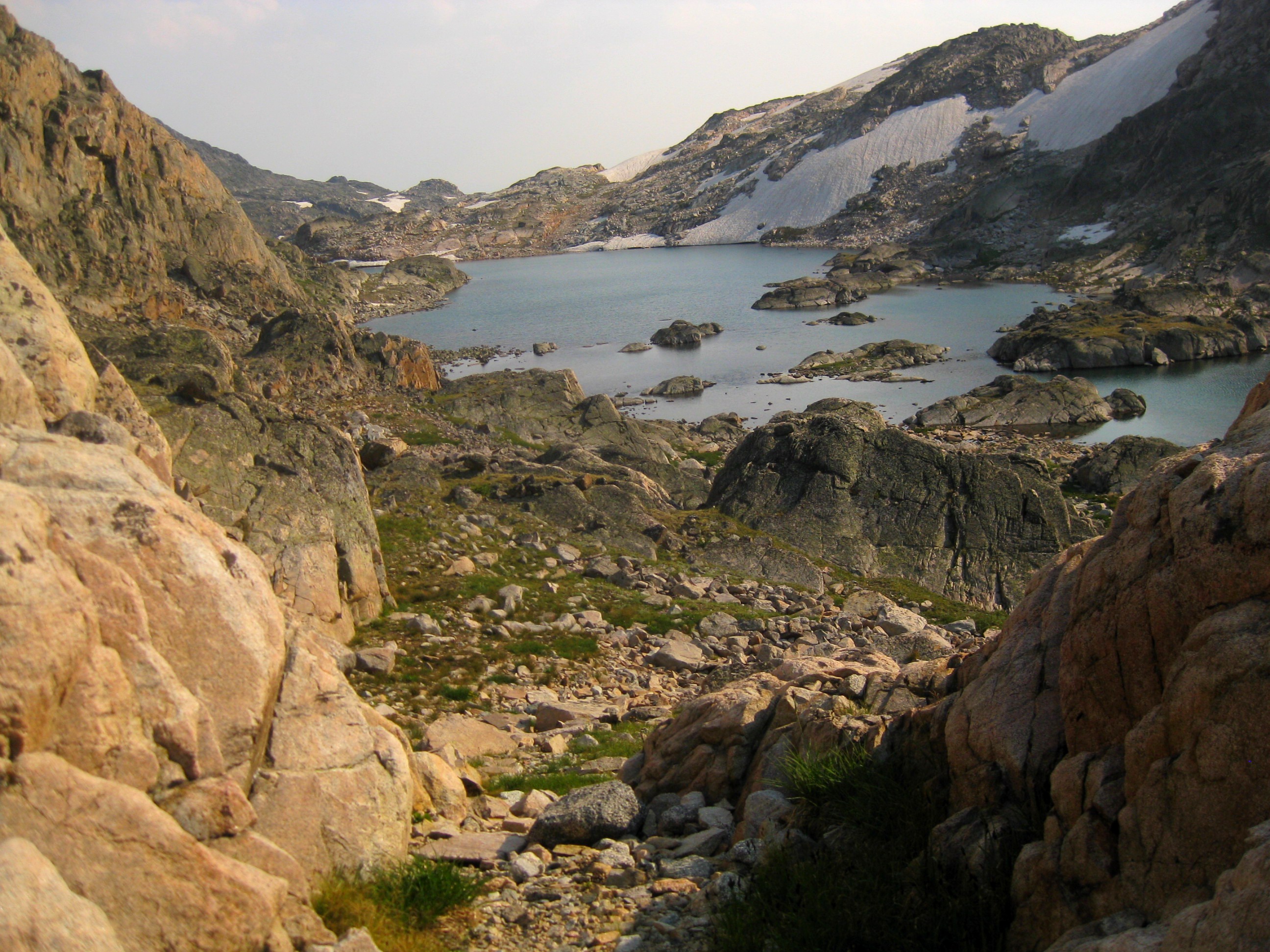
At this lake I started heading down what looked like a valley but it was dry and I knew I had to follow a creek. I again backtracked and then found another waterfall - this time the right one. I was so delighted to see the stupid Rough Lake opening up in front of me!
I made it down to the lake at 1 pm, and found three figures on the horizon. But when I got closer, I realized they were not my original climbing partners. There was no sign of those guys. I contemplated camping here for the night as by now I was absolutely mentally drained. I find it hard to believe that I almost got lost and perhaps died on this mountain, not because of the tricky and technical route to the summit, but due to irresponsibility of my climbing team. However, it was still too early, and the sun was shining so I pressed on.
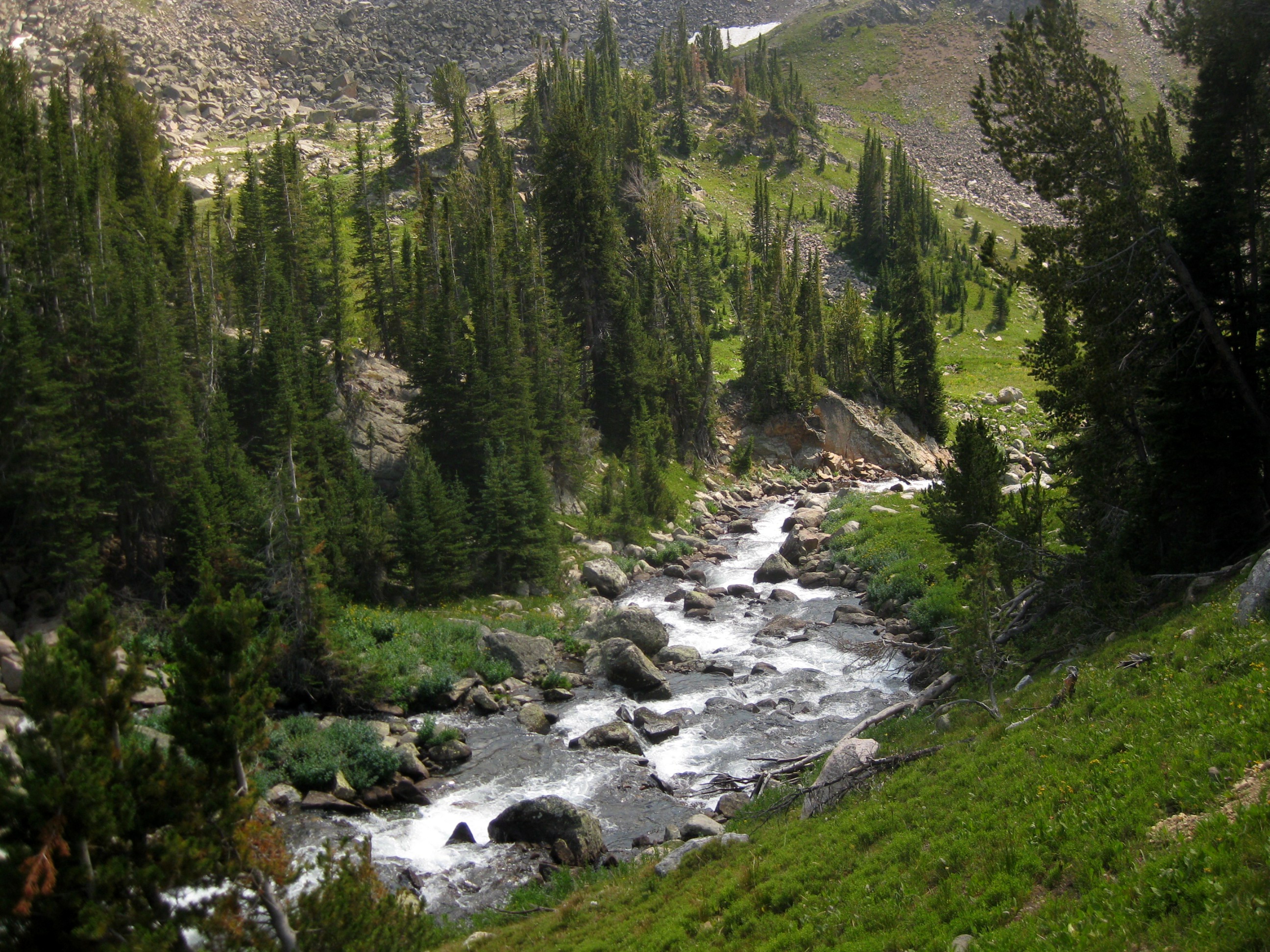
There were few sections heading down where I lost the trail again. This was mainly around Lone Elk Lake. The descend was very mentally taxing. First, Mitchell scared us about grizzlies, and being alone, I felt like the perfect snack opportunity. Plus after two days in such a remote, empty land, you sort of start going crazy and start missing people. There was only one other group of two at the top Sky Top Lake (the ones launching those rock slides on our summit push) and the three guys at Rough Lake. I passed only 3 more groups the entire way down: a group of three and two dogs heading up for a week backpack, a lone hiker descending down, and a father and son holding on to bear sprays on their way up to Aero Lake. To keep myself from going crazy and to motivate myself to keep going, I kept counting, out loud, from 1 to 100 the entire way down. Must have gone through this sequence few hundred times.The river crossings were particularly bad. I was so tired by this point that it became an utter mental torture to have to take off the pack, remove my boots and socks, put on sandals, cross the river, dry my feet, put on the socks, put on the boots, put on the backpack, and get back up. It would take me about 30 minutes per crossing. Then at one, one of my sandals decided to bid me a farewell and go for a voyage down the river. Luckily, there were only two more crossings after this point, which I made barefoot. After the long struggle, I made it first to Lady of the Lake, and then about an hour later, I made it to this cabin. The first sign I was almost out! By the way, I did not see any bears nor goats, and just one deer. However, the adventure was not over when I got to the trail head. As suspected, the two cars we came in were gone. There is also no cell phone service anywhere on this mountain nor in the near-by Cooke City. However, there is a section along the road where you can get 4G data signal, so I sent an email to Sandrita telling here what happened and also a massive "FU" to the rest of the guys. I continued walking down the empty road, until I came upon some older guy setting up to spend a night in his converted van in a little parking lot off the side of a road. Sketchy or not, he was nice, and gave me a ride to the Alpine Motel. I asked the receptionist if there was a note, but again, nothing. The guys just disappeared.
However, I managed to get a hold of Alex using the motel's phone. I gave him an earshot and he was not even apologetic at first.
He said they waited for me until 6pm but then left since they didn't know where I was and wanted to get to a lower camp. They didn't leave a note since they didn't have a pen and paper. They spent the night between the Rough and Lone Elk lakes and started hiking down the next morning around 7 or 8.
Him and Fun were now in Billings, but Mitchell stayed behind to look for me and call the rangers to report me missing. Well, the problem now was that, since there is no cell phone reception here, we could not get a hold of Mitchell. His signal finally came on as he got out of the mountains and into Red Lodge, about hour and half from Cooke City. All this time, my awesome Colombian girlfriend kept pestering the guys pretending she didn't know where I was to make them feel bad about leaving me on the mountain. After we got a hold of Mitchell, I headed across the street to the "casino" for burgers and beer. They tasted great! Mitchell picked me up around 10 and we got to Billings little after midnight, just in time to catch about 3 hours of sleep before our 6 am flight the next morning. So in the end, everything ended OK, even though this turned out for me to be much more of an adventure than I had envisioned. I don't think that Alex, Fun, and Mitchell meant bad, they seem to be nice guys, perhaps they are just less experienced in this sort of stuff. I hope they learned a lesson here that you should never leave a climbing partner on a mountain, and should wait at least until the next morning for him/her to come back.